The right side offers more cumulative variety: during cruise it faces the South China Sea and the Vietnamese and Cambodian coastline as the route crosses landfall, and it wins the approach into Bangkok with river and skyline views. The left side is dominated by open ocean for most of the flight.
Flown OKA to BKK? Did we get it right?
Flight Path
Naha to Bangkok is 1,943 miles (3,127 km), a flight of about 4 hours 50 minutes.
The flight path crosses the northern South China Sea, passing near the Vietnamese coastline around Da Nang before continuing over the Mekong Delta region and into the Gulf of Thailand toward Bangkok.
Great circle distance and headings ›

Phase by phase
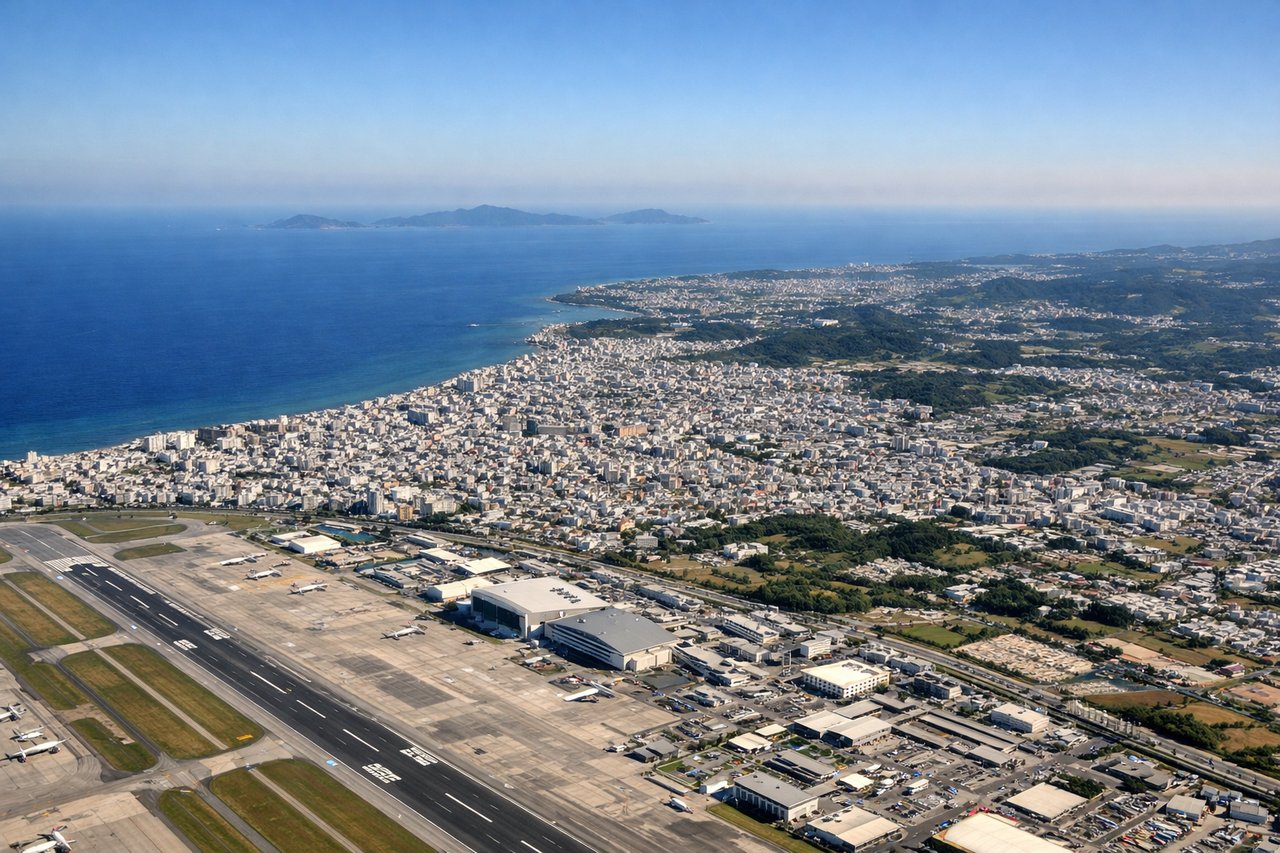
Takeoff from OKA
LEFTDeparting Naha southbound, the left side looks east over Okinawa's main island, showing the city grid, reef-lined coastline, and small offshore islets before the aircraft turns out over open water. The right side only shows the flat blue expanse of the East China Sea.
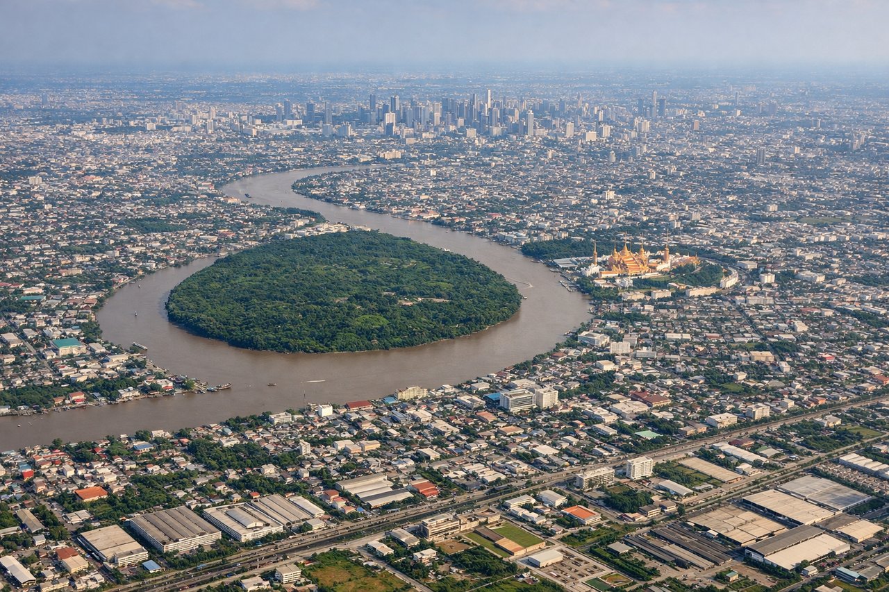
Landing at BKK
RIGHTOn approach into Suvarnabhumi from the northeast, the right side faces west toward central Bangkok, giving views of the Chao Phraya River winding through the skyline and dense urban sprawl before the final turn onto the runway. The left side mostly shows flat agricultural land and canals east of the city.
Will your flight be in sunlight?
Pick a date and time in the Sun Map to watch the sun move across your whole flight.
About This Route
Which side of the plane should I sit on flying from Naha (OKA) to Suvarnabhumi Airport (BKK)?
Sit on the Right side of the plane for the best views on flights from Naha to Bangkok. The right side offers more cumulative variety: during cruise it faces the South China Sea and the Vietnamese and Cambodian coastline as the route crosses landfall, and it wins the approach into Bangkok with river and skyline views. The left side is dominated by open ocean for most of the flight.
What can I see during takeoff from Naha in Naha?
During takeoff from Naha (OKA), sit on the Left side for the best views. Departing Naha southbound, the left side looks east over Okinawa's main island, showing the city grid, reef-lined coastline, and small offshore islets before the aircraft turns out over open water. The right side only shows the flat blue expanse of the East China Sea. Notable sights include: Naha city and harbor, Okinawa's central ridge, coral reef shoreline, small offshore islets.
What can I see when landing at Suvarnabhumi Airport in Bangkok?
When landing at Suvarnabhumi Airport (BKK), sit on the Right side for the best views. On approach into Suvarnabhumi from the northeast, the right side faces west toward central Bangkok, giving views of the Chao Phraya River winding through the skyline and dense urban sprawl before the final turn onto the runway. The left side mostly shows flat agricultural land and canals east of the city. Notable sights include: Chao Phraya River, Bangkok skyline and skyscraper clusters, Bang Na canals, Gulf of Thailand haze on the horizon.
How long is the flight from Naha to Bangkok?
The flight from Naha (OKA) to Suvarnabhumi Airport (BKK) takes about 4 hours 50 minutes. The shortest flight path between them is 1,943 miles (3,127 km); winds and air traffic control usually add a few percent.
What does the Naha to Bangkok flight path pass over?
The flight path crosses the northern South China Sea, passing near the Vietnamese coastline around Da Nang before continuing over the Mekong Delta region and into the Gulf of Thailand toward Bangkok.