While takeoff scenery is comparable on both sides, the right side's approach into Incheon delivers a genuinely distinctive payoff with the Han River estuary and distant Seoul skyline, giving it a slight edge over the left side's ocean-dominated cruise and less distinct landing view.
Flown OKA to ICN? Did we get it right?
Flight Path
Naha to Seoul is 782 miles (1,259 km), a flight of about 2 hours 15 minutes.
East China Sea open water with Jeju Island visible off to the west of the flight path, transitioning to the Yellow Sea as the route approaches the Korean peninsula
Great circle distance and headings ›Phase by phase
Takeoff from OKA
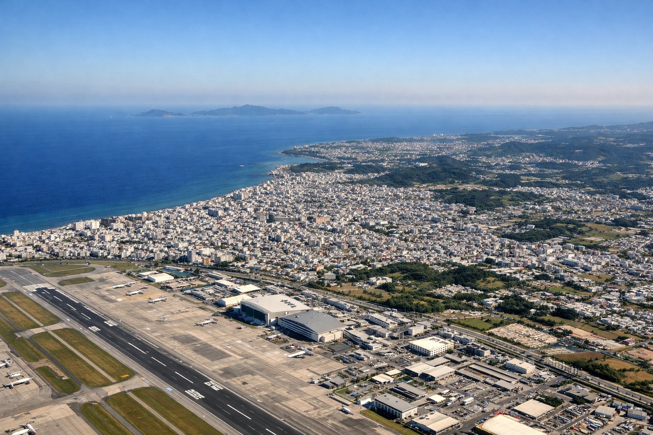
LEFTDeparting Naha over the East China Sea, the left side offers a view back toward Okinawa's turquoise reef flats and the scattered Kerama Islands chain just offshore, while the right side mostly shows open Pacific water with less definition.
Landing at ICN
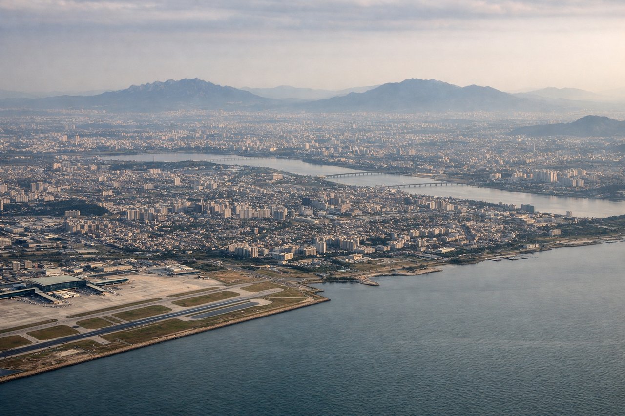
RIGHTOn approach to Incheon from the south under typical westerly wind conditions, the aircraft banks toward runways 33/34, putting the Seoul metropolitan skyline, the Han River estuary, and Incheon's coastal islands on the right side of the cabin.
Will your flight be in sunlight?
Pick a date and time in the Sun Map to watch the sun move across your whole flight.
About This Route
Which side of the plane should I sit on flying from Naha (OKA) to Incheon International (ICN)?
Sit on the Right side of the plane for the best views on flights from Naha to Seoul. While takeoff scenery is comparable on both sides, the right side's approach into Incheon delivers a genuinely distinctive payoff with the Han River estuary and distant Seoul skyline, giving it a slight edge over the left side's ocean-dominated cruise and less distinct landing view.
What can I see during takeoff from Naha in Naha?
During takeoff from Naha (OKA), sit on the Left side for the best views. Departing Naha over the East China Sea, the left side offers a view back toward Okinawa's turquoise reef flats and the scattered Kerama Islands chain just offshore, while the right side mostly shows open Pacific water with less definition. Notable sights include: Kerama Islands, Okinawa's coral reef flats, Naha harbor, East China Sea coastline.
What can I see when landing at Incheon International in Seoul?
When landing at Incheon International (ICN), sit on the Right side for the best views. On approach to Incheon from the south under typical westerly wind conditions, the aircraft banks toward runways 33/34, putting the Seoul metropolitan skyline, the Han River estuary, and Incheon's coastal islands on the right side of the cabin. Notable sights include: Han River estuary, Seoul skyline in the distance, Yeongjongdo and Ganghwa islands, Incheon coastline.
How long is the flight from Naha to Seoul?
The flight from Naha (OKA) to Incheon International (ICN) takes about 2 hours 15 minutes. The shortest flight path between them is 782 miles (1,259 km); winds and air traffic control usually add a few percent.
What does the Naha to Seoul flight path pass over?
East China Sea open water with Jeju Island visible off to the west of the flight path, transitioning to the Yellow Sea as the route approaches the Korean peninsula