The left side edges out overall thanks to the brief but real coastal glimpses during departure near Vietnam and the chance of seeing Taiwan's outline during cruise, whereas the right side is dominated by featureless open ocean for most of the flight.
Flown BKK to OKA? Did we get it right?
Flight Path
Bangkok to Naha is 1,943 miles (3,127 km), a flight of about 3 hours 25 minutes.
South China Sea, Luzon Strait, and the eastern coastline of Taiwan visible in the distance during cruise before the East China Sea approach to Okinawa
Great circle distance and headings ›

Phase by phase
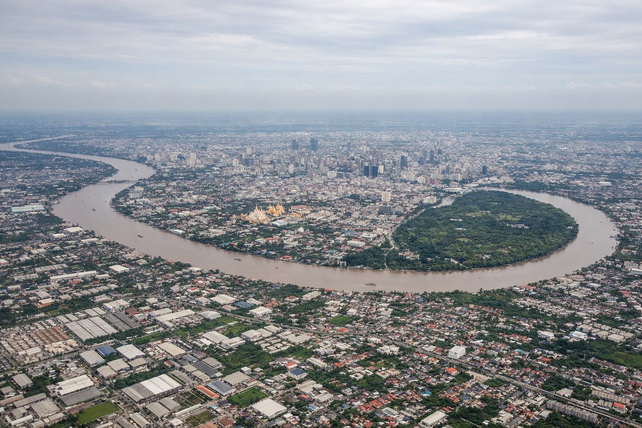
Takeoff from BKK
LEFTDeparting Suvarnabhumi to the north or south, the aircraft banks onto a northeast heading that keeps the Vietnamese coastline and Gulf of Tonkin approach roughly off the left side, giving a brief but genuine coastal view before the long overwater stretch. The right side only shows the flat, hazy Chao Phraya delta and open Gulf of Thailand.
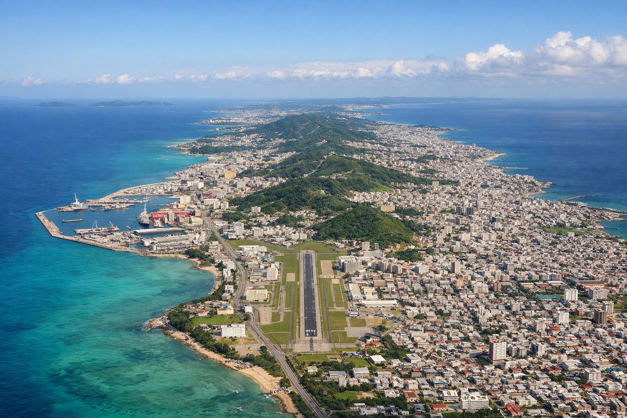
Landing at OKA
RIGHTOn approach into Naha, the descent path over the Kerama Islands and East China Sea typically curves so passengers on the right side get a clear view of the turquoise reef-fringed waters and the Okinawa coastline just before touchdown. The left side mostly faces open ocean with no land features.
Will your flight be in sunlight?
Pick a date and time in the Sun Map to watch the sun move across your whole flight.
About This Route
Which side of the plane should I sit on flying from Suvarnabhumi Airport (BKK) to Naha (OKA)?
Sit on the Left side of the plane for the best views on flights from Bangkok to Naha. The left side edges out overall thanks to the brief but real coastal glimpses during departure near Vietnam and the chance of seeing Taiwan's outline during cruise, whereas the right side is dominated by featureless open ocean for most of the flight.
What can I see during takeoff from Suvarnabhumi Airport in Bangkok?
During takeoff from Suvarnabhumi Airport (BKK), sit on the Left side for the best views. Departing Suvarnabhumi to the north or south, the aircraft banks onto a northeast heading that keeps the Vietnamese coastline and Gulf of Tonkin approach roughly off the left side, giving a brief but genuine coastal view before the long overwater stretch. The right side only shows the flat, hazy Chao Phraya delta and open Gulf of Thailand. Notable sights include: Chao Phraya River delta, Gulf of Thailand shoreline, southern Vietnam coast in the distance.
What can I see when landing at Naha in Naha?
When landing at Naha (OKA), sit on the Right side for the best views. On approach into Naha, the descent path over the Kerama Islands and East China Sea typically curves so passengers on the right side get a clear view of the turquoise reef-fringed waters and the Okinawa coastline just before touchdown. The left side mostly faces open ocean with no land features. Notable sights include: Kerama Islands, turquoise coral reefs of the East China Sea, Naha city and harbor, Okinawa's western coastline.
How long is the flight from Bangkok to Naha?
The flight from Suvarnabhumi Airport (BKK) to Naha (OKA) takes about 3 hours 25 minutes. The shortest flight path between them is 1,943 miles (3,127 km); winds and air traffic control usually add a few percent.
What does the Bangkok to Naha flight path pass over?
South China Sea, Luzon Strait, and the eastern coastline of Taiwan visible in the distance during cruise before the East China Sea approach to Okinawa