The left side strings together the Ryukyu island chain, Kyushu's volcanic coastline near Kagoshima, and a dramatic Kobe/Rokko mountain backdrop on arrival, giving continuous terrain and landmark variety. The right side is dominated by open Pacific-facing water during cruise with fewer distinctive features.
Flown OKA to ITM? Did we get it right?
Flight Path
Naha to Osaka is 753 miles (1,212 km), a flight of about 2 hours 10 minutes.
Ryukyu island chain (Amami Oshima, Tokunoshima), Kyushu's southern coast near Kagoshima and Sakurajima volcano, Bungo Channel, approach over the Kii Channel toward Osaka Bay
Great circle distance and headings ›Phase by phase
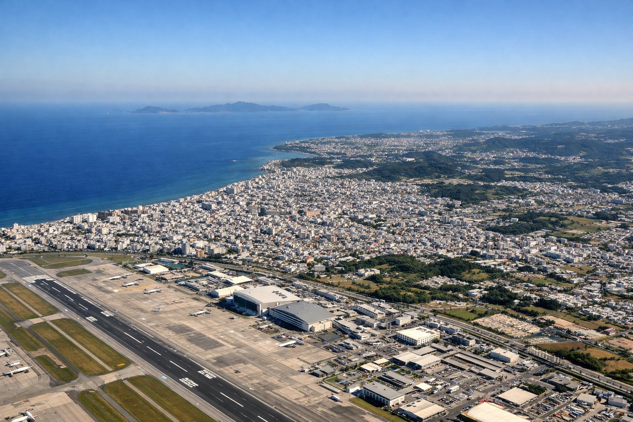
Takeoff from OKA
LEFTDeparting Naha, the initial turn toward the northeast puts passengers on the left side looking back over Naha's harbor, the turquoise reef-lined coastline, and the small Kerama Islands offshore. The right side mostly faces open East China Sea with little to anchor the view.
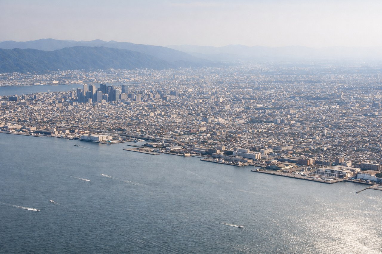
Landing at ITM
LEFTOn the descent into Itami, the left side faces west across Osaka Bay toward Kobe's coastline and the steep green wall of the Rokko mountain range, with the Akashi Kaikyo Bridge to Awaji Island visible near the bay mouth. The right side mostly shows flat Osaka suburban sprawl without the same terrain contrast.
Will your flight be in sunlight?
Pick a date and time in the Sun Map to watch the sun move across your whole flight.
About This Route
Which side of the plane should I sit on flying from Naha (OKA) to Osaka International (ITM)?
Sit on the Left side of the plane for the best views on flights from Naha to Osaka. The left side strings together the Ryukyu island chain, Kyushu's volcanic coastline near Kagoshima, and a dramatic Kobe/Rokko mountain backdrop on arrival, giving continuous terrain and landmark variety. The right side is dominated by open Pacific-facing water during cruise with fewer distinctive features.
What can I see during takeoff from Naha in Naha?
During takeoff from Naha (OKA), sit on the Left side for the best views. Departing Naha, the initial turn toward the northeast puts passengers on the left side looking back over Naha's harbor, the turquoise reef-lined coastline, and the small Kerama Islands offshore. The right side mostly faces open East China Sea with little to anchor the view. Notable sights include: Naha city and harbor, Okinawa's coral reef coastline, Kerama Islands, East China Sea.
What can I see when landing at Osaka International in Osaka?
When landing at Osaka International (ITM), sit on the Left side for the best views. On the descent into Itami, the left side faces west across Osaka Bay toward Kobe's coastline and the steep green wall of the Rokko mountain range, with the Akashi Kaikyo Bridge to Awaji Island visible near the bay mouth. The right side mostly shows flat Osaka suburban sprawl without the same terrain contrast. Notable sights include: Mt. Rokko range, Kobe waterfront, Akashi Kaikyo Bridge, Osaka Bay.
How long is the flight from Naha to Osaka?
The flight from Naha (OKA) to Osaka International (ITM) takes about 2 hours 10 minutes. The shortest flight path between them is 753 miles (1,212 km); winds and air traffic control usually add a few percent.
What does the Naha to Osaka flight path pass over?
Ryukyu island chain (Amami Oshima, Tokunoshima), Kyushu's southern coast near Kagoshima and Sakurajima volcano, Bungo Channel, approach over the Kii Channel toward Osaka Bay