Omaha to Phoenix is 1,036 miles (1,667 km), a flight of about 2 hours 55 minutes.
The right side captures both bookend highlights of the trip — Omaha's river skyline at takeoff and the Superstition Mountains with the Phoenix valley on approach — while the left side spends most of the flight over featureless high plains and desert with no comparable landmarks.
Flight Path
Eastern Colorado high plains giving way to the Sangre de Cristo foothills near Trinidad, then the Sandia Mountains and Rio Grande Valley near Albuquerque before crossing into Arizona's high desert plateau
Great circle distance and headings ›.jpg?width=600)

Phase by phase
Takeoff from OMA
RIGHTEppley Airfield sits on the east bank of the Missouri River, and departures off Runway 14 bank right toward the southwest heading for Phoenix. That turn puts downtown Omaha's skyline and the river directly under the right wing before the plains take over.
Landing at PHX
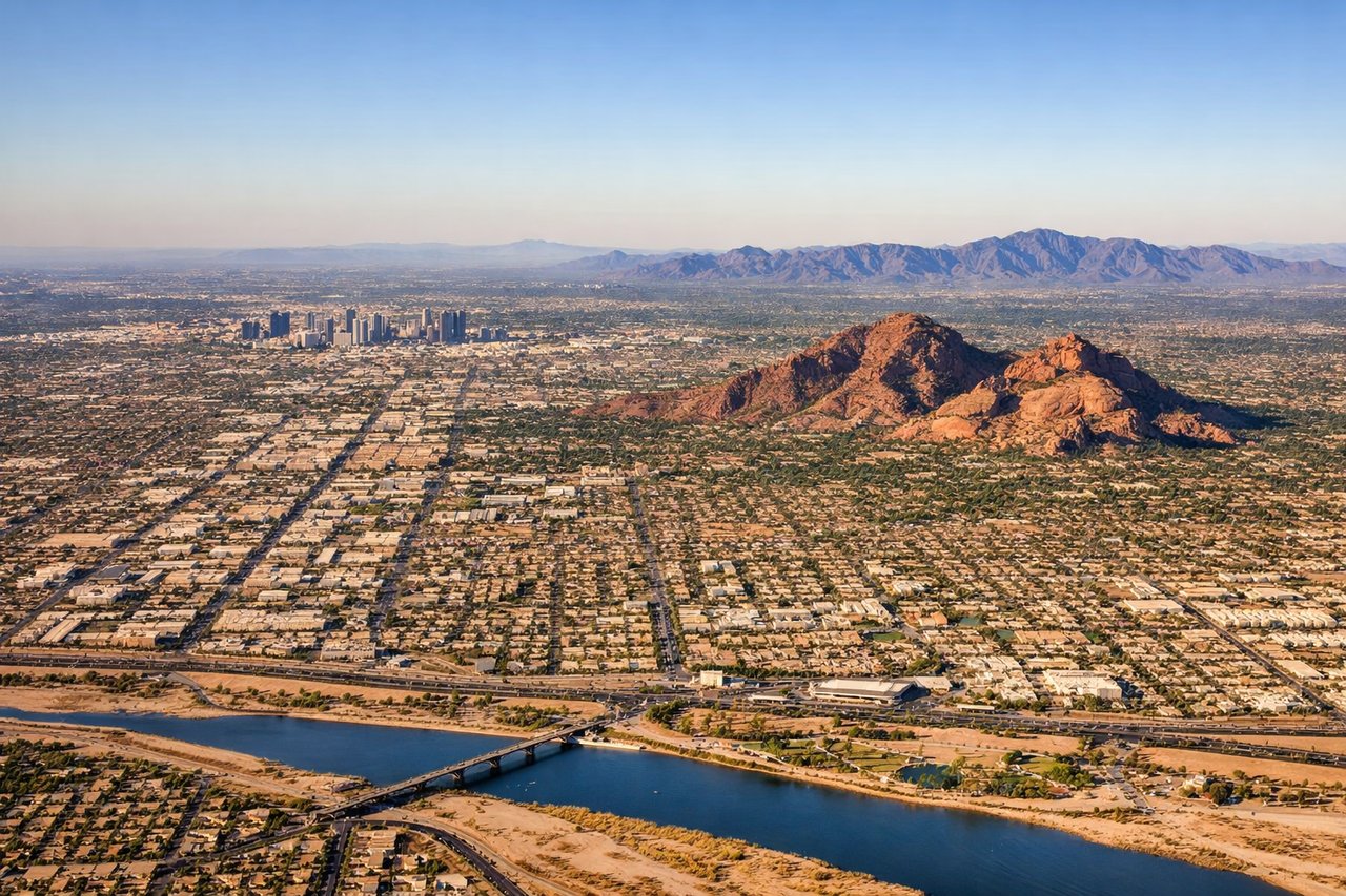
RIGHTArrivals into Phoenix from the northeast typically descend over the desert and swing south for the east-facing runways, giving right-side passengers a close look at the jagged Superstition Mountains before the turn reveals the Phoenix valley and Camelback Mountain.
Landmarks on this routeAll landmarks →
Will your flight be in sunlight?
Pick a date and time in the Sun Map to watch the sun move across your whole flight.
About This Route
Which side of the plane should I sit on flying from Eppley Afld (OMA) to Phoenix Sky Harbor International (PHX)?
Sit on the Right side of the plane for the best views on flights from Omaha to Phoenix. The right side captures both bookend highlights of the trip — Omaha's river skyline at takeoff and the Superstition Mountains with the Phoenix valley on approach — while the left side spends most of the flight over featureless high plains and desert with no comparable landmarks.
What can I see during takeoff from Eppley Afld in Omaha?
During takeoff from Eppley Afld (OMA), sit on the Right side for the best views. Eppley Airfield sits on the east bank of the Missouri River, and departures off Runway 14 bank right toward the southwest heading for Phoenix. That turn puts downtown Omaha's skyline and the river directly under the right wing before the plains take over. Notable sights include: Missouri River, downtown Omaha skyline, Council Bluffs, eastern Nebraska farmland grid.
What can I see when landing at Phoenix Sky Harbor International in Phoenix?
When landing at Phoenix Sky Harbor International (PHX), sit on the Right side for the best views. Arrivals into Phoenix from the northeast typically descend over the desert and swing south for the east-facing runways, giving right-side passengers a close look at the jagged Superstition Mountains before the turn reveals the Phoenix valley and Camelback Mountain. Notable sights include: Superstition Mountains, Salt River bed, Camelback Mountain, Phoenix downtown skyline.
How long is the flight from Omaha to Phoenix?
The flight from Eppley Afld (OMA) to Phoenix Sky Harbor International (PHX) takes about 2 hours 55 minutes. The shortest flight path between them is 1,036 miles (1,667 km); winds and air traffic control usually add a few percent.
What does the Omaha to Phoenix flight path pass over?
Eastern Colorado high plains giving way to the Sangre de Cristo foothills near Trinidad, then the Sandia Mountains and Rio Grande Valley near Albuquerque before crossing into Arizona's high desert plateau