While landing offers the iconic Mississippi River and Gateway Arch views, the takeoff provides sustained scenic interest with the Missouri River's curves and Omaha's urban-rural transition. Right-side seats capture the best of both segments.
Flown OMA to STL? Did we get it right?
Flight Path
Omaha to St. Louis is 341 miles (549 km), a flight of about 1 hour 15 minutes.
Des Moines metropolitan area (visible from cruise altitude around 25,000 feet), Des Moines River valley, Iowa River system, transition from Cornhusker plains to rolling Iowa farmland, scattered lakes and reservoirs in central Iowa
Great circle distance and headings ›Phase by phase
Takeoff from OMA
RIGHTRight-side seats offer views of the Missouri River as it curves southeast from Omaha, plus the urban sprawl of the metro area receding below. Left side faces inland prairie with minimal visual interest during climb-out.
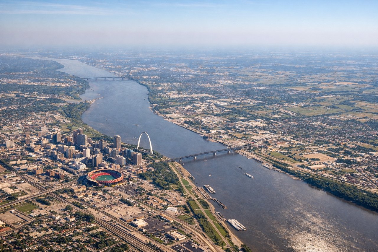
Landing at STL
LEFTLeft-side seats provide excellent views of the Mississippi River and St. Louis's urban core during descent. The river's dramatic confluence with the Missouri is visible, and the Gateway Arch area becomes prominent as you approach from the north.
Will your flight be in sunlight?
Pick a date and time in the Sun Map to watch the sun move across your whole flight.
About This Route
Which side of the plane should I sit on flying from Eppley Afld (OMA) to Lambert St Louis International (STL)?
Sit on the Right side of the plane for the best views on flights from Omaha to St. Louis. While landing offers the iconic Mississippi River and Gateway Arch views, the takeoff provides sustained scenic interest with the Missouri River's curves and Omaha's urban-rural transition. Right-side seats capture the best of both segments.
What can I see during takeoff from Eppley Afld in Omaha?
During takeoff from Eppley Afld (OMA), sit on the Right side for the best views. Right-side seats offer views of the Missouri River as it curves southeast from Omaha, plus the urban sprawl of the metro area receding below. Left side faces inland prairie with minimal visual interest during climb-out. Notable sights include: Missouri River (immediate southeast of airport), Omaha metropolitan area, Papillion Creek valley, flat Cornhusker plains extending south.
What can I see when landing at Lambert St Louis International in St. Louis?
When landing at Lambert St Louis International (STL), sit on the Left side for the best views. Left-side seats provide excellent views of the Mississippi River and St. Louis's urban core during descent. The river's dramatic confluence with the Missouri is visible, and the Gateway Arch area becomes prominent as you approach from the north. Notable sights include: Mississippi River (main descent corridor), Missouri River confluence, St. Louis downtown and Gateway Arch, Illinois bluffs east of the river.
How long is the flight from Omaha to St. Louis?
The flight from Eppley Afld (OMA) to Lambert St Louis International (STL) takes about 1 hour 15 minutes. The shortest flight path between them is 341 miles (549 km); winds and air traffic control usually add a few percent.
What does the Omaha to St. Louis flight path pass over?
Des Moines metropolitan area (visible from cruise altitude around 25,000 feet), Des Moines River valley, Iowa River system, transition from Cornhusker plains to rolling Iowa farmland, scattered lakes and reservoirs in central Iowa