While left offers good Bucharest views at takeoff, right dominates the flight with extensive Alpine scenery during the long descent into Switzerland. The Carpathians visible from Bucharest are modest compared to the dramatic Swiss Alps visible for the final 45 minutes of descent.
Flown OTP to ZRH? Did we get it right?
Flight Path
Bucharest to Zurich is 864 miles (1,390 km), a flight of about 2 hours 15 minutes.
The flight path crosses the Carpathian Mountains (Piatra Craiului and Bucegi ranges visible from the climb), then proceeds northwest over the Hungarian Plain and Austrian foothills. The Danube River is visible for much of the early flight. As you approach Switzerland, the landscape transitions from rolling hills to increasingly dramatic Alpine terrain. The Appenzell Alps and Säntis massif dominate the final approach, with Zurich Lake visible shortly before landing.
Great circle distance and headings ›


Phase by phase
Takeoff from OTP
LEFTLeft side offers immediate views of Bucharest's urban sprawl and the Danube River plain stretching westward. The city's grid pattern and surrounding flat terrain are distinctive during climb-out, with the Carpathian Mountains appearing on the horizon ahead.
Landing at ZRH
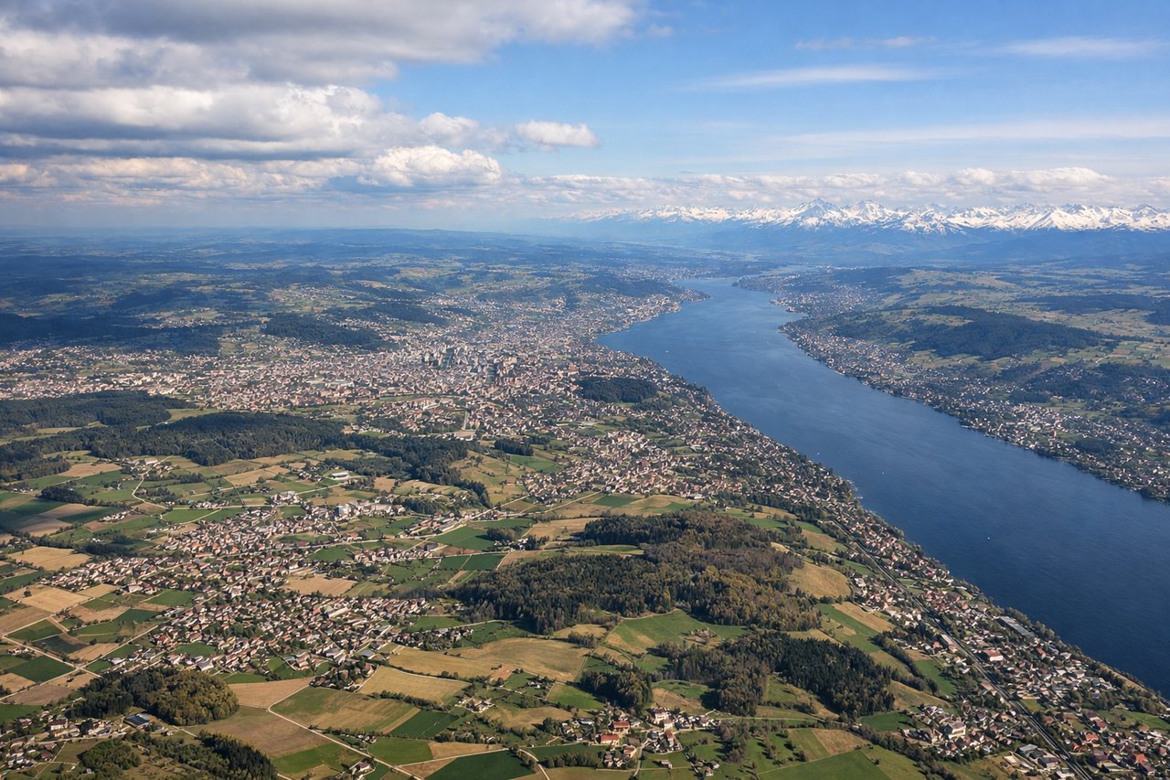
RIGHTRight side provides excellent views of the Swiss Alps during descent into Zurich. The Säntis massif and surrounding Alpine peaks become increasingly prominent as you approach from the northeast, with the Glarus Alps and Appenzell Alps visible to the right.
Will your flight be in sunlight?
Pick a date and time in the Sun Map to watch the sun move across your whole flight.
About This Route
Which side of the plane should I sit on flying from Otopeni (OTP) to Zurich (ZRH)?
Sit on the Right side of the plane for the best views on flights from Bucharest to Zurich. While left offers good Bucharest views at takeoff, right dominates the flight with extensive Alpine scenery during the long descent into Switzerland. The Carpathians visible from Bucharest are modest compared to the dramatic Swiss Alps visible for the final 45 minutes of descent.
What can I see during takeoff from Otopeni in Bucharest?
During takeoff from Otopeni (OTP), sit on the Left side for the best views. Left side offers immediate views of Bucharest's urban sprawl and the Danube River plain stretching westward. The city's grid pattern and surrounding flat terrain are distinctive during climb-out, with the Carpathian Mountains appearing on the horizon ahead. Notable sights include: Bucharest city center and suburbs, Danube River floodplain to the south, Carpathian Mountains (distant northern horizon), Prahova River valley.
What can I see when landing at Zurich in Zurich?
When landing at Zurich (ZRH), sit on the Right side for the best views. Right side provides excellent views of the Swiss Alps during descent into Zurich. The Säntis massif and surrounding Alpine peaks become increasingly prominent as you approach from the northeast, with the Glarus Alps and Appenzell Alps visible to the right. Notable sights include: Swiss Alps (Säntis, Glarus Alps, Appenzell Alps), Zurich Lake (Zürichsee), Rhine River valley, Zurich city and airport.
How long is the flight from Bucharest to Zurich?
The flight from Otopeni (OTP) to Zurich (ZRH) takes about 2 hours 15 minutes. The shortest flight path between them is 864 miles (1,390 km); winds and air traffic control usually add a few percent.
What does the Bucharest to Zurich flight path pass over?
The flight path crosses the Carpathian Mountains (Piatra Craiului and Bucegi ranges visible from the climb), then proceeds northwest over the Hungarian Plain and Austrian foothills. The Danube River is visible for much of the early flight. As you approach Switzerland, the landscape transitions from rolling hills to increasingly dramatic Alpine terrain. The Appenzell Alps and Säntis massif dominate the final approach, with Zurich Lake visible shortly before landing.