Everett to Honolulu is 2,694 miles (4,335 km), a flight of about 5 hours 15 minutes.
Left seats capture the most dramatic Pacific Northwest geography at departure (Mount Rainier and Cascades) and still provide reasonable views of Oahu's windward features during approach. The takeoff view is significantly more striking than the landing view, and left seats maintain better sightlines throughout the cruise phase over the open Pacific.
Flight Path
The flight path crosses the open North Pacific with no significant landmarks. Departure climbs over the Cascade Range and Puget Sound region. The aircraft tracks southwest across the Pacific, passing north of the Hawaiian Islands' typical shipping lanes. Approach to Honolulu descends over the Kaiwi Channel and approaches Oahu from the northwest, with views of the Waianae Range and leeward coast. No major islands or atolls are typically visible during the cruise phase at 35,000 feet.
Great circle distance and headings ›Phase by phase
Takeoff from PAE
LEFTPAE typically departs runways 16L/R or 11L/R depending on wind. Left seats capture the Cascade Range and Mount Rainier during initial climb-out heading south or southeast. Right seats face Puget Sound and the Olympic Mountains, but the Cascades dominate the more dramatic view.
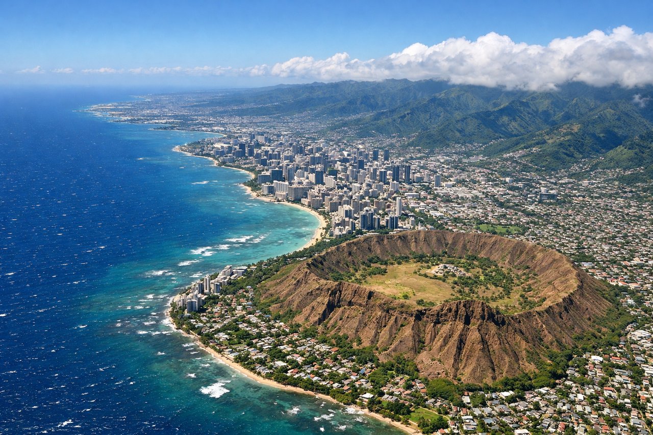
Landing at HNL
RIGHTApproach to HNL typically uses runways 08L/R or 26L/R depending on wind. Right seats on descent into Honolulu offer views of the Waianae Range and the leeward coast of Oahu. The island's western profile and the approach over the Kaena Point area provide dramatic topography and clear water views.
Landmarks on this routeAll landmarks →
Will your flight be in sunlight?
Pick a date and time in the Sun Map to watch the sun move across your whole flight.
About This Route
Which side of the plane should I sit on flying from Snohomish Co (PAE) to Honolulu International (HNL)?
Sit on the Left side of the plane for the best views on flights from Everett to Honolulu. Left seats capture the most dramatic Pacific Northwest geography at departure (Mount Rainier and Cascades) and still provide reasonable views of Oahu's windward features during approach. The takeoff view is significantly more striking than the landing view, and left seats maintain better sightlines throughout the cruise phase over the open Pacific.
What can I see during takeoff from Snohomish Co in Everett?
During takeoff from Snohomish Co (PAE), sit on the Left side for the best views. PAE typically departs runways 16L/R or 11L/R depending on wind. Left seats capture the Cascade Range and Mount Rainier during initial climb-out heading south or southeast. Right seats face Puget Sound and the Olympic Mountains, but the Cascades dominate the more dramatic view. Notable sights include: Mount Rainier (14,411 ft, ~60 miles southeast), Cascade Range spine, Lake Union and Lake Washington (visible during initial climb), Puget Sound waters.
What can I see when landing at Honolulu International in Honolulu?
When landing at Honolulu International (HNL), sit on the Right side for the best views. Approach to HNL typically uses runways 08L/R or 26L/R depending on wind. Right seats on descent into Honolulu offer views of the Waianae Range and the leeward coast of Oahu. The island's western profile and the approach over the Kaena Point area provide dramatic topography and clear water views. Notable sights include: Waianae Range (western Oahu mountains, ~4,000 ft peaks), Kaena Point (northwestern tip of Oahu), Molokai visible across the Kaiwi Channel (on clear days), Pacific Ocean and reef systems.
How long is the flight from Everett to Honolulu?
The flight from Snohomish Co (PAE) to Honolulu International (HNL) takes about 5 hours 15 minutes. The shortest flight path between them is 2,694 miles (4,335 km); winds and air traffic control usually add a few percent.
What does the Everett to Honolulu flight path pass over?
The flight path crosses the open North Pacific with no significant landmarks. Departure climbs over the Cascade Range and Puget Sound region. The aircraft tracks southwest across the Pacific, passing north of the Hawaiian Islands' typical shipping lanes. Approach to Honolulu descends over the Kaiwi Channel and approaches Oahu from the northwest, with views of the Waianae Range and leeward coast. No major islands or atolls are typically visible during the cruise phase at 35,000 feet.