Everett to Las Vegas is 894 miles (1,439 km), a flight of about 2 hours 25 minutes.
The left side delivers the spectacular Cascade volcanic chain on departure including Rainier and Baker, then tracks the Sierra Nevada and eastern California ranges through the cruise portion. While the right side wins at landing for the Strip view, the sheer drama of the Cascades on departure and the longer scenic exposure along the flight path gives the left side the edge overall.
Flight Path
After clearing the Cascades, the route crosses the Columbia Plateau's high desert terrain over central Oregon and Nevada. The Steens Mountain range in southeastern Oregon is visible, followed by the vast Basin and Range topography of Nevada with parallel north-south fault-block mountain ranges separated by flat alkali playas. The Black Rock Desert playa is a notable feature mid-route. Approaching Las Vegas, Lake Mead's blue reservoir becomes visible on the right side roughly 20-30 miles out.
Great circle distance and headings ›


Phase by phase
Takeoff from PAE
LEFTPAE's primary departure runway 16R sends aircraft southbound over Puget Sound. The left side faces east toward the Cascade Range, giving you a direct view of Mount Rainier, Mount Baker, and the full volcanic chain as you climb out. The right side looks west over the Sound and the less dramatic Olympic Peninsula foothills.
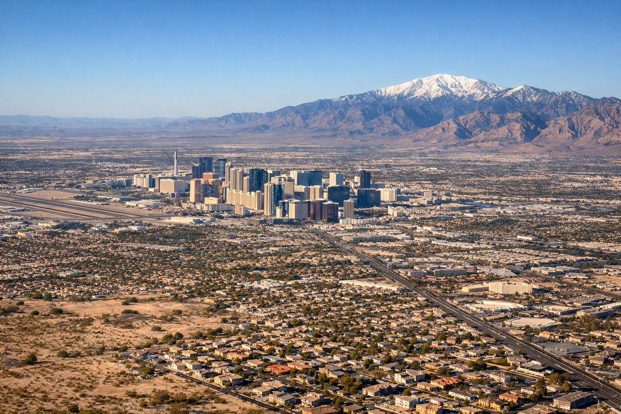
Landing at LAS
RIGHTMcCarran typically uses runways 26L/26R or 19R for arrivals, meaning aircraft approach from the east or north. The right side on approach gives you the Las Vegas Strip laid out clearly below, with the city grid and resort towers visible before touchdown. The left side faces toward the Spring Mountains and Red Rock Canyon, which are scenic but the Strip is the signature view.
Landmarks on this routeAll landmarks →
Will your flight be in sunlight?
Pick a date and time in the Sun Map to watch the sun move across your whole flight.
About This Route
Which side of the plane should I sit on flying from Snohomish Co (PAE) to Mc Carran International (LAS)?
Sit on the Left side of the plane for the best views on flights from Everett to Las Vegas. The left side delivers the spectacular Cascade volcanic chain on departure including Rainier and Baker, then tracks the Sierra Nevada and eastern California ranges through the cruise portion. While the right side wins at landing for the Strip view, the sheer drama of the Cascades on departure and the longer scenic exposure along the flight path gives the left side the edge overall.
What can I see during takeoff from Snohomish Co in Everett?
During takeoff from Snohomish Co (PAE), sit on the Left side for the best views. PAE's primary departure runway 16R sends aircraft southbound over Puget Sound. The left side faces east toward the Cascade Range, giving you a direct view of Mount Rainier, Mount Baker, and the full volcanic chain as you climb out. The right side looks west over the Sound and the less dramatic Olympic Peninsula foothills. Notable sights include: Mount Rainier (14,411 ft), Mount Baker to the north, the Cascade Range spine, Puget Sound below.
What can I see when landing at Mc Carran International in Las Vegas?
When landing at Mc Carran International (LAS), sit on the Right side for the best views. McCarran typically uses runways 26L/26R or 19R for arrivals, meaning aircraft approach from the east or north. The right side on approach gives you the Las Vegas Strip laid out clearly below, with the city grid and resort towers visible before touchdown. The left side faces toward the Spring Mountains and Red Rock Canyon, which are scenic but the Strip is the signature view. Notable sights include: Las Vegas Strip resort corridor, Lake Mead to the east, Hoover Dam, Spring Mountains (Charleston Peak).
How long is the flight from Everett to Las Vegas?
The flight from Snohomish Co (PAE) to Mc Carran International (LAS) takes about 2 hours 25 minutes. The shortest flight path between them is 894 miles (1,439 km); winds and air traffic control usually add a few percent.
What does the Everett to Las Vegas flight path pass over?
After clearing the Cascades, the route crosses the Columbia Plateau's high desert terrain over central Oregon and Nevada. The Steens Mountain range in southeastern Oregon is visible, followed by the vast Basin and Range topography of Nevada with parallel north-south fault-block mountain ranges separated by flat alkali playas. The Black Rock Desert playa is a notable feature mid-route. Approaching Las Vegas, Lake Mead's blue reservoir becomes visible on the right side roughly 20-30 miles out.