The left side delivers the flight's two best visual moments — Mount Hood at departure and the Sonoran Desert mountains (Four Peaks, Superstitions, South Mountain) at arrival — bookending a cruise phase that also tracks closer to the Cascade volcanoes and Nevada's desert ranges. The right side spends most of the flight over comparatively featureless basin terrain.
Flown PDX to PHX? Did we get it right?
Flight Path
Portland to Phoenix is 1,010 miles (1,625 km), a flight of about 2 hours 25 minutes.
Great Basin desert ranges of northern Nevada, with the arid Basin and Range topography of parallel mountain ridges and dry valleys visible below as the route crosses from Oregon into Nevada en route to Arizona
Great circle distance and headings ›Phase by phase
Takeoff from PDX
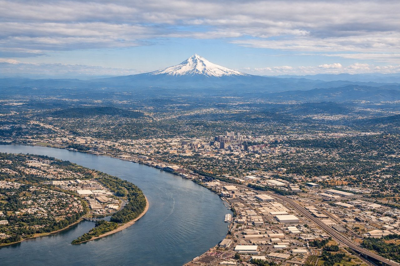
LEFTDepartures turning south from PDX put Mount Hood's snow-capped cone directly in view on the left, rising above the Willamette Valley just minutes after liftoff. The right side mostly shows the flat Tualatin Valley and Coast Range foothills, which are far less distinctive.

Landing at PHX
LEFTOn the typical approach into Phoenix from the north, the left side reveals the desert ranges east of the city — Four Peaks and the jagged Superstition Mountains — along with South Mountain and the downtown skyline as the aircraft lines up for landing. The right side mostly faces the flatter, less distinctive West Valley desert.
Will your flight be in sunlight?
Pick a date and time in the Sun Map to watch the sun move across your whole flight.
About This Route
Which side of the plane should I sit on flying from Portland International (PDX) to Phoenix Sky Harbor International (PHX)?
Sit on the Left side of the plane for the best views on flights from Portland to Phoenix. The left side delivers the flight's two best visual moments — Mount Hood at departure and the Sonoran Desert mountains (Four Peaks, Superstitions, South Mountain) at arrival — bookending a cruise phase that also tracks closer to the Cascade volcanoes and Nevada's desert ranges. The right side spends most of the flight over comparatively featureless basin terrain.
What can I see during takeoff from Portland International in Portland?
During takeoff from Portland International (PDX), sit on the Left side for the best views. Departures turning south from PDX put Mount Hood's snow-capped cone directly in view on the left, rising above the Willamette Valley just minutes after liftoff. The right side mostly shows the flat Tualatin Valley and Coast Range foothills, which are far less distinctive. Notable sights include: Mount Hood, Willamette River and downtown Portland, Cascade Range foothills.
What can I see when landing at Phoenix Sky Harbor International in Phoenix?
When landing at Phoenix Sky Harbor International (PHX), sit on the Left side for the best views. On the typical approach into Phoenix from the north, the left side reveals the desert ranges east of the city — Four Peaks and the jagged Superstition Mountains — along with South Mountain and the downtown skyline as the aircraft lines up for landing. The right side mostly faces the flatter, less distinctive West Valley desert. Notable sights include: Four Peaks, Superstition Mountains, South Mountain, downtown Phoenix skyline.
How long is the flight from Portland to Phoenix?
The flight from Portland International (PDX) to Phoenix Sky Harbor International (PHX) takes about 2 hours 25 minutes. The shortest flight path between them is 1,010 miles (1,625 km); winds and air traffic control usually add a few percent.
What does the Portland to Phoenix flight path pass over?
Great Basin desert ranges of northern Nevada, with the arid Basin and Range topography of parallel mountain ridges and dry valleys visible below as the route crosses from Oregon into Nevada en route to Arizona