The right side wins on both ends of the flight: Phoenix's desert peaks and buttes during takeoff, and the dramatic Mount Hood view during the Portland approach, giving it more consistent landmark payoff than the left side's flatter desert and distant, hazy mountain views.
Flown PHX to PDX? Did we get it right?
Flight Path
Phoenix to Portland is 1,010 miles (1,625 km), a flight of about 2 hours 25 minutes.
The route crosses the Basin and Range desert of Nevada near Las Vegas and the Colorado River corridor, then passes over the high desert plateau of central Oregon before the Cascade Range's volcanic peaks, including Mount Jefferson and the Three Sisters, come into view ahead of the Portland approach.
Great circle distance and headings ›Phase by phase
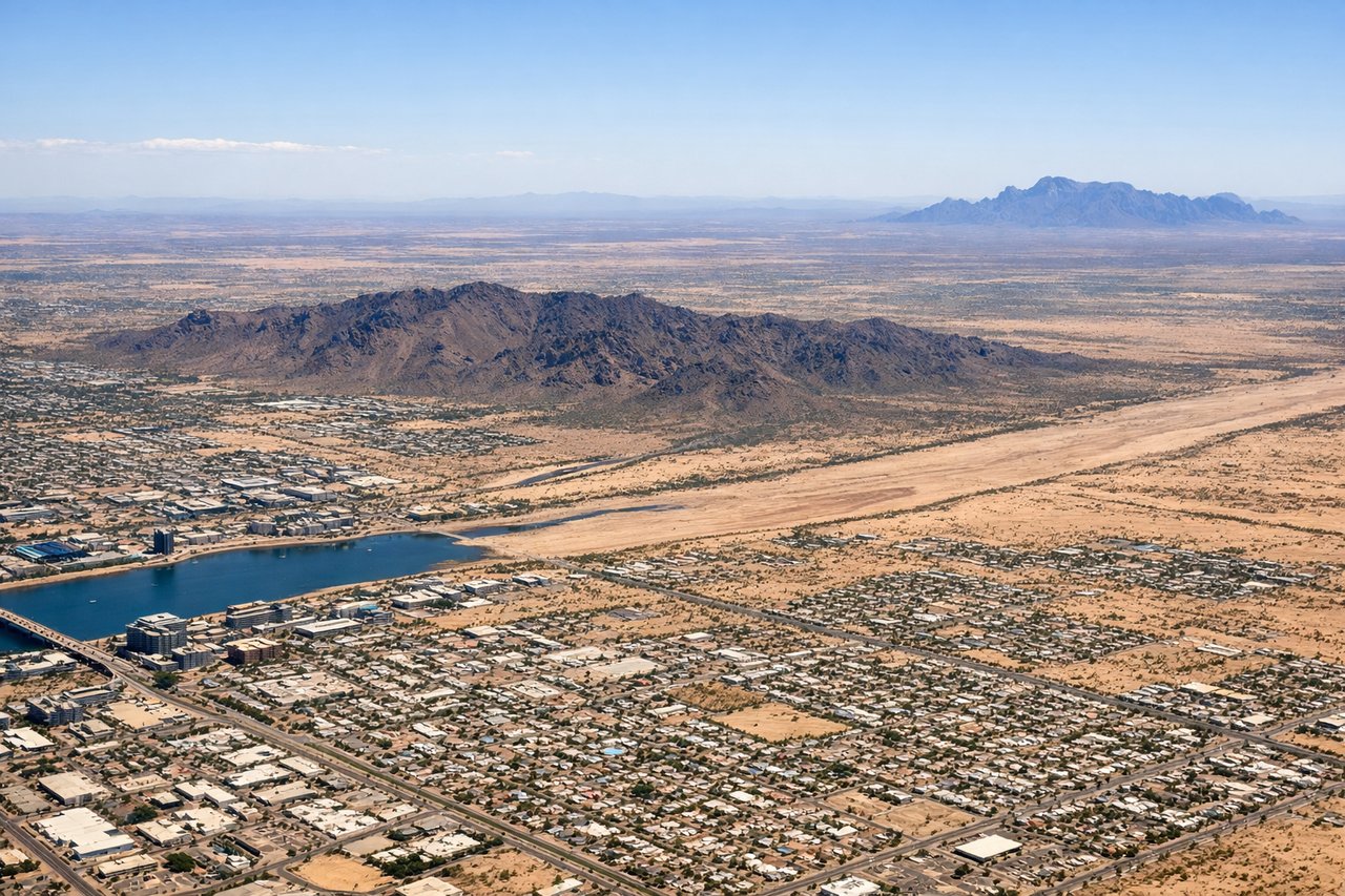
Takeoff from PHX
RIGHTDeparting PHX to the west and then banking north toward Portland puts Phoenix's signature desert landmarks on the right side of the aircraft. Camelback Mountain, the Papago Buttes, and the jagged Superstition Mountains are all visible as the plane climbs, plus a good look at downtown Phoenix's skyline.
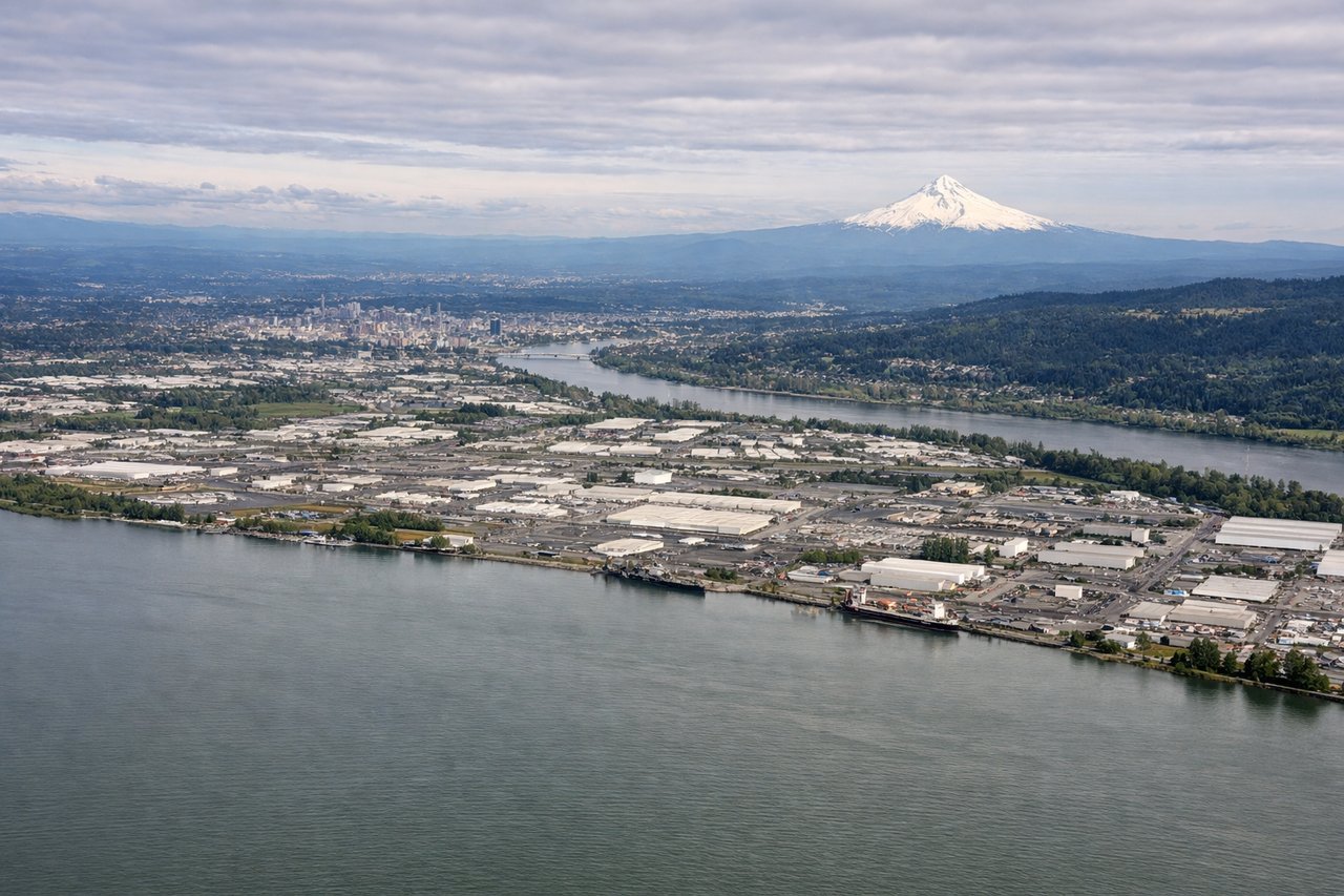
Landing at PDX
RIGHTOn approach into PDX from the south, the descent path runs up the Willamette Valley before turning onto the west-facing runway, keeping snow-capped Mount Hood prominently visible off the right side. It's one of the most recognizable volcanic peaks in the country and dominates the view during the final minutes of the flight.
Will your flight be in sunlight?
Pick a date and time in the Sun Map to watch the sun move across your whole flight.
About This Route
Which side of the plane should I sit on flying from Phoenix Sky Harbor International (PHX) to Portland International (PDX)?
Sit on the Right side of the plane for the best views on flights from Phoenix to Portland. The right side wins on both ends of the flight: Phoenix's desert peaks and buttes during takeoff, and the dramatic Mount Hood view during the Portland approach, giving it more consistent landmark payoff than the left side's flatter desert and distant, hazy mountain views.
What can I see during takeoff from Phoenix Sky Harbor International in Phoenix?
During takeoff from Phoenix Sky Harbor International (PHX), sit on the Right side for the best views. Departing PHX to the west and then banking north toward Portland puts Phoenix's signature desert landmarks on the right side of the aircraft. Camelback Mountain, the Papago Buttes, and the jagged Superstition Mountains are all visible as the plane climbs, plus a good look at downtown Phoenix's skyline. Notable sights include: Camelback Mountain, Papago Buttes (Hole-in-the-Rock), Superstition Mountains, Downtown Phoenix skyline.
What can I see when landing at Portland International in Portland?
When landing at Portland International (PDX), sit on the Right side for the best views. On approach into PDX from the south, the descent path runs up the Willamette Valley before turning onto the west-facing runway, keeping snow-capped Mount Hood prominently visible off the right side. It's one of the most recognizable volcanic peaks in the country and dominates the view during the final minutes of the flight. Notable sights include: Mount Hood, Willamette River, Downtown Portland, Columbia River.
How long is the flight from Phoenix to Portland?
The flight from Phoenix Sky Harbor International (PHX) to Portland International (PDX) takes about 2 hours 25 minutes. The shortest flight path between them is 1,010 miles (1,625 km); winds and air traffic control usually add a few percent.
What does the Phoenix to Portland flight path pass over?
The route crosses the Basin and Range desert of Nevada near Las Vegas and the Colorado River corridor, then passes over the high desert plateau of central Oregon before the Cascade Range's volcanic peaks, including Mount Jefferson and the Three Sisters, come into view ahead of the Portland approach.