The left side delivers sustained, dramatic scenery through both takeoff and cruise, with the Cascade volcano chain (Mount Hood, Mount Shasta) dominating the view for most of the short flight, while the right side is mostly flat valley until the final approach payoff at SFO.
Flown PDX to SFO? Did we get it right?
Flight Path
Portland to San Francisco is 551 miles (886 km), a flight of about 1 hour 50 minutes.
The route crosses the Cascade Range spine near Mount Shasta and the Klamath Basin in southern Oregon/northern California before descending into the Sacramento Valley.
Great circle distance and headings ›


Phase by phase
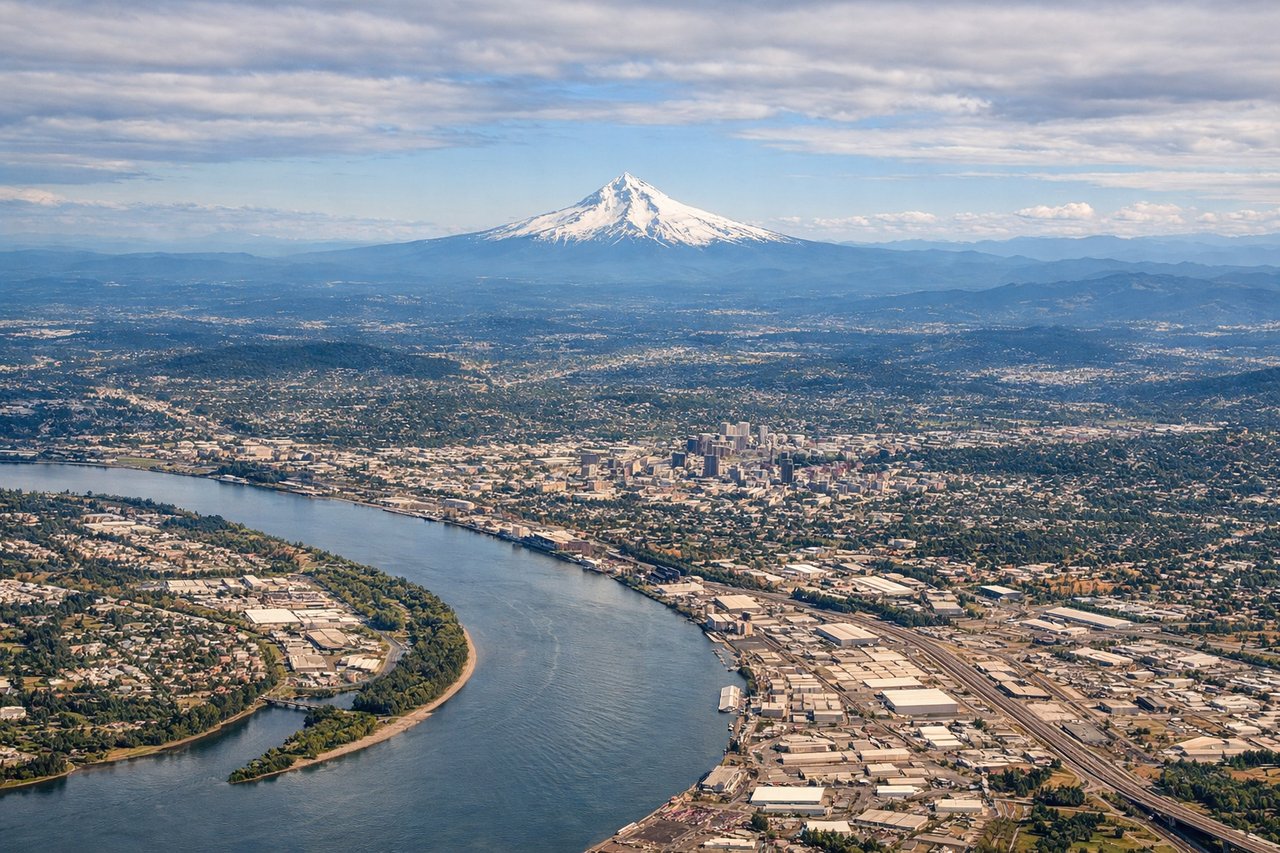
Takeoff from PDX
LEFTDeparting PDX, the aircraft typically climbs out and turns south toward SFO, putting the Cascade volcanoes on the left. Mount Hood and, on clear days, Mount St. Helens and Mount Adams rise dramatically above the Willamette Valley farmland below.

Landing at SFO
RIGHTOn approach into SFO from the north, the aircraft descends over San Francisco Bay before lining up with the runway, putting the San Francisco skyline, Golden Gate Bridge, and Marin Headlands on the right side of the plane. This is one of the most recognizable urban approach views in the US.
Will your flight be in sunlight?
Pick a date and time in the Sun Map to watch the sun move across your whole flight.
About This Route
Which side of the plane should I sit on flying from Portland International (PDX) to San Francisco International (SFO)?
Sit on the Left side of the plane for the best views on flights from Portland to San Francisco. The left side delivers sustained, dramatic scenery through both takeoff and cruise, with the Cascade volcano chain (Mount Hood, Mount Shasta) dominating the view for most of the short flight, while the right side is mostly flat valley until the final approach payoff at SFO.
What can I see during takeoff from Portland International in Portland?
During takeoff from Portland International (PDX), sit on the Left side for the best views. Departing PDX, the aircraft typically climbs out and turns south toward SFO, putting the Cascade volcanoes on the left. Mount Hood and, on clear days, Mount St. Helens and Mount Adams rise dramatically above the Willamette Valley farmland below. Notable sights include: Mount Hood, Mount St. Helens, Mount Adams, Willamette Valley farmland.
What can I see when landing at San Francisco International in San Francisco?
When landing at San Francisco International (SFO), sit on the Right side for the best views. On approach into SFO from the north, the aircraft descends over San Francisco Bay before lining up with the runway, putting the San Francisco skyline, Golden Gate Bridge, and Marin Headlands on the right side of the plane. This is one of the most recognizable urban approach views in the US. Notable sights include: Golden Gate Bridge, San Francisco skyline, San Francisco Bay, Marin Headlands.
How long is the flight from Portland to San Francisco?
The flight from Portland International (PDX) to San Francisco International (SFO) takes about 1 hour 50 minutes. The shortest flight path between them is 551 miles (886 km); winds and air traffic control usually add a few percent.
What does the Portland to San Francisco flight path pass over?
The route crosses the Cascade Range spine near Mount Shasta and the Klamath Basin in southern Oregon/northern California before descending into the Sacramento Valley.