The right side captures the more dramatic bookends of the flight: San Francisco Bay and skyline during departure, and the striking profile of Mount Hood during arrival, while the left side offers mostly flat valley terrain with little variation.
Flight Path
Sacramento Valley farmland, the southern Cascade Range near Mount Shasta, and the forested mountains of southern Oregon
Great circle distance and headings ›


Phase by phase

Takeoff from SFO
RIGHTDeparting SFO into prevailing westerlies, the aircraft climbs out over the Pacific then banks right (east) to turn north toward Oregon, putting San Francisco Bay, the city skyline, and the Bay Bridge directly beneath the right side during the turn. The left side only shows open ocean during this maneuver.
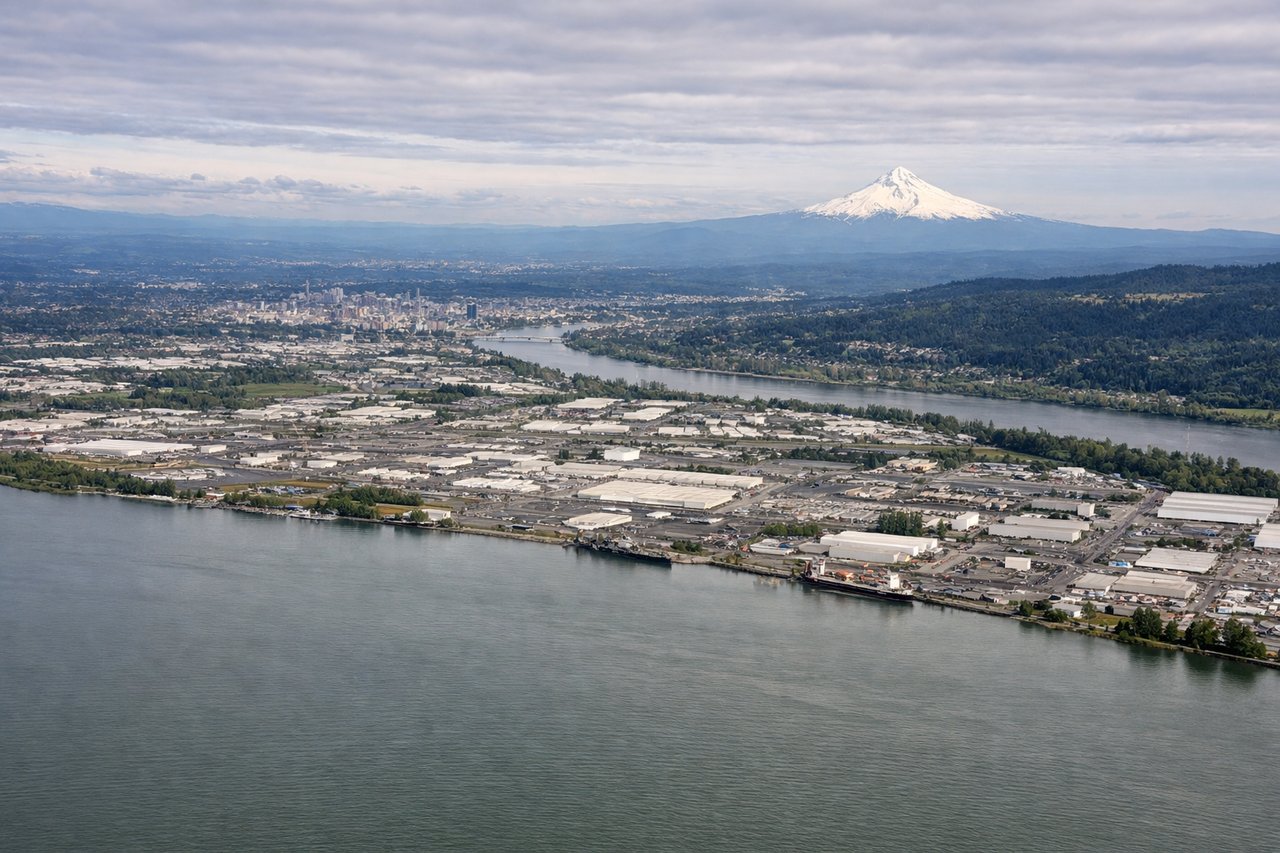
Landing at PDX
RIGHTOn the descent into PDX, the approach path passes south of the Columbia River with Mount Hood's snow-capped cone dominating the eastern horizon on the right side. The left side mostly shows the flat Willamette Valley farmland with only distant glimpses of downtown Portland.
Landmarks on this routeAll landmarks →
Will your flight be in sunlight?
See exactly which side of the plane gets sun and shade at your departure time.
About This Route
Which side of the plane should I sit on flying from San Francisco International (SFO) to Portland International (PDX)?
Sit on the Right side of the plane for the best views on flights from San Francisco to Portland. The right side captures the more dramatic bookends of the flight: San Francisco Bay and skyline during departure, and the striking profile of Mount Hood during arrival, while the left side offers mostly flat valley terrain with little variation.
What can I see during takeoff from San Francisco International in San Francisco?
During takeoff from San Francisco International (SFO), sit on the Right side for the best views. Departing SFO into prevailing westerlies, the aircraft climbs out over the Pacific then banks right (east) to turn north toward Oregon, putting San Francisco Bay, the city skyline, and the Bay Bridge directly beneath the right side during the turn. The left side only shows open ocean during this maneuver. Notable sights include: San Francisco Bay, San Francisco skyline, Bay Bridge, Oakland hills.
What can I see when landing at Portland International in Portland?
When landing at Portland International (PDX), sit on the Right side for the best views. On the descent into PDX, the approach path passes south of the Columbia River with Mount Hood's snow-capped cone dominating the eastern horizon on the right side. The left side mostly shows the flat Willamette Valley farmland with only distant glimpses of downtown Portland. Notable sights include: Mount Hood, Columbia River, Willamette Valley farmland, Portland's eastern suburbs.
How long is the flight from San Francisco to Portland?
The flight from San Francisco International (SFO) to Portland International (PDX) takes 1h 35m.
What does the San Francisco to Portland flight path pass over?
Sacramento Valley farmland, the southern Cascade Range near Mount Shasta, and the forested mountains of southern Oregon