While takeoff favors the left, landing views are more dramatic and geographically distinctive. The Canterbury Plains' agricultural geometry and the Port Hills' prominent ridgeline provide stronger visual interest than Perth's suburban sprawl. Right seats capture the approach to Christchurch's most recognizable landscape features.
Flown PER to CHC? Did we get it right?
Flight Path
Perth to Christchurch is 3,130 miles (5,038 km), a flight of about 5 hours 15 minutes.
The flight crosses the Tasman Sea for roughly 2,000 km. Around the midpoint (2.5 hours out), the aircraft passes over open ocean with no visible landmarks. As the aircraft approaches New Zealand airspace, the North Island's northern tip becomes visible on the horizon approximately 1 hour before landing. The flight typically passes east of the North Island, so passengers see only distant coastline. The descent into Christchurch begins over the South Island's east coast, where the Canterbury Bight's coastal waters transition to the braided river systems and plains.
Great circle distance and headings ›


Phase by phase

Takeoff from PER
LEFTPerth typically departs runway 03 (northbound) or 21 (southbound). Left seats offer views of the Swan River estuary and Perth's western suburbs during initial climb. The river's distinctive meanders and the Indian Ocean coastline are clearly visible within the first 10 minutes of flight.
Landing at CHC
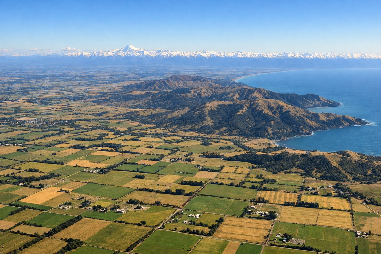
RIGHTChristchurch typically lands runway 02 (southbound) or 20 (northbound). Right seats provide excellent views of the Canterbury Plains' patchwork farmland and the Southern Alps' eastern foothills during descent. The Rakaia and Waimakariri river valleys are visible as they converge toward the coast, and on clear days, the Port Hills' distinctive ridgeline appears to the southeast.
Will your flight be in sunlight?
Pick a date and time in the Sun Map to watch the sun move across your whole flight.
About This Route
Which side of the plane should I sit on flying from Perth International (PER) to Christchurch International (CHC)?
Sit on the Right side of the plane for the best views on flights from Perth to Christchurch. While takeoff favors the left, landing views are more dramatic and geographically distinctive. The Canterbury Plains' agricultural geometry and the Port Hills' prominent ridgeline provide stronger visual interest than Perth's suburban sprawl. Right seats capture the approach to Christchurch's most recognizable landscape features.
What can I see during takeoff from Perth International in Perth?
During takeoff from Perth International (PER), sit on the Left side for the best views. Perth typically departs runway 03 (northbound) or 21 (southbound). Left seats offer views of the Swan River estuary and Perth's western suburbs during initial climb. The river's distinctive meanders and the Indian Ocean coastline are clearly visible within the first 10 minutes of flight. Notable sights include: Swan River estuary, Fremantle port area to the southwest, Indian Ocean coastline, Perth city skyline to the east.
What can I see when landing at Christchurch International in Christchurch?
When landing at Christchurch International (CHC), sit on the Right side for the best views. Christchurch typically lands runway 02 (southbound) or 20 (northbound). Right seats provide excellent views of the Canterbury Plains' patchwork farmland and the Southern Alps' eastern foothills during descent. The Rakaia and Waimakariri river valleys are visible as they converge toward the coast, and on clear days, the Port Hills' distinctive ridgeline appears to the southeast. Notable sights include: Canterbury Plains agricultural grid, Port Hills ridgeline, Waimakariri River valley, Southern Alps foothills.
How long is the flight from Perth to Christchurch?
The flight from Perth International (PER) to Christchurch International (CHC) takes about 5 hours 15 minutes. The shortest flight path between them is 3,130 miles (5,038 km); winds and air traffic control usually add a few percent.
What does the Perth to Christchurch flight path pass over?
The flight crosses the Tasman Sea for roughly 2,000 km. Around the midpoint (2.5 hours out), the aircraft passes over open ocean with no visible landmarks. As the aircraft approaches New Zealand airspace, the North Island's northern tip becomes visible on the horizon approximately 1 hour before landing. The flight typically passes east of the North Island, so passengers see only distant coastline. The descent into Christchurch begins over the South Island's east coast, where the Canterbury Bight's coastal waters transition to the braided river systems and plains.