The left side delivers a more varied journey: Perth's coastline at departure, a possible glimpse of the Sunda Strait region and Sumatra's Barisan Mountains during cruise, and a Klang Valley/Kuala Lumpur skyline view on arrival. The right side is dominated by open ocean and flat, repetitive lowland terrain with fewer distinct landmarks.
Flight Path
Open Indian Ocean, the Sunda Strait region near Sumatra and Java (with Krakatoa possibly visible), Sumatra's Bukit Barisan mountain range, and the Strait of Malacca leading toward Peninsular Malaysia
Great circle distance and headings ›Phase by phase

Takeoff from PER
LEFTDeparting PER on runway 03, the aircraft climbs north before banking onto its northwest track toward Sumatra, putting Perth's coastline, Fremantle Harbour and the Indian Ocean on the left. The right side only shows the flatter eastern suburbs and the low Darling Range foothills fading into the outback.
Landing at KUL
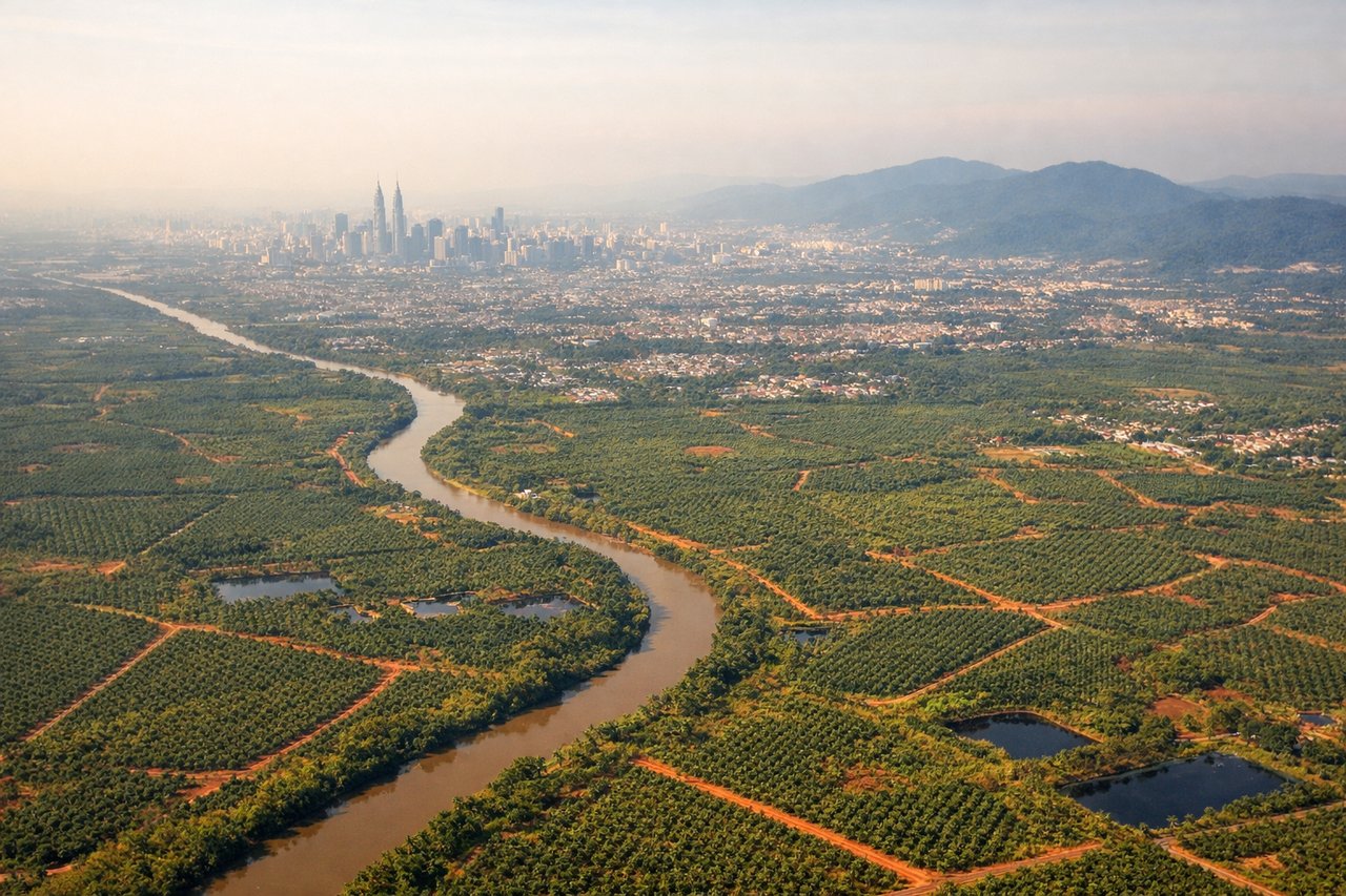
LEFTOn approach into KUL, the aircraft typically crosses the Strait of Malacca coastline near Port Klang before turning onto final for runway 14, putting the Klang Valley and, on clear days, the distant Kuala Lumpur skyline on the left side. The right side mainly shows repetitive palm oil plantations and flat delta land with less visual variety.
Landmarks on this routeAll landmarks →
Will your flight be in sunlight?
See exactly which side of the plane gets sun and shade at your departure time.
About This Route
Which side of the plane should I sit on flying from Perth International (PER) to Kuala Lumpur International (KUL)?
Sit on the Left side of the plane for the best views on flights from Perth to Kuala Lumpur. The left side delivers a more varied journey: Perth's coastline at departure, a possible glimpse of the Sunda Strait region and Sumatra's Barisan Mountains during cruise, and a Klang Valley/Kuala Lumpur skyline view on arrival. The right side is dominated by open ocean and flat, repetitive lowland terrain with fewer distinct landmarks.
What can I see during takeoff from Perth International in Perth?
During takeoff from Perth International (PER), sit on the Left side for the best views. Departing PER on runway 03, the aircraft climbs north before banking onto its northwest track toward Sumatra, putting Perth's coastline, Fremantle Harbour and the Indian Ocean on the left. The right side only shows the flatter eastern suburbs and the low Darling Range foothills fading into the outback. Notable sights include: Swan River mouth, Fremantle Harbour, Rottnest Island offshore, Indian Ocean coastline.
What can I see when landing at Kuala Lumpur International in Kuala Lumpur?
When landing at Kuala Lumpur International (KUL), sit on the Left side for the best views. On approach into KUL, the aircraft typically crosses the Strait of Malacca coastline near Port Klang before turning onto final for runway 14, putting the Klang Valley and, on clear days, the distant Kuala Lumpur skyline on the left side. The right side mainly shows repetitive palm oil plantations and flat delta land with less visual variety. Notable sights include: Strait of Malacca coastline, Klang River delta, Kuala Lumpur skyline in the distance, oil palm plantations.
How long is the flight from Perth to Kuala Lumpur?
The flight from Perth International (PER) to Kuala Lumpur International (KUL) takes 5h 20m.
What does the Perth to Kuala Lumpur flight path pass over?
Open Indian Ocean, the Sunda Strait region near Sumatra and Java (with Krakatoa possibly visible), Sumatra's Bukit Barisan mountain range, and the Strait of Malacca leading toward Peninsular Malaysia