Right side scores higher due to superior landing approach scenery. While both sides offer modest takeoff views, the right side's approach into Ho Chi Minh City provides significantly more visual variety and geographic interest—the Saigon River's dramatic curves, the Mekong Delta's intricate waterway network, and the transition from urban to agricultural landscape create a more compelling 8-hour journey than the left side's predominantly ocean-dominated cruise phase.
Flown PER to SGN? Did we get it right?
Flight Path
Perth to Ho Chi Minh City is 3,018 miles (4,857 km), a flight of about 6 hours 15 minutes.
Timor Sea crossing (open ocean, minimal landmarks), Ashmore and Cartier Islands (small, rarely visible), Sunda Strait region approaching Southeast Asia, Java Sea transition zone, coastal Sumatra and Malaysian Peninsula (if visible during daylight), Gulf of Thailand approach
Great circle distance and headings ›


Phase by phase
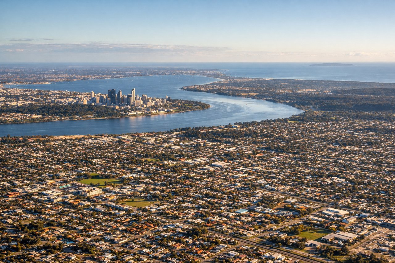
Takeoff from PER
RIGHTRight side captures Perth's Swan River estuary and Indian Ocean coastline during departure. The city skyline and harbor are visible during climb-out, with the dramatic contrast between urban development and open water providing immediate visual interest.
Landing at SGN
RIGHTRight side offers superior approach views into Ho Chi Minh City. The Saigon River's distinctive serpentine curves, the Mekong Delta's intricate waterway network, and the city's sprawling urban footprint create layered visual interest during descent. The delta's agricultural patchwork and river systems are particularly striking from altitude.
Will your flight be in sunlight?
Pick a date and time in the Sun Map to watch the sun move across your whole flight.
About This Route
Which side of the plane should I sit on flying from Perth International (PER) to Tansonnhat International (SGN)?
Sit on the Right side of the plane for the best views on flights from Perth to Ho Chi Minh City. Right side scores higher due to superior landing approach scenery. While both sides offer modest takeoff views, the right side's approach into Ho Chi Minh City provides significantly more visual variety and geographic interest—the Saigon River's dramatic curves, the Mekong Delta's intricate waterway network, and the transition from urban to agricultural landscape create a more compelling 8-hour journey than the left side's predominantly ocean-dominated cruise phase.
What can I see during takeoff from Perth International in Perth?
During takeoff from Perth International (PER), sit on the Right side for the best views. Right side captures Perth's Swan River estuary and Indian Ocean coastline during departure. The city skyline and harbor are visible during climb-out, with the dramatic contrast between urban development and open water providing immediate visual interest. Notable sights include: Swan River estuary, Perth city center skyline, Fremantle Harbor to the south, Indian Ocean.
What can I see when landing at Tansonnhat International in Ho Chi Minh City?
When landing at Tansonnhat International (SGN), sit on the Right side for the best views. Right side offers superior approach views into Ho Chi Minh City. The Saigon River's distinctive serpentine curves, the Mekong Delta's intricate waterway network, and the city's sprawling urban footprint create layered visual interest during descent. The delta's agricultural patchwork and river systems are particularly striking from altitude. Notable sights include: Saigon River with its characteristic bends, Mekong Delta waterways and rice paddies, Ho Chi Minh City urban sprawl, Tan Son Nhat Airport runway approach.
How long is the flight from Perth to Ho Chi Minh City?
The flight from Perth International (PER) to Tansonnhat International (SGN) takes about 6 hours 15 minutes. The shortest flight path between them is 3,018 miles (4,857 km); winds and air traffic control usually add a few percent.
What does the Perth to Ho Chi Minh City flight path pass over?
Timor Sea crossing (open ocean, minimal landmarks), Ashmore and Cartier Islands (small, rarely visible), Sunda Strait region approaching Southeast Asia, Java Sea transition zone, coastal Sumatra and Malaysian Peninsula (if visible during daylight), Gulf of Thailand approach