Phnom Penh to Abu Dhabi is 3,397 miles (5,467 km), a flight of about 5 hours 50 minutes.
The landing approach into Abu Dhabi scores significantly higher due to the dramatic coastal scenery, visible gulf waters, island formations, and the striking contrast between desert and developed waterfront. While Phnom Penh's takeoff offers river delta interest, the cruise segment over the Arabian Peninsula and Indian Ocean is largely featureless desert and open water. Abu Dhabi's approach provides concentrated visual drama that outweighs the takeoff advantage.
Flight Path
The flight path crosses the Bay of Bengal (open water, minimal landmarks), then transitions over the Indian subcontinent's western coast near Gujarat and Rajasthan (flat to gently rolling terrain, sparse settlements visible at altitude), continues over the Arabian Sea (open water), and approaches the Arabian Peninsula's coastal regions before reaching the Persian Gulf. The most notable midpoint feature is the transition from the Indian Ocean to the Arabian Peninsula's desert landscape, though this occurs at cruise altitude where individual landmarks are difficult to distinguish. The Indus River delta in Pakistan may be visible on the northern route variant, appearing as a broad, braided river system with agricultural plains.
Great circle distance and headings ›Phase by phase
Takeoff from PNH
LEFTPhnom Penh sits on the Tonlé Sap River delta with visible water channels, wetlands, and the city's urban sprawl spreading across flat terrain. Left side captures the river system and surrounding agricultural plains during climb-out.
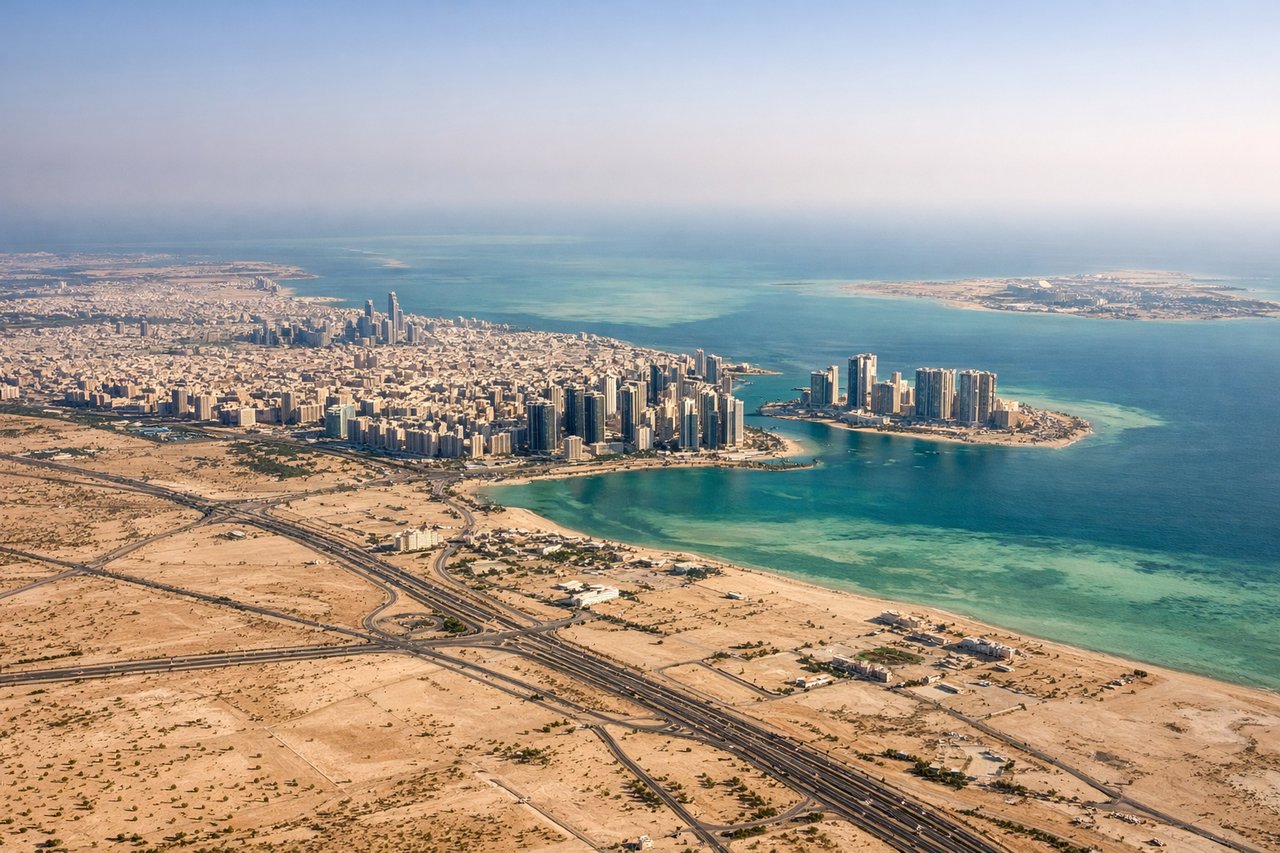
Landing at AUH
RIGHTAbu Dhabi's approach from the east reveals the Persian Gulf coastline, the city's distinctive waterfront development, and the dramatic contrast between desert and sea. Right side captures the coastal approach with visible islands, the Corniche, and urban geometry against the gulf waters.
Landmarks on this routeAll landmarks →
Will your flight be in sunlight?
Pick a date and time in the Sun Map to watch the sun move across your whole flight.
About This Route
Which side of the plane should I sit on flying from Pochentong International (PNH) to Abu Dhabi International (AUH)?
Sit on the Right side of the plane for the best views on flights from Phnom Penh to Abu Dhabi. The landing approach into Abu Dhabi scores significantly higher due to the dramatic coastal scenery, visible gulf waters, island formations, and the striking contrast between desert and developed waterfront. While Phnom Penh's takeoff offers river delta interest, the cruise segment over the Arabian Peninsula and Indian Ocean is largely featureless desert and open water. Abu Dhabi's approach provides concentrated visual drama that outweighs the takeoff advantage.
What can I see during takeoff from Pochentong International in Phnom Penh?
During takeoff from Pochentong International (PNH), sit on the Left side for the best views. Phnom Penh sits on the Tonlé Sap River delta with visible water channels, wetlands, and the city's urban sprawl spreading across flat terrain. Left side captures the river system and surrounding agricultural plains during climb-out. Notable sights include: Tonlé Sap River delta channels, Phnom Penh city grid, surrounding rice paddies and wetlands, Mekong River confluence zone.
What can I see when landing at Abu Dhabi International in Abu Dhabi?
When landing at Abu Dhabi International (AUH), sit on the Right side for the best views. Abu Dhabi's approach from the east reveals the Persian Gulf coastline, the city's distinctive waterfront development, and the dramatic contrast between desert and sea. Right side captures the coastal approach with visible islands, the Corniche, and urban geometry against the gulf waters. Notable sights include: Persian Gulf coastline, Abu Dhabi Corniche and waterfront development, Saadiyat Island and offshore islands, desert-to-sea transition.
How long is the flight from Phnom Penh to Abu Dhabi?
The flight from Pochentong International (PNH) to Abu Dhabi International (AUH) takes about 5 hours 50 minutes. The shortest flight path between them is 3,397 miles (5,467 km); winds and air traffic control usually add a few percent.
What does the Phnom Penh to Abu Dhabi flight path pass over?
The flight path crosses the Bay of Bengal (open water, minimal landmarks), then transitions over the Indian subcontinent's western coast near Gujarat and Rajasthan (flat to gently rolling terrain, sparse settlements visible at altitude), continues over the Arabian Sea (open water), and approaches the Arabian Peninsula's coastal regions before reaching the Persian Gulf. The most notable midpoint feature is the transition from the Indian Ocean to the Arabian Peninsula's desert landscape, though this occurs at cruise altitude where individual landmarks are difficult to distinguish. The Indus River delta in Pakistan may be visible on the northern route variant, appearing as a broad, braided river system with agricultural plains.