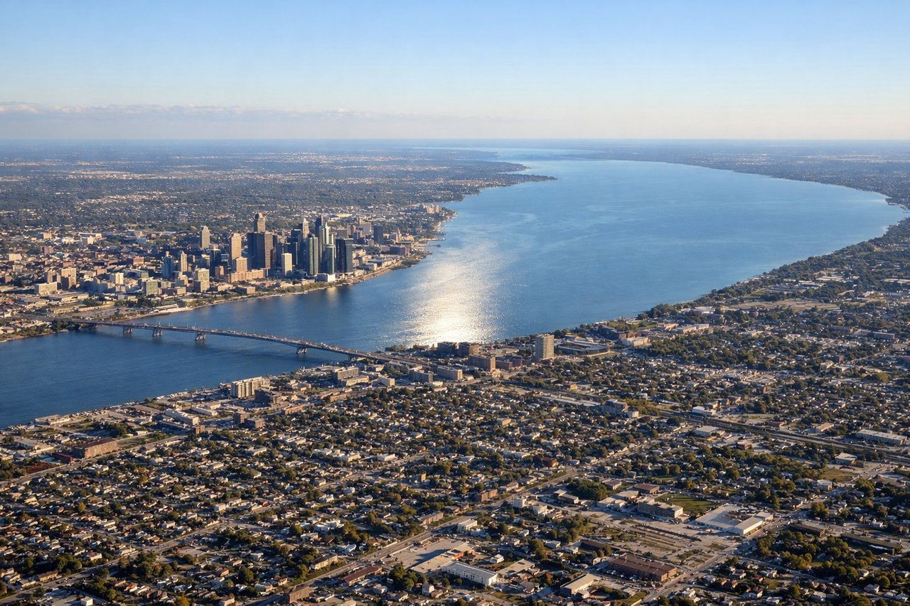
While takeoff favors the right for Pensacola Bay views, the landing experience on the left is more dramatic—the Detroit River, downtown skyline, and Lake St. Clair provide stronger visual interest than the suburban approach on the right. The landing view outweighs the takeoff advantage.
Flown PNS to DTW? Did we get it right?
Flight Path
Pensacola to Detroit is 839 miles (1,349 km), a flight of about 2 hours 20 minutes.
The flight path crosses the Tennessee Valley (visible as rolling terrain and river systems around 1.5 hours into flight), then transitions over Kentucky and Ohio farmland. The Ohio River may be visible as a distinct linear feature in the middle section. As the aircraft approaches Michigan, the landscape flattens and becomes increasingly developed with scattered lakes visible. Lake Michigan lies to the west but typically remains off the direct flight path.
Great circle distance and headings ›Phase by phase
Takeoff from PNS
RIGHTPensacola Regional typically departs to the north or northeast. Right-side seats offer views of Pensacola Bay and the barrier islands (Santa Rosa Island) immediately after liftoff, with the city grid visible below. Left side faces inland terrain with less distinctive features.
Landing at DTW
LEFTDetroit Metro typically lands on runways 3L/3R or 9L/9R depending on wind. On approach from the southwest, left-side seats provide views of the Detroit River, downtown Detroit skyline, and Lake St. Clair. Right side faces suburban sprawl with fewer distinctive landmarks.
Will your flight be in sunlight?
Pick a date and time in the Sun Map to watch the sun move across your whole flight.
About This Route
Which side of the plane should I sit on flying from Pensacola Rgnl (PNS) to Detroit Metro Wayne Co (DTW)?
Sit on the Left side of the plane for the best views on flights from Pensacola to Detroit. While takeoff favors the right for Pensacola Bay views, the landing experience on the left is more dramatic—the Detroit River, downtown skyline, and Lake St. Clair provide stronger visual interest than the suburban approach on the right. The landing view outweighs the takeoff advantage.
What can I see during takeoff from Pensacola Rgnl in Pensacola?
During takeoff from Pensacola Rgnl (PNS), sit on the Right side for the best views. Pensacola Regional typically departs to the north or northeast. Right-side seats offer views of Pensacola Bay and the barrier islands (Santa Rosa Island) immediately after liftoff, with the city grid visible below. Left side faces inland terrain with less distinctive features. Notable sights include: Pensacola Bay (turquoise shallow waters), Santa Rosa Island (narrow white sand barrier), Pensacola city grid, East Bay.
What can I see when landing at Detroit Metro Wayne Co in Detroit?
When landing at Detroit Metro Wayne Co (DTW), sit on the Left side for the best views. Detroit Metro typically lands on runways 3L/3R or 9L/9R depending on wind. On approach from the southwest, left-side seats provide views of the Detroit River, downtown Detroit skyline, and Lake St. Clair. Right side faces suburban sprawl with fewer distinctive landmarks. Notable sights include: Detroit River (visible as a distinct waterway), Lake St. Clair (large freshwater body to the northeast), downtown Detroit skyline, Belle Isle (island in the river).
How long is the flight from Pensacola to Detroit?
The flight from Pensacola Rgnl (PNS) to Detroit Metro Wayne Co (DTW) takes about 2 hours 20 minutes. The shortest flight path between them is 839 miles (1,349 km); winds and air traffic control usually add a few percent.
What does the Pensacola to Detroit flight path pass over?
The flight path crosses the Tennessee Valley (visible as rolling terrain and river systems around 1.5 hours into flight), then transitions over Kentucky and Ohio farmland. The Ohio River may be visible as a distinct linear feature in the middle section. As the aircraft approaches Michigan, the landscape flattens and becomes increasingly developed with scattered lakes visible. Lake Michigan lies to the west but typically remains off the direct flight path.