While takeoff offers brief Detroit-area views, the landing approach into Pensacola provides more sustained and visually distinctive scenery—Pensacola Bay, the Gulf coastline, and Santa Rosa Island are far more dramatic than suburban Detroit. Left-side seats capture the best of the final descent.
Flown DTW to PNS? Did we get it right?
Flight Path
Detroit to Pensacola is 839 miles (1,349 km), a flight of about 2 hours 15 minutes.
The flight path crosses central Tennessee and northern Alabama, passing near or over the Cumberland Plateau, the Tennessee River valley, and the northern foothills of the Appalachian Mountains. The landscape transitions from the Great Lakes region through deciduous forest and rolling terrain to the coastal plain of the Gulf South. Notable geographic features include the Tennessee River (visible as a winding waterway in central Tennessee), various reservoirs, and the gradual flattening of terrain as the aircraft approaches the Gulf Coast. No single dramatic midpoint landmark dominates, but the shift from forested highlands to coastal lowlands is apparent over the 2+ hour flight.
Great circle distance and headings ›Phase by phase
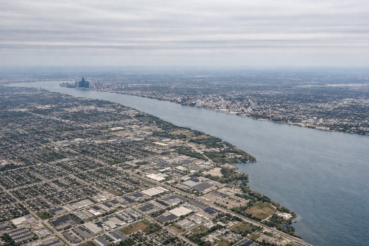
Takeoff from DTW
RIGHTRight-side seats offer views of the Detroit River, Lake St. Clair, and the sprawling suburban landscape east of the airport during the initial climb-out. The aircraft typically departs eastbound or southeastbound, making the right wing the scenic side for the first 10-15 minutes.
Landing at PNS
LEFTLeft-side seats provide excellent views of Pensacola Bay, the Gulf of Mexico coastline, and Pensacola's waterfront during the descent and approach. The aircraft typically descends from the north and approaches from the northwest, making the left wing ideal for coastal scenery in the final 20-30 minutes.
Will your flight be in sunlight?
Pick a date and time in the Sun Map to watch the sun move across your whole flight.
About This Route
Which side of the plane should I sit on flying from Detroit Metro Wayne Co (DTW) to Pensacola Rgnl (PNS)?
Sit on the Left side of the plane for the best views on flights from Detroit to Pensacola. While takeoff offers brief Detroit-area views, the landing approach into Pensacola provides more sustained and visually distinctive scenery—Pensacola Bay, the Gulf coastline, and Santa Rosa Island are far more dramatic than suburban Detroit. Left-side seats capture the best of the final descent.
What can I see during takeoff from Detroit Metro Wayne Co in Detroit?
During takeoff from Detroit Metro Wayne Co (DTW), sit on the Right side for the best views. Right-side seats offer views of the Detroit River, Lake St. Clair, and the sprawling suburban landscape east of the airport during the initial climb-out. The aircraft typically departs eastbound or southeastbound, making the right wing the scenic side for the first 10-15 minutes. Notable sights include: Detroit River, Lake St. Clair, suburban Detroit sprawl, Lake Erie (distant).
What can I see when landing at Pensacola Rgnl in Pensacola?
When landing at Pensacola Rgnl (PNS), sit on the Left side for the best views. Left-side seats provide excellent views of Pensacola Bay, the Gulf of Mexico coastline, and Pensacola's waterfront during the descent and approach. The aircraft typically descends from the north and approaches from the northwest, making the left wing ideal for coastal scenery in the final 20-30 minutes. Notable sights include: Pensacola Bay, Gulf of Mexico, Pensacola waterfront and downtown, Santa Rosa Island.
How long is the flight from Detroit to Pensacola?
The flight from Detroit Metro Wayne Co (DTW) to Pensacola Rgnl (PNS) takes about 2 hours 15 minutes. The shortest flight path between them is 839 miles (1,349 km); winds and air traffic control usually add a few percent.
What does the Detroit to Pensacola flight path pass over?
The flight path crosses central Tennessee and northern Alabama, passing near or over the Cumberland Plateau, the Tennessee River valley, and the northern foothills of the Appalachian Mountains. The landscape transitions from the Great Lakes region through deciduous forest and rolling terrain to the coastal plain of the Gulf South. Notable geographic features include the Tennessee River (visible as a winding waterway in central Tennessee), various reservoirs, and the gradual flattening of terrain as the aircraft approaches the Gulf Coast. No single dramatic midpoint landmark dominates, but the shift from forested highlands to coastal lowlands is apparent over the 2+ hour flight.