The right side captures more dramatic and varied scenery across the full flight: the approach to Panama City includes the visually striking Gatun Lake, the Panama Canal infrastructure, and tropical forest landscape—features with genuine geographic and engineering significance. The left side offers coastal departure scenery but then transitions to open Caribbean waters with minimal landmarks for most of the cruise phase. Right-side landing approach is substantially more scenic than left-side departure.
Flown POP to PTY? Did we get it right?
Flight Path
Puerto Plata to Panama City is 944 miles (1,520 km), a flight of about 2 hours 30 minutes.
Caribbean Sea (open water dominates the cruise phase), Mosquito Coast region of Honduras/Nicaragua (distant, not clearly visible at altitude), transition from Dominican airspace to Central American airspace over open water, approach to Panama begins over Darien region and Gatun Lake system
Great circle distance and headings ›Phase by phase
Takeoff from POP
LEFTPuerto Plata sits on the northern Dominican coast with immediate views of the Atlantic Ocean and the Cordillera Septentrional mountains rising inland. Left-side departure offers coastal scenery and mountain backdrop during climb-out.
Landing at PTY
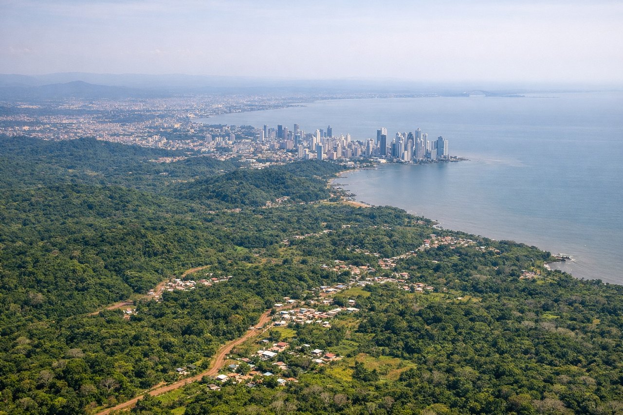
RIGHTApproach to Panama City from the northeast crosses the Panama Canal, Gatun Lake, and the Darien region—dramatic water features and tropical landscape. Right-side descent offers views of the canal's locks, the lake system, and the city's skyline against the Pacific.
Will your flight be in sunlight?
Pick a date and time in the Sun Map to watch the sun move across your whole flight.
About This Route
Which side of the plane should I sit on flying from Gregorio Luperon International (POP) to Tocumen International (PTY)?
Sit on the Right side of the plane for the best views on flights from Puerto Plata to Panama City. The right side captures more dramatic and varied scenery across the full flight: the approach to Panama City includes the visually striking Gatun Lake, the Panama Canal infrastructure, and tropical forest landscape—features with genuine geographic and engineering significance. The left side offers coastal departure scenery but then transitions to open Caribbean waters with minimal landmarks for most of the cruise phase. Right-side landing approach is substantially more scenic than left-side departure.
What can I see during takeoff from Gregorio Luperon International in Puerto Plata?
During takeoff from Gregorio Luperon International (POP), sit on the Left side for the best views. Puerto Plata sits on the northern Dominican coast with immediate views of the Atlantic Ocean and the Cordillera Septentrional mountains rising inland. Left-side departure offers coastal scenery and mountain backdrop during climb-out. Notable sights include: Atlantic Ocean shoreline, Puerto Plata harbor, Cordillera Septentrional ridge, Playa Dorada resort area.
What can I see when landing at Tocumen International in Panama City?
When landing at Tocumen International (PTY), sit on the Right side for the best views. Approach to Panama City from the northeast crosses the Panama Canal, Gatun Lake, and the Darien region—dramatic water features and tropical landscape. Right-side descent offers views of the canal's locks, the lake system, and the city's skyline against the Pacific. Notable sights include: Gatun Lake (massive freshwater reservoir), Panama Canal locks and channel, Darien tropical forest, Panama City skyline and Pacific coastline.
How long is the flight from Puerto Plata to Panama City?
The flight from Gregorio Luperon International (POP) to Tocumen International (PTY) takes about 2 hours 30 minutes. The shortest flight path between them is 944 miles (1,520 km); winds and air traffic control usually add a few percent.
What does the Puerto Plata to Panama City flight path pass over?
Caribbean Sea (open water dominates the cruise phase), Mosquito Coast region of Honduras/Nicaragua (distant, not clearly visible at altitude), transition from Dominican airspace to Central American airspace over open water, approach to Panama begins over Darien region and Gatun Lake system