Puerto Princesa to Iloilo is 265 miles (426 km), a flight of about 1 hour 15 minutes.
Right-side seats capture the most dramatic geography: the departure over Palawan's distinctive limestone karst and turquoise Sulu Sea, then the mid-flight crossing of open water with island views, and finally the approach to Iloilo's strait and coastal features. The takeoff view is particularly striking.
Flight Path
The flight crosses the Sulu Sea between Palawan and Panay Island. At cruise altitude (around 15,000-20,000 feet), passengers see open water with occasional small islands and fishing vessel activity. Cuyo Islands may be visible to the left (north) depending on exact routing. The water transitions from the shallow turquoise banks near Palawan to deeper blue-green in the central Sulu Sea. Panay Island's forested interior becomes visible ahead as the aircraft approaches from the west, with the island's mountain spine creating subtle elevation changes visible as terrain shading.
Great circle distance and headings ›Phase by phase
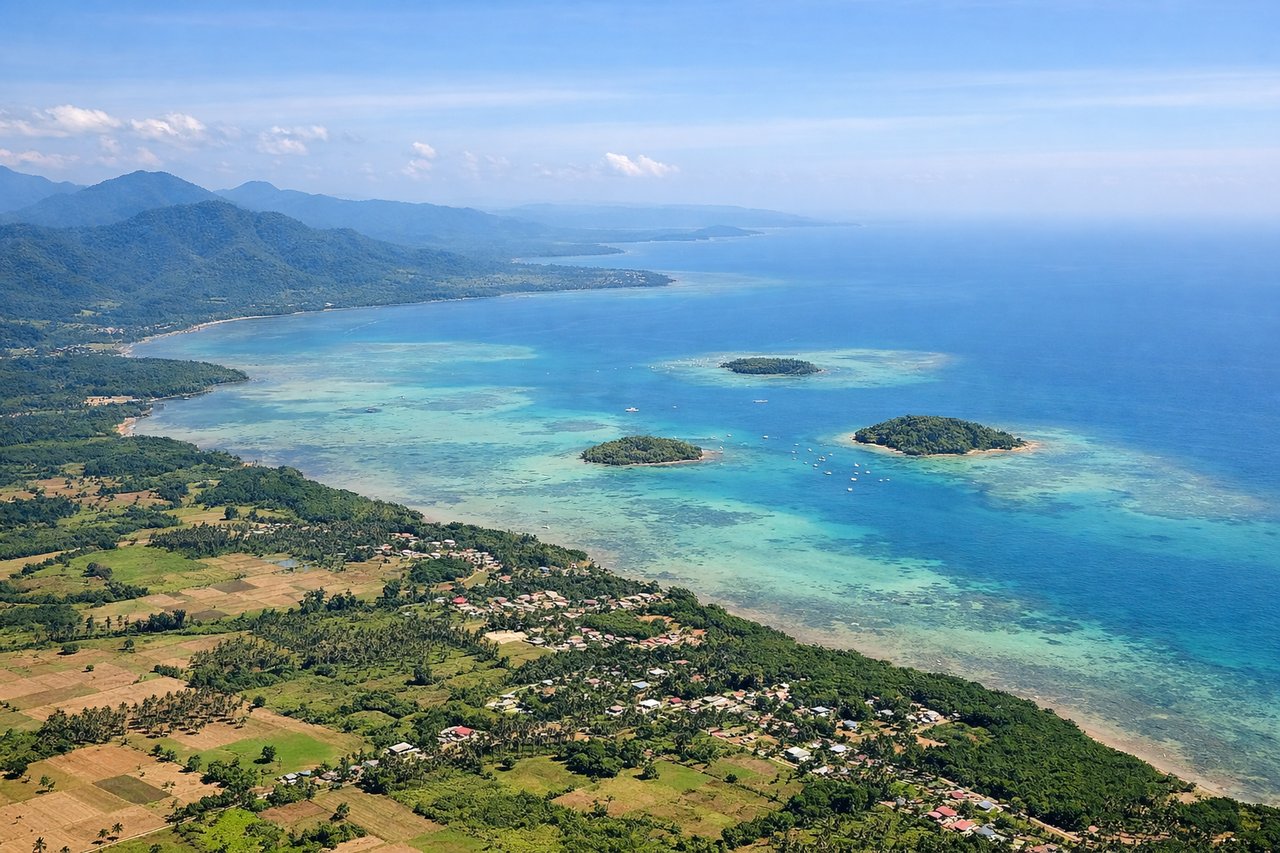
Takeoff from PPS
RIGHTPuerto Princesa typically departs northeastward (Runway 03/21). Right-side seats face toward Palawan's northern coastline and the Sulu Sea, offering views of the limestone cliffs and shallow turquoise waters that define this region during initial climb.
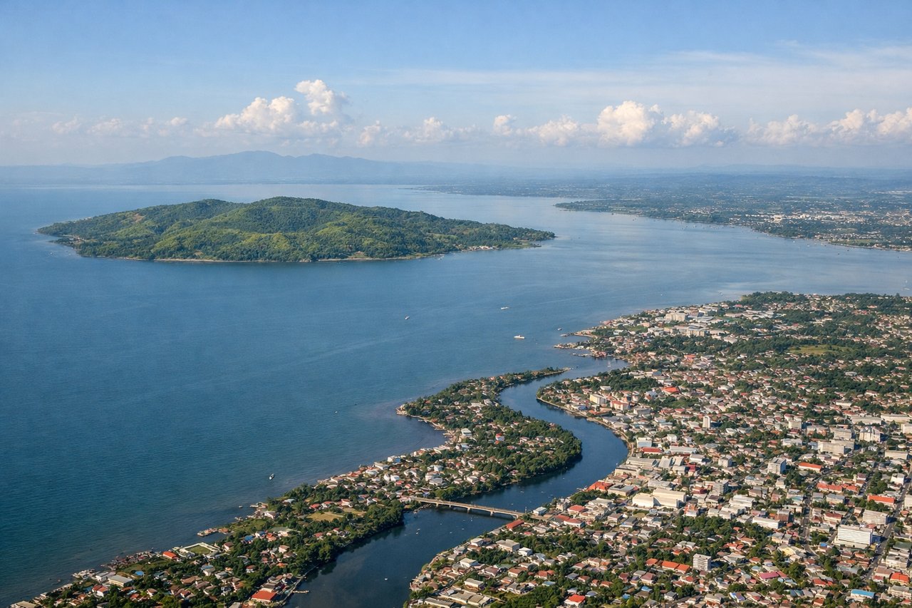
Landing at ILO
LEFTIloilo typically lands from the southwest (Runway 03/21 approach). Left-side seats during descent face the Panay coastline and Iloilo Strait, revealing the transition from open water to the densely populated Iloilo City area and surrounding agricultural plains.
Will your flight be in sunlight?
Pick a date and time in the Sun Map to watch the sun move across your whole flight.
About This Route
Which side of the plane should I sit on flying from Puerto Princesa (PPS) to Iloilo International Airport (ILO)?
Sit on the Right side of the plane for the best views on flights from Puerto Princesa to Iloilo. Right-side seats capture the most dramatic geography: the departure over Palawan's distinctive limestone karst and turquoise Sulu Sea, then the mid-flight crossing of open water with island views, and finally the approach to Iloilo's strait and coastal features. The takeoff view is particularly striking.
What can I see during takeoff from Puerto Princesa in Puerto Princesa?
During takeoff from Puerto Princesa (PPS), sit on the Right side for the best views. Puerto Princesa typically departs northeastward (Runway 03/21). Right-side seats face toward Palawan's northern coastline and the Sulu Sea, offering views of the limestone cliffs and shallow turquoise waters that define this region during initial climb. Notable sights include: Palawan's northern limestone karst formations, Sulu Sea shallow banks, Puerto Princesa Bay, mangrove-lined coastal inlets.
What can I see when landing at Iloilo International Airport in Iloilo?
When landing at Iloilo International Airport (ILO), sit on the Left side for the best views. Iloilo typically lands from the southwest (Runway 03/21 approach). Left-side seats during descent face the Panay coastline and Iloilo Strait, revealing the transition from open water to the densely populated Iloilo City area and surrounding agricultural plains. Notable sights include: Iloilo Strait, Panay Island's western coastline, Iloilo City urban sprawl, Guimaras Island across the strait.
How long is the flight from Puerto Princesa to Iloilo?
The flight from Puerto Princesa (PPS) to Iloilo International Airport (ILO) takes about 1 hour 15 minutes. The shortest flight path between them is 265 miles (426 km); winds and air traffic control usually add a few percent.
What does the Puerto Princesa to Iloilo flight path pass over?
The flight crosses the Sulu Sea between Palawan and Panay Island. At cruise altitude (around 15,000-20,000 feet), passengers see open water with occasional small islands and fishing vessel activity. Cuyo Islands may be visible to the left (north) depending on exact routing. The water transitions from the shallow turquoise banks near Palawan to deeper blue-green in the central Sulu Sea. Panay Island's forested interior becomes visible ahead as the aircraft approaches from the west, with the island's mountain spine creating subtle elevation changes visible as terrain shading.