The right side wins overall because the takeoff view over Honda Bay and the Palawan coast is genuinely spectacular and unique. During the cruise over the South China Sea and Natuna Sea the views are mostly open water on both sides, so the takeoff experience tips the balance. At landing the left side is better for Singapore, but the right side still gets reasonable views of the southern Singapore waterfront and Sentosa.
Flight Path
The flight tracks southwest over the Sulu Sea, then crosses the southern tip of Borneo or passes west of it depending on routing, before crossing the Natuna Sea. Most of the cruise is over open water — the South China Sea and Natuna Sea — with occasional glimpses of small Indonesian islands in the Natuna archipelago visible below. The northern coast of Borneo may be visible as a distant landmass on the right side during the early cruise phase.
Great circle distance and headings ›Phase by phase
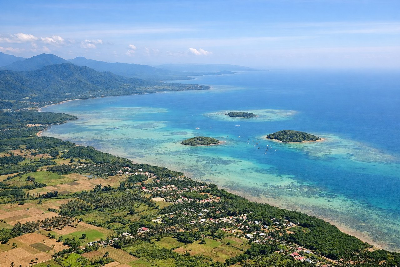
Takeoff from PPS
RIGHTPuerto Princesa airport runway 02/20 means southbound departures head roughly south over Honda Bay. The right side gives you views over Honda Bay's island-dotted waters and the eastern coastline of Palawan, while the left side faces inland jungle.
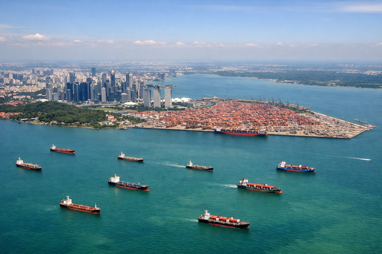
Landing at SIN
LEFTChangi Airport's primary arrival from the north typically uses runways 02L/02C, meaning aircraft approach from the north over the Johor Strait. The left side gives a clear view over Marina Bay, the CBD skyline, and the southern Singapore waterfront as you descend.
Landmarks on this routeAll landmarks →
Will your flight be in sunlight?
See exactly which side of the plane gets sun and shade at your departure time.
About This Route
Which side of the plane should I sit on flying from Puerto Princesa (PPS) to Singapore Changi (SIN)?
Sit on the Right side of the plane for the best views on flights from Puerto Princesa to Singapore. The right side wins overall because the takeoff view over Honda Bay and the Palawan coast is genuinely spectacular and unique. During the cruise over the South China Sea and Natuna Sea the views are mostly open water on both sides, so the takeoff experience tips the balance. At landing the left side is better for Singapore, but the right side still gets reasonable views of the southern Singapore waterfront and Sentosa.
What can I see during takeoff from Puerto Princesa in Puerto Princesa?
During takeoff from Puerto Princesa (PPS), sit on the Right side for the best views. Puerto Princesa airport runway 02/20 means southbound departures head roughly south over Honda Bay. The right side gives you views over Honda Bay's island-dotted waters and the eastern coastline of Palawan, while the left side faces inland jungle. Notable sights include: Honda Bay and its scatter of small islands, the eastern Palawan coastline, the Sulu Sea opening to the southeast, forested karst hills east of the city.
What can I see when landing at Singapore Changi in Singapore?
When landing at Singapore Changi (SIN), sit on the Left side for the best views. Changi Airport's primary arrival from the north typically uses runways 02L/02C, meaning aircraft approach from the north over the Johor Strait. The left side gives a clear view over Marina Bay, the CBD skyline, and the southern Singapore waterfront as you descend. Notable sights include: Marina Bay Sands and the CBD skyline, the Johor Strait and causeway, Sentosa Island and the southern port anchorage, the dense urban grid of central Singapore.
How long is the flight from Puerto Princesa to Singapore?
The flight from Puerto Princesa (PPS) to Singapore Changi (SIN) takes Approximately 2 hours 45 minutes to 3 hours.
What does the Puerto Princesa to Singapore flight path pass over?
The flight tracks southwest over the Sulu Sea, then crosses the southern tip of Borneo or passes west of it depending on routing, before crossing the Natuna Sea. Most of the cruise is over open water — the South China Sea and Natuna Sea — with occasional glimpses of small Indonesian islands in the Natuna archipelago visible below. The northern coast of Borneo may be visible as a distant landmass on the right side during the early cruise phase.