Puerto Princesa to Cebu is 357 miles (575 km), a flight of about 1 hour 15 minutes.
The left side offers a more varied and dramatic sequence: Palawan's coastal islets and hills at departure, a possible glimpse of Negros' Mount Kanlaon volcano during cruise, and the Cebu City skyline with mountain backdrop on arrival, whereas the right side is dominated by open sea with only modest coastal views at each end.
Flight Path
Sulu Sea crossing, Panay Gulf near Guimaras Strait, Negros Island with Mount Kanlaon volcano visible to the north, and the Tañon Strait separating Negros from Cebu
Great circle distance and headings ›Phase by phase
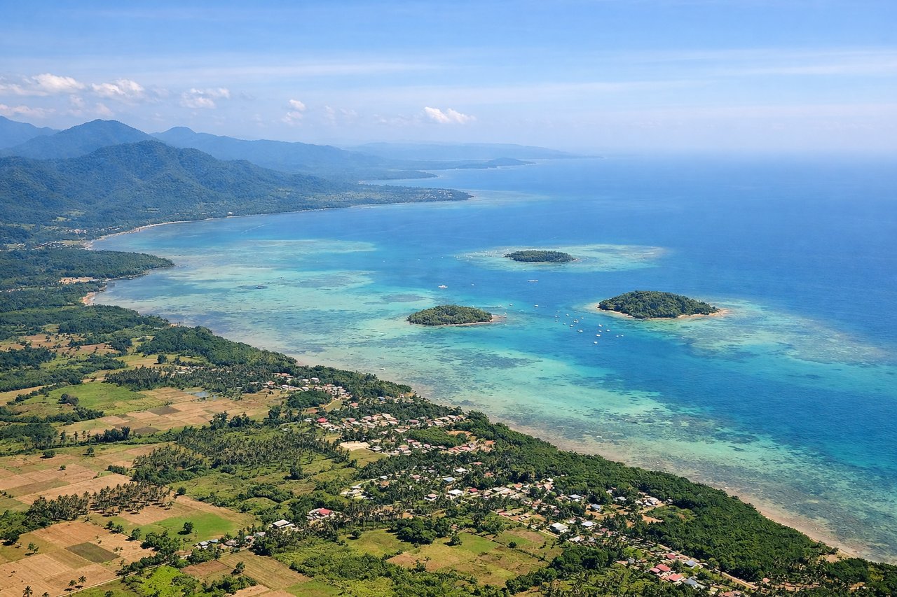
Takeoff from PPS
LEFTClimbing out from Puerto Princesa on the east-facing runway, the left side looks north toward Honda Bay's scattered limestone islets and the green foothills of Palawan's central mountain spine, while the right side mostly shows open Sulu Sea beyond the city's edge.
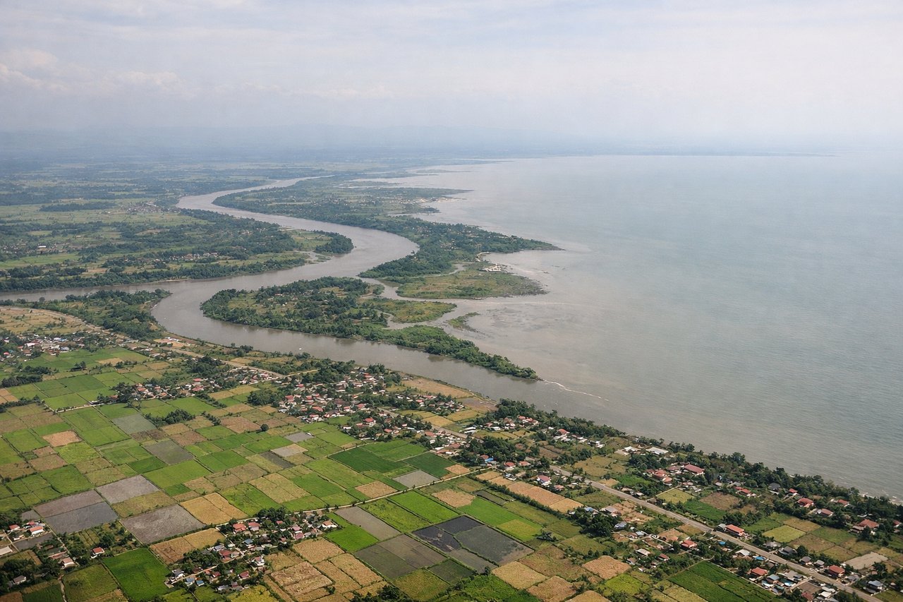
Landing at CEB
LEFTOn the typical southwest approach into Mactan, the left side faces Cebu City and the island's central mountain ridge across the strait, while the right side shows the flatter Mactan coastline and Olango Island, which is pleasant but less dramatic.
Will your flight be in sunlight?
Pick a date and time in the Sun Map to watch the sun move across your whole flight.
About This Route
Which side of the plane should I sit on flying from Puerto Princesa (PPS) to Mactan Cebu International Airport (CEB)?
Sit on the Left side of the plane for the best views on flights from Puerto Princesa to Cebu. The left side offers a more varied and dramatic sequence: Palawan's coastal islets and hills at departure, a possible glimpse of Negros' Mount Kanlaon volcano during cruise, and the Cebu City skyline with mountain backdrop on arrival, whereas the right side is dominated by open sea with only modest coastal views at each end.
What can I see during takeoff from Puerto Princesa in Puerto Princesa?
During takeoff from Puerto Princesa (PPS), sit on the Left side for the best views. Climbing out from Puerto Princesa on the east-facing runway, the left side looks north toward Honda Bay's scattered limestone islets and the green foothills of Palawan's central mountain spine, while the right side mostly shows open Sulu Sea beyond the city's edge. Notable sights include: Honda Bay islets, Puerto Princesa Bay coastline, Palawan's Victoria-Anepahan foothills.
What can I see when landing at Mactan Cebu International Airport in Cebu?
When landing at Mactan Cebu International Airport (CEB), sit on the Left side for the best views. On the typical southwest approach into Mactan, the left side faces Cebu City and the island's central mountain ridge across the strait, while the right side shows the flatter Mactan coastline and Olango Island, which is pleasant but less dramatic. Notable sights include: Cebu City skyline, Cebu's central mountain ridge (Busay Hills), Cebu Strait, Mactan coastline.
How long is the flight from Puerto Princesa to Cebu?
The flight from Puerto Princesa (PPS) to Mactan Cebu International Airport (CEB) takes about 1 hour 15 minutes. The shortest flight path between them is 357 miles (575 km); winds and air traffic control usually add a few percent.
What does the Puerto Princesa to Cebu flight path pass over?
Sulu Sea crossing, Panay Gulf near Guimaras Strait, Negros Island with Mount Kanlaon volcano visible to the north, and the Tañon Strait separating Negros from Cebu