Punta Cana to Sao Paulo is 3,256 miles (5,240 km), a flight of about 5 hours 15 minutes.
Right-side seats capture the more dramatic geography: the Caribbean departure scenery from PUJ is more visually distinctive than the urban approach to GRU. The takeoff view of the Punta Cana peninsula and reef systems outweighs the landing view of São Paulo's urban sprawl.
Flight Path
The flight path crosses the Caribbean Sea for roughly 2 hours, then transitions over the Atlantic. You'll pass south of Puerto Rico and the Lesser Antilles (visible only on very clear days as distant landmasses). The Equator crossing occurs around the 3-hour mark. The Brazilian coast becomes visible around 4.5 hours—the Atlantic escarpment and coastal mountains of southeastern Brazil (Serra do Mar) form a distinctive ridge line as you approach the continent. The interior plateau of São Paulo state is visible before descent into the metropolitan area.
Great circle distance and headings ›

Phase by phase
Takeoff from PUJ
RIGHTPUJ typically departs runway 03/21 or 09/27. For southwestbound departures toward Brazil, right-side seats offer views of the Caribbean coastline and the Punta Cana peninsula as you climb. The eastern Dominican coast and reef systems are visible during the initial climb-out.
Landing at GRU
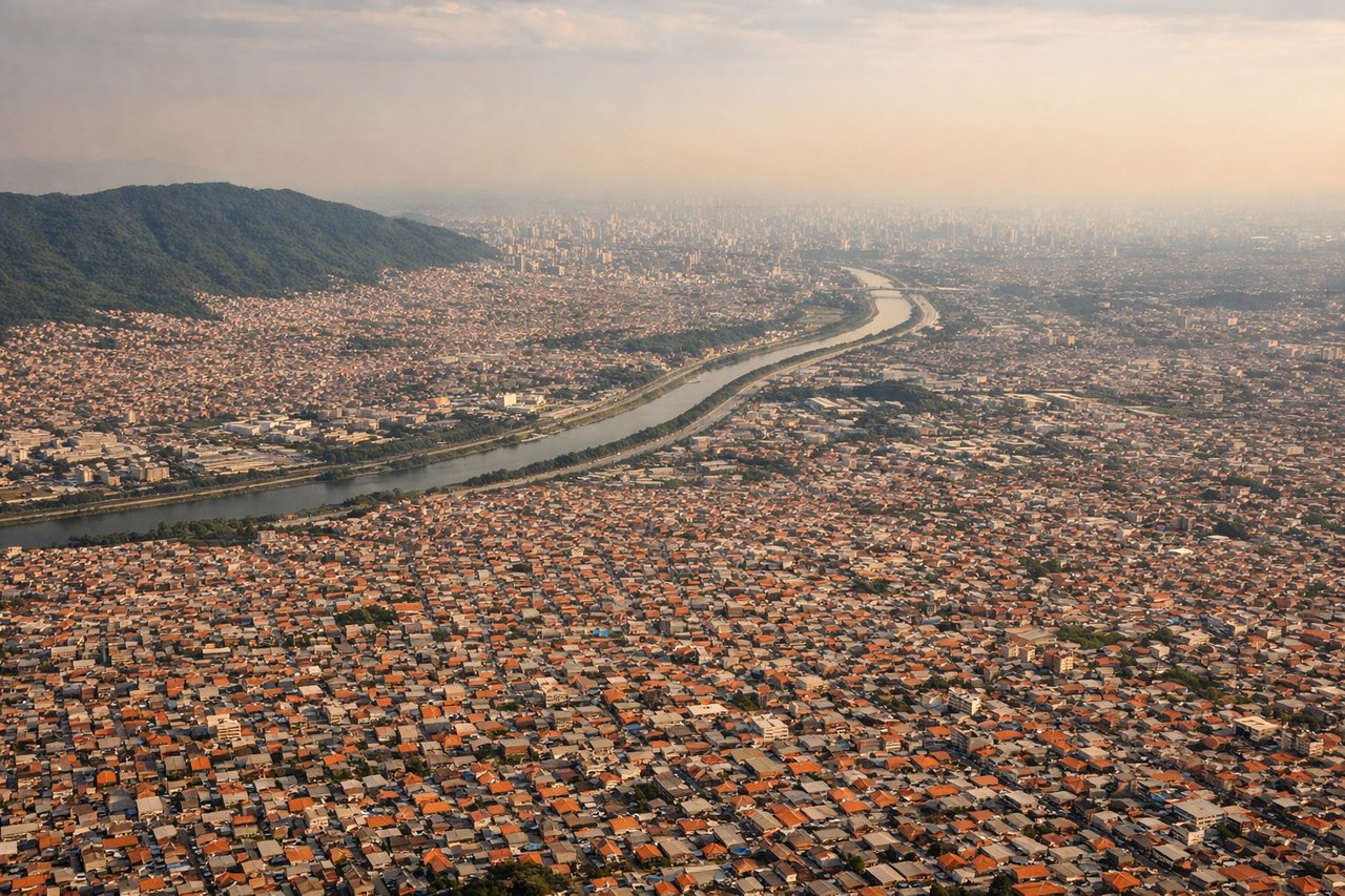
LEFTApproaching GRU from the northeast, aircraft typically descend on final approach from the Atlantic side. Left-side seats provide views of the São Paulo metropolitan area, including the urban sprawl of Guarulhos and surrounding industrial zones. You'll see the transition from rural interior to dense city development.
Landmarks on this routeAll landmarks →
Will your flight be in sunlight?
Pick a date and time in the Sun Map to watch the sun move across your whole flight.
About This Route
Which side of the plane should I sit on flying from Punta Cana International (PUJ) to Guarulhos (GRU)?
Sit on the Right side of the plane for the best views on flights from Punta Cana to Sao Paulo. Right-side seats capture the more dramatic geography: the Caribbean departure scenery from PUJ is more visually distinctive than the urban approach to GRU. The takeoff view of the Punta Cana peninsula and reef systems outweighs the landing view of São Paulo's urban sprawl.
What can I see during takeoff from Punta Cana International in Punta Cana?
During takeoff from Punta Cana International (PUJ), sit on the Right side for the best views. PUJ typically departs runway 03/21 or 09/27. For southwestbound departures toward Brazil, right-side seats offer views of the Caribbean coastline and the Punta Cana peninsula as you climb. The eastern Dominican coast and reef systems are visible during the initial climb-out. Notable sights include: Caribbean Sea (immediate offshore waters), Punta Cana peninsula (distinctive eastern hook of land), Coral reef systems along the coast, Hispaniola island interior (mountainous terrain receding westward).
What can I see when landing at Guarulhos in Sao Paulo?
When landing at Guarulhos (GRU), sit on the Left side for the best views. Approaching GRU from the northeast, aircraft typically descend on final approach from the Atlantic side. Left-side seats provide views of the São Paulo metropolitan area, including the urban sprawl of Guarulhos and surrounding industrial zones. You'll see the transition from rural interior to dense city development. Notable sights include: São Paulo metropolitan area (massive urban grid), Cantareira Mountains (northern boundary of the city), Tietê River valley (visible as linear feature through urban area), Atlantic coastal escarpment (distant southern horizon).
How long is the flight from Punta Cana to Sao Paulo?
The flight from Punta Cana International (PUJ) to Guarulhos (GRU) takes about 5 hours 15 minutes. The shortest flight path between them is 3,256 miles (5,240 km); winds and air traffic control usually add a few percent.
What does the Punta Cana to Sao Paulo flight path pass over?
The flight path crosses the Caribbean Sea for roughly 2 hours, then transitions over the Atlantic. You'll pass south of Puerto Rico and the Lesser Antilles (visible only on very clear days as distant landmasses). The Equator crossing occurs around the 3-hour mark. The Brazilian coast becomes visible around 4.5 hours—the Atlantic escarpment and coastal mountains of southeastern Brazil (Serra do Mar) form a distinctive ridge line as you approach the continent. The interior plateau of São Paulo state is visible before descent into the metropolitan area.