While takeoff offers coastal views, the landing approach into Bogotá provides more dramatic and sustained visual interest—the Andes rising beneath you and the high-altitude savanna landscape are more distinctive than the relatively flat New England departure.
Flown PVD to BOG? Did we get it right?
Flight Path
Providence to Bogota is 2,564 miles (4,126 km), a flight of about 5 hours 15 minutes.
The flight path crosses the Caribbean Sea and passes over or near the Yucatan Peninsula, then continues south over Central America (Guatemala/Honduras region) before reaching the Colombian Pacific coast and climbing toward the Andes. The Caribbean waters, Central American mountain ranges, and the dramatic transition from lowland jungle to high-altitude savanna are the major geographical features along this route.
Great circle distance and headings ›

Phase by phase
Takeoff from PVD
RIGHTPVD typically departs runway 5 (northeast) or runway 23 (southwest). Right-side seats on a northeast departure give you the Atlantic coastline and Narragansett Bay receding beneath you. On a southwest departure, right seats face toward the Rhode Island interior and Connecticut.
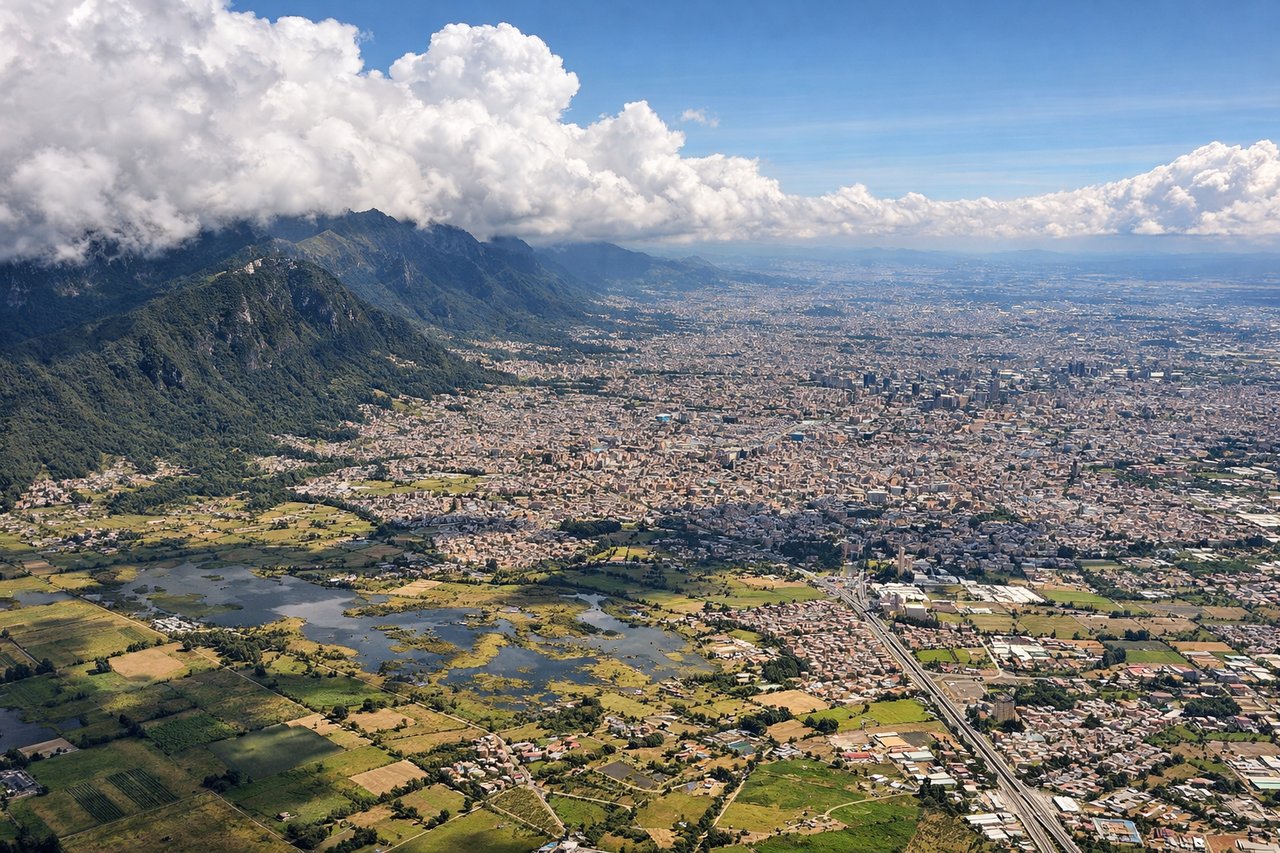
Landing at BOG
LEFTBOG uses runways 1L/1R (north) and 15L/15R (south). On approach from the northeast, left-side seats face the Andes foothills and the Bogotá Savanna's eastern edge. You'll see the terrain rising dramatically as you descend toward the 8,660-foot elevation.
Will your flight be in sunlight?
Pick a date and time in the Sun Map to watch the sun move across your whole flight.
About This Route
Which side of the plane should I sit on flying from Theodore Francis Green State (PVD) to Eldorado International (BOG)?
Sit on the Left side of the plane for the best views on flights from Providence to Bogota. While takeoff offers coastal views, the landing approach into Bogotá provides more dramatic and sustained visual interest—the Andes rising beneath you and the high-altitude savanna landscape are more distinctive than the relatively flat New England departure.
What can I see during takeoff from Theodore Francis Green State in Providence?
During takeoff from Theodore Francis Green State (PVD), sit on the Right side for the best views. PVD typically departs runway 5 (northeast) or runway 23 (southwest). Right-side seats on a northeast departure give you the Atlantic coastline and Narragansett Bay receding beneath you. On a southwest departure, right seats face toward the Rhode Island interior and Connecticut. Notable sights include: Narragansett Bay, Atlantic Ocean, Providence River, Mount Hope Bridge (visible as a thin line crossing the bay during climb).
What can I see when landing at Eldorado International in Bogota?
When landing at Eldorado International (BOG), sit on the Left side for the best views. BOG uses runways 1L/1R (north) and 15L/15R (south). On approach from the northeast, left-side seats face the Andes foothills and the Bogotá Savanna's eastern edge. You'll see the terrain rising dramatically as you descend toward the 8,660-foot elevation. Notable sights include: Eastern Cordillera (Andes), Bogotá Savanna, Monserrate peak, Río Magdalena valley.
How long is the flight from Providence to Bogota?
The flight from Theodore Francis Green State (PVD) to Eldorado International (BOG) takes about 5 hours 15 minutes. The shortest flight path between them is 2,564 miles (4,126 km); winds and air traffic control usually add a few percent.
What does the Providence to Bogota flight path pass over?
The flight path crosses the Caribbean Sea and passes over or near the Yucatan Peninsula, then continues south over Central America (Guatemala/Honduras region) before reaching the Colombian Pacific coast and climbing toward the Andes. The Caribbean waters, Central American mountain ranges, and the dramatic transition from lowland jungle to high-altitude savanna are the major geographical features along this route.