While takeoff favors the right side briefly for the Providence skyline, the left side wins overall due to the more prolonged and visually richer Chesapeake Bay approach into BWI, which offers sustained water and shoreline scenery during descent.
Flown PVD to BWI? Did we get it right?
Flight Path
Providence to Baltimore is 327 miles (526 km), a flight of about 1 hour 15 minutes.
Flight path crosses Connecticut, Long Island Sound edge, and New Jersey/Pennsylvania farmland before descending toward the Chesapeake Bay region; mostly flat terrain with no major mountain ranges.
Great circle distance and headings ›

Phase by phase
Takeoff from PVD
RIGHTDeparting PVD to the southwest, the right side offers views of Providence's downtown skyline and Narragansett Bay before the turn onto course. This gives a brief but distinctive urban and coastal look not visible on the left.
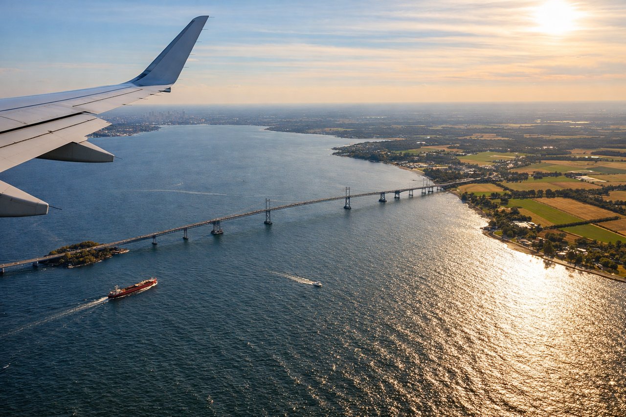
Landing at BWI
LEFTArrivals into BWI from the northeast typically bank to align with runway 10/28 or 15R/33L, putting the Chesapeake Bay and its shoreline on the left side during the descent. Passengers get a clear view of the bay's inlets and the approach into Baltimore's harbor area.
Will your flight be in sunlight?
Pick a date and time in the Sun Map to watch the sun move across your whole flight.
About This Route
Which side of the plane should I sit on flying from Theodore Francis Green State (PVD) to Baltimore Washington International (BWI)?
Sit on the Left side of the plane for the best views on flights from Providence to Baltimore. While takeoff favors the right side briefly for the Providence skyline, the left side wins overall due to the more prolonged and visually richer Chesapeake Bay approach into BWI, which offers sustained water and shoreline scenery during descent.
What can I see during takeoff from Theodore Francis Green State in Providence?
During takeoff from Theodore Francis Green State (PVD), sit on the Right side for the best views. Departing PVD to the southwest, the right side offers views of Providence's downtown skyline and Narragansett Bay before the turn onto course. This gives a brief but distinctive urban and coastal look not visible on the left. Notable sights include: Providence skyline, Narragansett Bay, Providence River.
What can I see when landing at Baltimore Washington International in Baltimore?
When landing at Baltimore Washington International (BWI), sit on the Left side for the best views. Arrivals into BWI from the northeast typically bank to align with runway 10/28 or 15R/33L, putting the Chesapeake Bay and its shoreline on the left side during the descent. Passengers get a clear view of the bay's inlets and the approach into Baltimore's harbor area. Notable sights include: Chesapeake Bay, Baltimore Harbor, Patapsco River.
How long is the flight from Providence to Baltimore?
The flight from Theodore Francis Green State (PVD) to Baltimore Washington International (BWI) takes about 1 hour 15 minutes. The shortest flight path between them is 327 miles (526 km); winds and air traffic control usually add a few percent.
What does the Providence to Baltimore flight path pass over?
Flight path crosses Connecticut, Long Island Sound edge, and New Jersey/Pennsylvania farmland before descending toward the Chesapeake Bay region; mostly flat terrain with no major mountain ranges.