While takeoff favors the left side with Narragansett Bay, the landing approach on the right side delivers superior scenic value with the Potomac River, Arlington's urban landscape, and Washington Monument visibility. The landing experience outweighs the takeoff advantage, making right-side seats the better overall choice for this route.
Flown PVD to IAD? Did we get it right?
Flight Path
Providence to Washington is 371 miles (597 km), a flight of about 1 hour 15 minutes.
Delaware Bay and coastline, Chesapeake Bay western shore, Appalachian foothills of Maryland and Virginia, Shenandoah Valley ridgelines in distance
Great circle distance and headings ›

Phase by phase
Takeoff from PVD
LEFTLeft side captures Providence's harbor and Narragansett Bay during climb-out, offering immediate urban and coastal scenery. Right side faces inland toward flat Rhode Island terrain with minimal visual interest during departure.
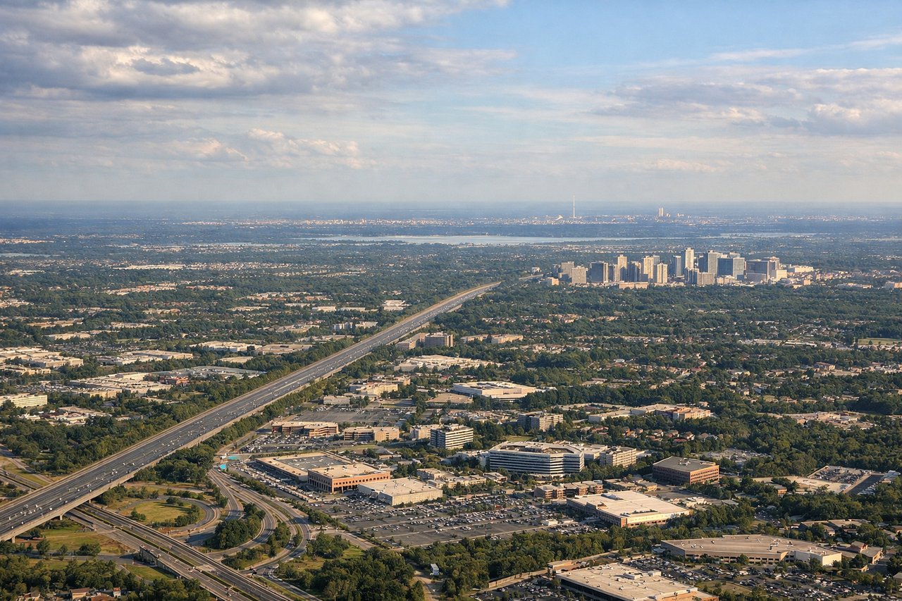
Landing at IAD
RIGHTRight side offers superior landing approach scenery with the Potomac River, Arlington's urban grid, and the Washington Monument visible during descent into Dulles. Left side shows only suburban sprawl and forested terrain with no distinctive landmarks.
Will your flight be in sunlight?
Pick a date and time in the Sun Map to watch the sun move across your whole flight.
About This Route
Which side of the plane should I sit on flying from Theodore Francis Green State (PVD) to Washington Dulles International (IAD)?
Sit on the Right side of the plane for the best views on flights from Providence to Washington. While takeoff favors the left side with Narragansett Bay, the landing approach on the right side delivers superior scenic value with the Potomac River, Arlington's urban landscape, and Washington Monument visibility. The landing experience outweighs the takeoff advantage, making right-side seats the better overall choice for this route.
What can I see during takeoff from Theodore Francis Green State in Providence?
During takeoff from Theodore Francis Green State (PVD), sit on the Left side for the best views. Left side captures Providence's harbor and Narragansett Bay during climb-out, offering immediate urban and coastal scenery. Right side faces inland toward flat Rhode Island terrain with minimal visual interest during departure. Notable sights include: Narragansett Bay, Providence downtown waterfront, Atlantic coastline to the east.
What can I see when landing at Washington Dulles International in Washington?
When landing at Washington Dulles International (IAD), sit on the Right side for the best views. Right side offers superior landing approach scenery with the Potomac River, Arlington's urban grid, and the Washington Monument visible during descent into Dulles. Left side shows only suburban sprawl and forested terrain with no distinctive landmarks. Notable sights include: Potomac River, Arlington Virginia urban area, Washington Monument and National Mall, Dulles Airport runways.
How long is the flight from Providence to Washington?
The flight from Theodore Francis Green State (PVD) to Washington Dulles International (IAD) takes about 1 hour 15 minutes. The shortest flight path between them is 371 miles (597 km); winds and air traffic control usually add a few percent.
What does the Providence to Washington flight path pass over?
Delaware Bay and coastline, Chesapeake Bay western shore, Appalachian foothills of Maryland and Virginia, Shenandoah Valley ridgelines in distance