Both sides score equally for the full flight due to the route's ocean-dominated cruise phase (4+ hours over open Atlantic with minimal landmarks). However, the right side edges ahead on landing quality: the approach into San Juan over El Yunque's forested ridgeline and the dramatic turquoise waters of San Juan Bay provide more visual interest than the left side's open ocean descent. Takeoff favors left (Narragansett Bay), but landing's scenic advantage tips the overall winner to right.
Flown PVD to SJU? Did we get it right?
Flight Path
Providence to San Juan is 1,640 miles (2,640 km), a flight of about 3 hours 45 minutes.
Open Atlantic Ocean with occasional cloud formations; no significant land features visible during cruise phase. Flight path crosses the Atlantic between New England and the Caribbean, passing over deep ocean with no islands or coastal landmarks in the typical routing corridor.
Great circle distance and headings ›Phase by phase
Takeoff from PVD
LEFTLeft side captures Providence's urban waterfront and Narragansett Bay during initial climb. Runway 5 northeast departures bank left, offering views of the bay's islands and coastline. Right side sees inland Rhode Island terrain—flat and unremarkable.
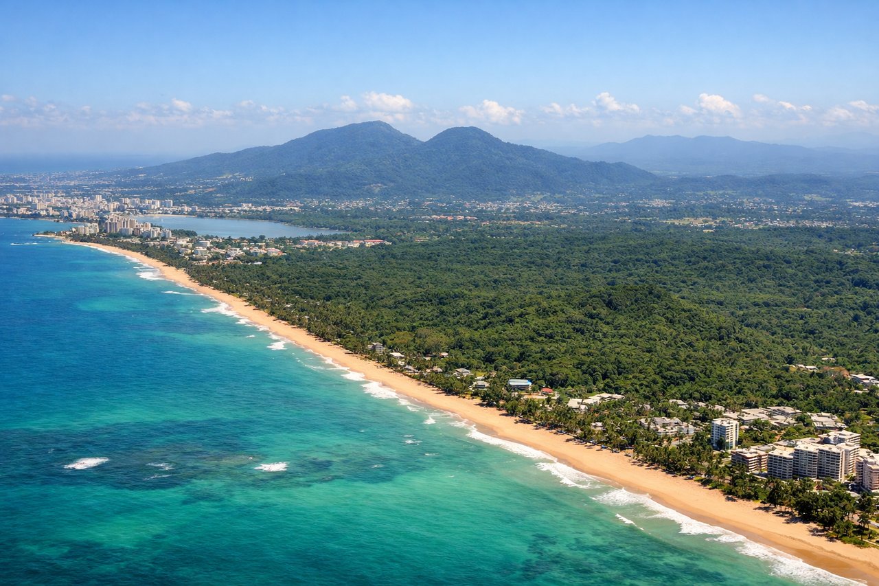
Landing at SJU
RIGHTRight side (north) during descent into SJU offers views of Puerto Rico's northern coast, El Yunque National Forest's green ridgeline, and the approach over San Juan Bay. Runway 08 eastbound arrivals descend from the northwest, positioning right-side passengers to see the island's interior and coastal approach. Left side sees open Atlantic Ocean for most of descent.
Will your flight be in sunlight?
Pick a date and time in the Sun Map to watch the sun move across your whole flight.
About This Route
Which side of the plane should I sit on flying from Theodore Francis Green State (PVD) to Luis Munoz Marin International (SJU)?
Sit on the Right side of the plane for the best views on flights from Providence to San Juan. Both sides score equally for the full flight due to the route's ocean-dominated cruise phase (4+ hours over open Atlantic with minimal landmarks). However, the right side edges ahead on landing quality: the approach into San Juan over El Yunque's forested ridgeline and the dramatic turquoise waters of San Juan Bay provide more visual interest than the left side's open ocean descent. Takeoff favors left (Narragansett Bay), but landing's scenic advantage tips the overall winner to right.
What can I see during takeoff from Theodore Francis Green State in Providence?
During takeoff from Theodore Francis Green State (PVD), sit on the Left side for the best views. Left side captures Providence's urban waterfront and Narragansett Bay during initial climb. Runway 5 northeast departures bank left, offering views of the bay's islands and coastline. Right side sees inland Rhode Island terrain—flat and unremarkable. Notable sights include: Narragansett Bay, Providence River waterfront, Conanicut Island, Mount Hope Bridge.
What can I see when landing at Luis Munoz Marin International in San Juan?
When landing at Luis Munoz Marin International (SJU), sit on the Right side for the best views. Right side (north) during descent into SJU offers views of Puerto Rico's northern coast, El Yunque National Forest's green ridgeline, and the approach over San Juan Bay. Runway 08 eastbound arrivals descend from the northwest, positioning right-side passengers to see the island's interior and coastal approach. Left side sees open Atlantic Ocean for most of descent. Notable sights include: El Yunque National Forest ridge, San Juan Bay, Old San Juan waterfront, Dorado coastal plain.
How long is the flight from Providence to San Juan?
The flight from Theodore Francis Green State (PVD) to Luis Munoz Marin International (SJU) takes about 3 hours 45 minutes. The shortest flight path between them is 1,640 miles (2,640 km); winds and air traffic control usually add a few percent.
What does the Providence to San Juan flight path pass over?
Open Atlantic Ocean with occasional cloud formations; no significant land features visible during cruise phase. Flight path crosses the Atlantic between New England and the Caribbean, passing over deep ocean with no islands or coastal landmarks in the typical routing corridor.