Portland to Charlotte is 812 miles (1,307 km), a flight of about 2 hours 20 minutes.
While takeoff offers nice coastal views, the landing approach into Charlotte provides more dramatic and sustained scenery—the Piedmont landscape, suburban patterns, and Charlotte's skyline are visually engaging. Right seats capture this better during descent.
Flight Path
The flight path crosses the Appalachian foothills and Blue Ridge Mountains in western North Carolina. Around the midpoint (near the Virginia-North Carolina border), you'll see the ridge-and-valley topography of the southern Appalachians, with parallel mountain ridges running northeast-southwest. The New River valley and various reservoirs may be visible depending on exact altitude and atmospheric conditions. As you approach Charlotte, the terrain flattens into the Piedmont plateau with increasing suburban development visible around Greensboro and the Piedmont Triad region.
Great circle distance and headings ›.jpg?width=600)
.jpeg?width=600)
Phase by phase
Takeoff from PWM
LEFTLeft seats offer views of Casco Bay and the Maine coastline as you climb out over the Atlantic. You'll see the irregular rocky shoreline and islands that define this region, with the city of Portland visible below.
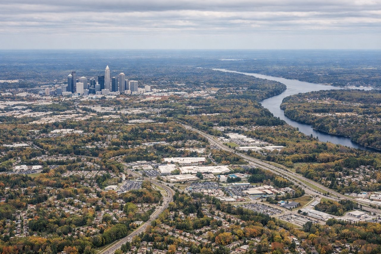
Landing at CLT
RIGHTRight seats provide excellent views of the Piedmont landscape as you descend into Charlotte. You'll see the rolling terrain, suburban sprawl, and the city's skyline approaching from the west, with clear views of the Charlotte metropolitan area.
Landmarks on this routeAll landmarks →
Will your flight be in sunlight?
Pick a date and time in the Sun Map to watch the sun move across your whole flight.
About This Route
Which side of the plane should I sit on flying from Portland International Jetport (PWM) to Charlotte Douglas International (CLT)?
Sit on the Right side of the plane for the best views on flights from Portland to Charlotte. While takeoff offers nice coastal views, the landing approach into Charlotte provides more dramatic and sustained scenery—the Piedmont landscape, suburban patterns, and Charlotte's skyline are visually engaging. Right seats capture this better during descent.
What can I see during takeoff from Portland International Jetport in Portland?
During takeoff from Portland International Jetport (PWM), sit on the Left side for the best views. Left seats offer views of Casco Bay and the Maine coastline as you climb out over the Atlantic. You'll see the irregular rocky shoreline and islands that define this region, with the city of Portland visible below. Notable sights include: Casco Bay with its scattered islands, Atlantic coastline, Portland city grid, Cape Elizabeth peninsula.
What can I see when landing at Charlotte Douglas International in Charlotte?
When landing at Charlotte Douglas International (CLT), sit on the Right side for the best views. Right seats provide excellent views of the Piedmont landscape as you descend into Charlotte. You'll see the rolling terrain, suburban sprawl, and the city's skyline approaching from the west, with clear views of the Charlotte metropolitan area. Notable sights include: Charlotte skyline and downtown district, suburban development patterns, Piedmont rolling terrain, Lake Norman to the north.
How long is the flight from Portland to Charlotte?
The flight from Portland International Jetport (PWM) to Charlotte Douglas International (CLT) takes about 2 hours 20 minutes. The shortest flight path between them is 812 miles (1,307 km); winds and air traffic control usually add a few percent.
What does the Portland to Charlotte flight path pass over?
The flight path crosses the Appalachian foothills and Blue Ridge Mountains in western North Carolina. Around the midpoint (near the Virginia-North Carolina border), you'll see the ridge-and-valley topography of the southern Appalachians, with parallel mountain ridges running northeast-southwest. The New River valley and various reservoirs may be visible depending on exact altitude and atmospheric conditions. As you approach Charlotte, the terrain flattens into the Piedmont plateau with increasing suburban development visible around Greensboro and the Piedmont Triad region.