Portland to Washington is 493 miles (793 km), a flight of about 1 hour 40 minutes.
The left side delivers the most dramatic scenery of the flight. The Casco Bay departure is genuinely spectacular with coastal Maine islands, and during cruise the left side tracks closer to the Connecticut and Hudson River valleys and offers better angles on the New England coastline before the flight turns inland over New Jersey and Maryland.
Flight Path
The flight tracks southwest over coastal New Hampshire and Massachusetts, crossing the Merrimack River valley and greater Boston metro area visible to the east. Over Connecticut the flight passes near Hartford and the Connecticut River valley. Crossing into New York airspace, the Hudson River valley is visible depending on routing. The flight then crosses northern New Jersey, the Delaware River, and descends over Maryland's Piedmont region before reaching Dulles.
Great circle distance and headings ›.jpg?width=600)
.jpeg?width=600)
Phase by phase
Takeoff from PWM
LEFTPWM's primary departure runway 29 sends aircraft northwest over Casco Bay before turning south. The left side captures the bay's island-dotted expanse, the Portland peninsula, and the open Atlantic. Right side gets inland suburban terrain with limited visual interest.
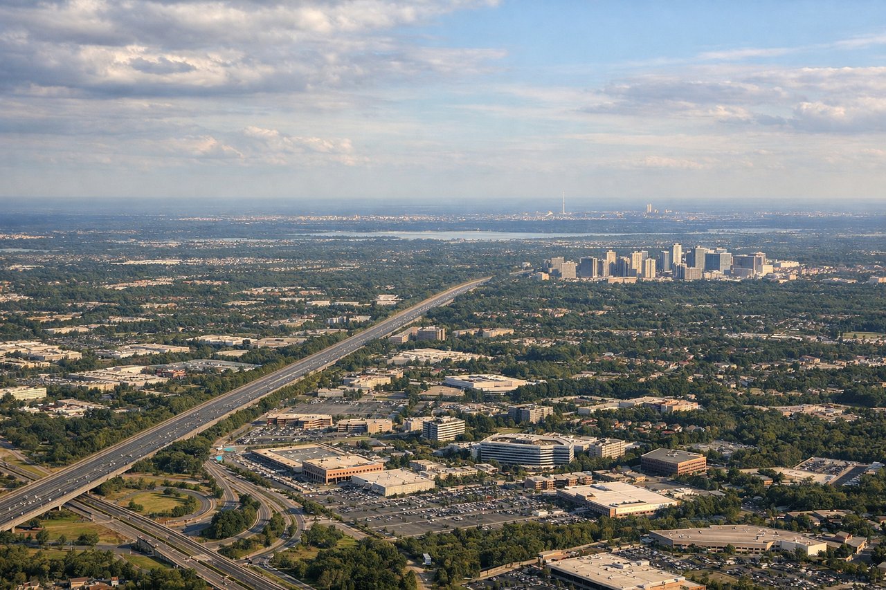
Landing at IAD
RIGHTIAD typically uses runways 01R/19L or 01L/19R aligned north-south. On approach from the northeast, the right side faces west and northwest, giving clear views of the Potomac River, the DC skyline to the east, and the Blue Ridge foothills. Left side looks into suburban Virginia sprawl.
Landmarks on this routeAll landmarks →
Will your flight be in sunlight?
Pick a date and time in the Sun Map to watch the sun move across your whole flight.
About This Route
Which side of the plane should I sit on flying from Portland International Jetport (PWM) to Washington Dulles International (IAD)?
Sit on the Left side of the plane for the best views on flights from Portland to Washington. The left side delivers the most dramatic scenery of the flight. The Casco Bay departure is genuinely spectacular with coastal Maine islands, and during cruise the left side tracks closer to the Connecticut and Hudson River valleys and offers better angles on the New England coastline before the flight turns inland over New Jersey and Maryland.
What can I see during takeoff from Portland International Jetport in Portland?
During takeoff from Portland International Jetport (PWM), sit on the Left side for the best views. PWM's primary departure runway 29 sends aircraft northwest over Casco Bay before turning south. The left side captures the bay's island-dotted expanse, the Portland peninsula, and the open Atlantic. Right side gets inland suburban terrain with limited visual interest. Notable sights include: Casco Bay and its islands, Portland peninsula and Old Port waterfront, Cape Elizabeth coastline, open Atlantic Ocean.
What can I see when landing at Washington Dulles International in Washington?
When landing at Washington Dulles International (IAD), sit on the Right side for the best views. IAD typically uses runways 01R/19L or 01L/19R aligned north-south. On approach from the northeast, the right side faces west and northwest, giving clear views of the Potomac River, the DC skyline to the east, and the Blue Ridge foothills. Left side looks into suburban Virginia sprawl. Notable sights include: Potomac River, Blue Ridge Mountains on the western horizon, Dulles Access Road corridor, suburban Fairfax County grid.
How long is the flight from Portland to Washington?
The flight from Portland International Jetport (PWM) to Washington Dulles International (IAD) takes about 1 hour 40 minutes. The shortest flight path between them is 493 miles (793 km); winds and air traffic control usually add a few percent.
What does the Portland to Washington flight path pass over?
The flight tracks southwest over coastal New Hampshire and Massachusetts, crossing the Merrimack River valley and greater Boston metro area visible to the east. Over Connecticut the flight passes near Hartford and the Connecticut River valley. Crossing into New York airspace, the Hudson River valley is visible depending on routing. The flight then crosses northern New Jersey, the Delaware River, and descends over Maryland's Piedmont region before reaching Dulles.