Portland to Mexico City is 2,357 miles (3,794 km), a flight of about 5 hours 15 minutes.
While Portland's coastal departure is scenic, the landing approach into Mexico City over the Sierra Madre Oriental and the Valley of Mexico provides significantly more dramatic terrain variety and landmark density. The volcanic peaks and mountain ranges visible on approach create a more memorable and visually striking experience than the relatively flat Maine interior on the left side during cruise.
Flight Path
The flight path crosses the Appalachian Mountains (visible during initial climb over Pennsylvania and West Virginia), then transitions over the flat terrain of the Ohio Valley and Mississippi River basin. As the aircraft moves southwestward, the Ozark Plateau becomes visible in Missouri and Arkansas. The flight then crosses into the Gulf of Mexico region, with the Gulf coast of Texas and the Yucatan Peninsula visible during descent. The final approach crosses the Mexican plateau and enters the Valley of Mexico from the north, with the Sierra Madre mountain ranges framing the approach corridor.
Great circle distance and headings ›.jpg?width=600)
.jpeg?width=600)


_(cropped).jpg?width=600)

Phase by phase
Takeoff from PWM
LEFTPortland's departure northwestward over Casco Bay offers immediate coastal scenery with rocky islands and the Atlantic shoreline. The right side departs inland over flat Maine terrain with minimal visual interest during climb-out.
Landing at MEX
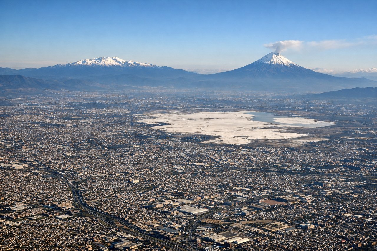
RIGHTThe approach to Mexico City from the north descends over the Valley of Mexico with dramatic views of the Sierra Madre Oriental mountains, urban sprawl of Mexico City itself, and the volcanic peaks of Popocatépetl and Iztaccíhuatl visible on clear days. The left side approaches over flatter terrain with less dramatic geography.
Landmarks on this routeAll landmarks →
Will your flight be in sunlight?
Pick a date and time in the Sun Map to watch the sun move across your whole flight.
About This Route
Which side of the plane should I sit on flying from Portland International Jetport (PWM) to Licenciado Benito Juarez International (MEX)?
Sit on the Right side of the plane for the best views on flights from Portland to Mexico City. While Portland's coastal departure is scenic, the landing approach into Mexico City over the Sierra Madre Oriental and the Valley of Mexico provides significantly more dramatic terrain variety and landmark density. The volcanic peaks and mountain ranges visible on approach create a more memorable and visually striking experience than the relatively flat Maine interior on the left side during cruise.
What can I see during takeoff from Portland International Jetport in Portland?
During takeoff from Portland International Jetport (PWM), sit on the Left side for the best views. Portland's departure northwestward over Casco Bay offers immediate coastal scenery with rocky islands and the Atlantic shoreline. The right side departs inland over flat Maine terrain with minimal visual interest during climb-out. Notable sights include: Casco Bay islands, Atlantic coastline, Portland Harbor, Cape Elizabeth lighthouse area.
What can I see when landing at Licenciado Benito Juarez International in Mexico City?
When landing at Licenciado Benito Juarez International (MEX), sit on the Right side for the best views. The approach to Mexico City from the north descends over the Valley of Mexico with dramatic views of the Sierra Madre Oriental mountains, urban sprawl of Mexico City itself, and the volcanic peaks of Popocatépetl and Iztaccíhuatl visible on clear days. The left side approaches over flatter terrain with less dramatic geography. Notable sights include: Sierra Madre Oriental mountains, Mexico City urban grid, Popocatépetl volcano, Lake Texcoco basin.
How long is the flight from Portland to Mexico City?
The flight from Portland International Jetport (PWM) to Licenciado Benito Juarez International (MEX) takes about 5 hours 15 minutes. The shortest flight path between them is 2,357 miles (3,794 km); winds and air traffic control usually add a few percent.
What does the Portland to Mexico City flight path pass over?
The flight path crosses the Appalachian Mountains (visible during initial climb over Pennsylvania and West Virginia), then transitions over the flat terrain of the Ohio Valley and Mississippi River basin. As the aircraft moves southwestward, the Ozark Plateau becomes visible in Missouri and Arkansas. The flight then crosses into the Gulf of Mexico region, with the Gulf coast of Texas and the Yucatan Peninsula visible during descent. The final approach crosses the Mexican plateau and enters the Valley of Mexico from the north, with the Sierra Madre mountain ranges framing the approach corridor.