Left side scores higher due to the dramatic Cascade volcanic peaks visible during takeoff from Redmond, which provide exceptional terrain variety and landmark density. While the landing approach favors the right side with the Wasatch Range, the takeoff scenery from the left is more visually distinctive and geographically dramatic. The full flight benefits from the early mountain exposure and the sustained high-desert plateau views during cruise.
Flown RDM to SLC? Did we get it right?
Flight Path
Redmond to Salt Lake City is 524 miles (844 km), a flight of about 1 hour 25 minutes.
High desert plateau between the Cascades and Wasatch Range, including the Malheur National Forest area, scattered volcanic buttes, and the transition from Oregon's forested terrain to Utah's arid basin-and-range topography. The flight path crosses the Blue Mountains and enters the Great Basin, with occasional views of isolated peaks and dry lake beds.
Great circle distance and headings ›Phase by phase
Takeoff from RDM
LEFTLeft side captures the Cascade Range immediately after departure from Redmond, with Mount Jefferson and the Three Sisters volcanic peaks visible to the south and southwest. Right side shows the high desert plateau stretching eastward with minimal dramatic terrain.
Landing at SLC
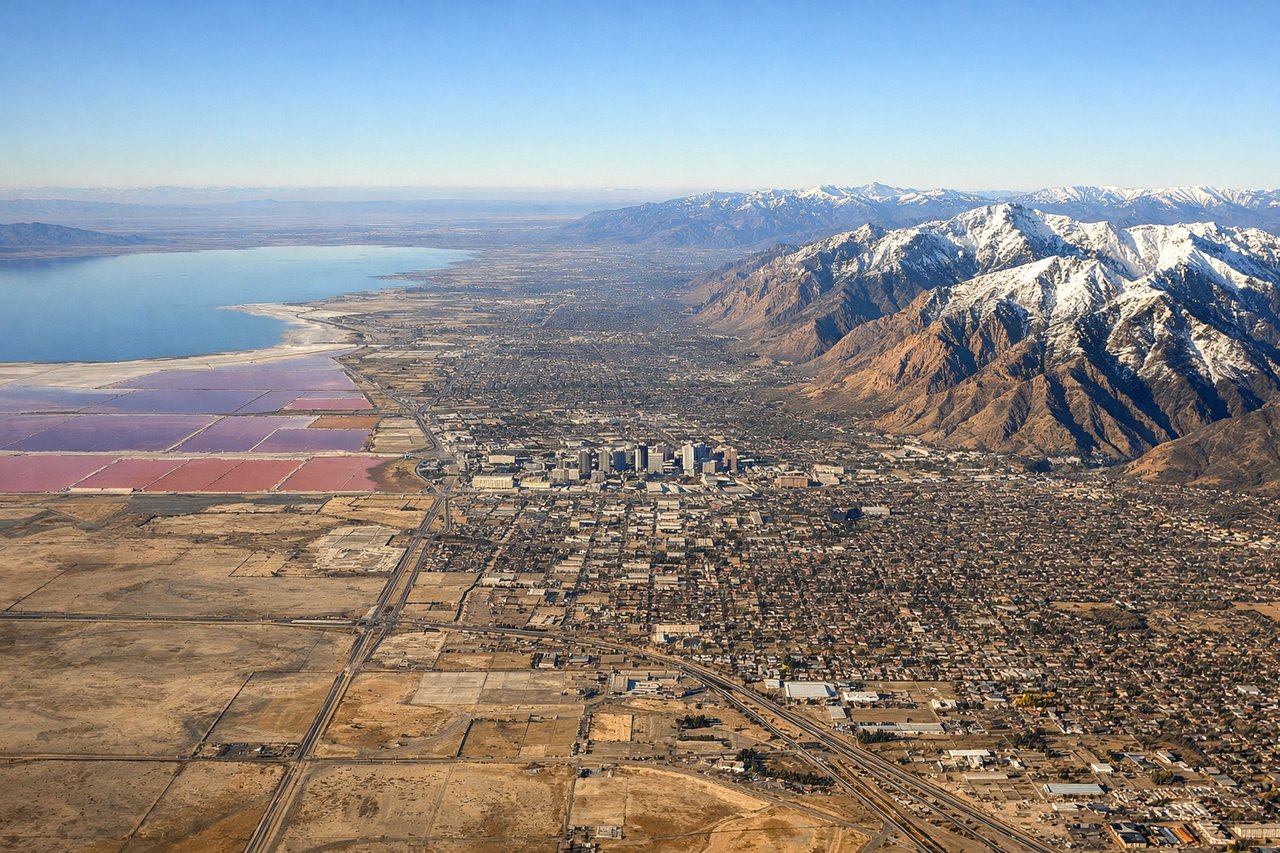
RIGHTRight side provides the superior approach into Salt Lake City, with the Wasatch Range forming a dramatic eastern backdrop and the Great Salt Lake visible to the northwest during descent. Left side shows the western desert and Oquirrh Range but lacks the iconic Wasatch prominence and urban context.
Will your flight be in sunlight?
Pick a date and time in the Sun Map to watch the sun move across your whole flight.
About This Route
Which side of the plane should I sit on flying from Roberts Field (RDM) to Salt Lake City International (SLC)?
Sit on the Left side of the plane for the best views on flights from Redmond to Salt Lake City. Left side scores higher due to the dramatic Cascade volcanic peaks visible during takeoff from Redmond, which provide exceptional terrain variety and landmark density. While the landing approach favors the right side with the Wasatch Range, the takeoff scenery from the left is more visually distinctive and geographically dramatic. The full flight benefits from the early mountain exposure and the sustained high-desert plateau views during cruise.
What can I see during takeoff from Roberts Field in Redmond?
During takeoff from Roberts Field (RDM), sit on the Left side for the best views. Left side captures the Cascade Range immediately after departure from Redmond, with Mount Jefferson and the Three Sisters volcanic peaks visible to the south and southwest. Right side shows the high desert plateau stretching eastward with minimal dramatic terrain. Notable sights include: Cascade Range (Mount Jefferson, Three Sisters), Deschutes River valley, high desert plateau extending east.
What can I see when landing at Salt Lake City International in Salt Lake City?
When landing at Salt Lake City International (SLC), sit on the Right side for the best views. Right side provides the superior approach into Salt Lake City, with the Wasatch Range forming a dramatic eastern backdrop and the Great Salt Lake visible to the northwest during descent. Left side shows the western desert and Oquirrh Range but lacks the iconic Wasatch prominence and urban context. Notable sights include: Wasatch Range (Mount Olympus, Lone Peak), Great Salt Lake, Salt Lake City urban grid, Jordan River valley.
How long is the flight from Redmond to Salt Lake City?
The flight from Roberts Field (RDM) to Salt Lake City International (SLC) takes about 1 hour 25 minutes. The shortest flight path between them is 524 miles (844 km); winds and air traffic control usually add a few percent.
What does the Redmond to Salt Lake City flight path pass over?
High desert plateau between the Cascades and Wasatch Range, including the Malheur National Forest area, scattered volcanic buttes, and the transition from Oregon's forested terrain to Utah's arid basin-and-range topography. The flight path crosses the Blue Mountains and enters the Great Basin, with occasional views of isolated peaks and dry lake beds.