While left offers good takeoff views of Riyadh, the right side provides superior landing scenery with the dramatic Nile River valley and Cairo approach. The landing experience outweighs the takeoff advantage.
Flight Path
The flight crosses the Sinai Peninsula's central plateau (barren, featureless desert at 3,000-4,000 feet elevation), the Gulf of Suez to the east (visible as a narrow blue water body separating Sinai from mainland Egypt), and the transition zone where the desert begins to show subtle wadi systems and limestone formations as the aircraft approaches the Nile valley. The Suez Canal itself may be visible as a thin linear feature if flying directly over it, though most routing passes slightly east. No significant mountains are visible on this route—the terrain is predominantly flat to gently rolling desert plateau.
Great circle distance and headings ›.JPG?width=600)
.jpg?width=600)


Phase by phase
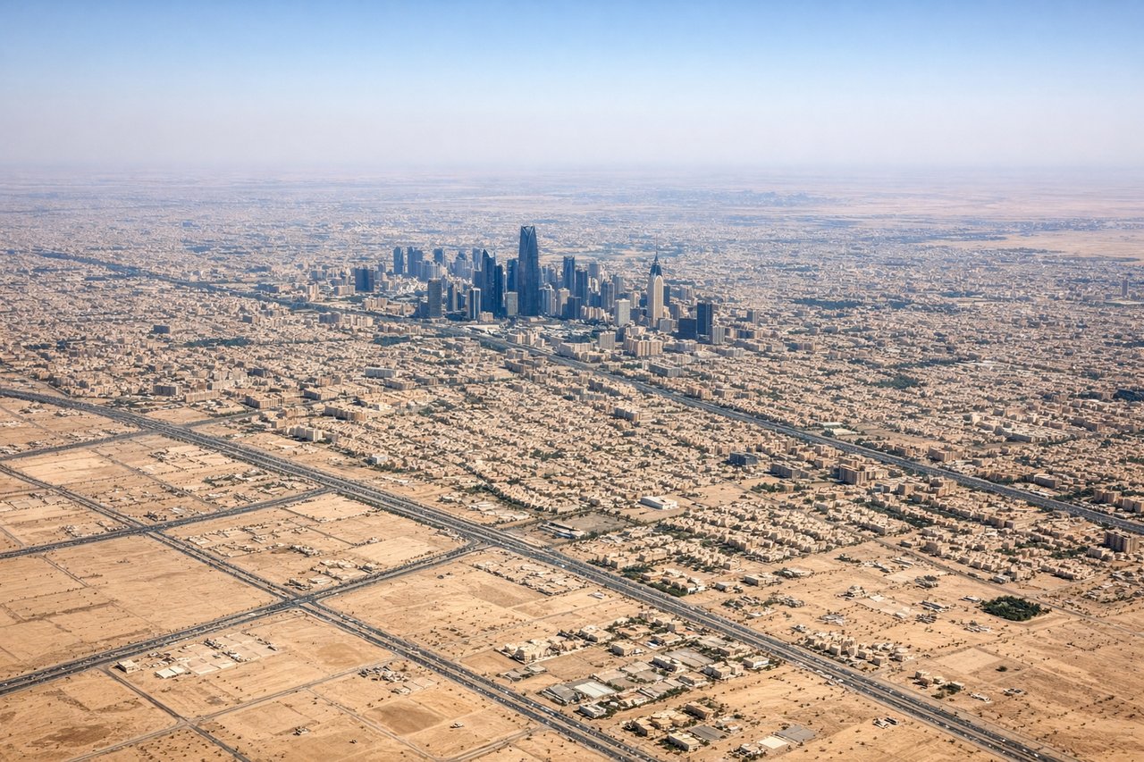
Takeoff from RUH
LEFTRUH typically departs runways 05R/05L or 23R/23L. Westbound departures (05R/05L) on a left side seat offer views of Riyadh's urban sprawl and the surrounding desert plateau. The city's grid pattern and modern development are clearly visible during climb-out before the aircraft turns toward Cairo.
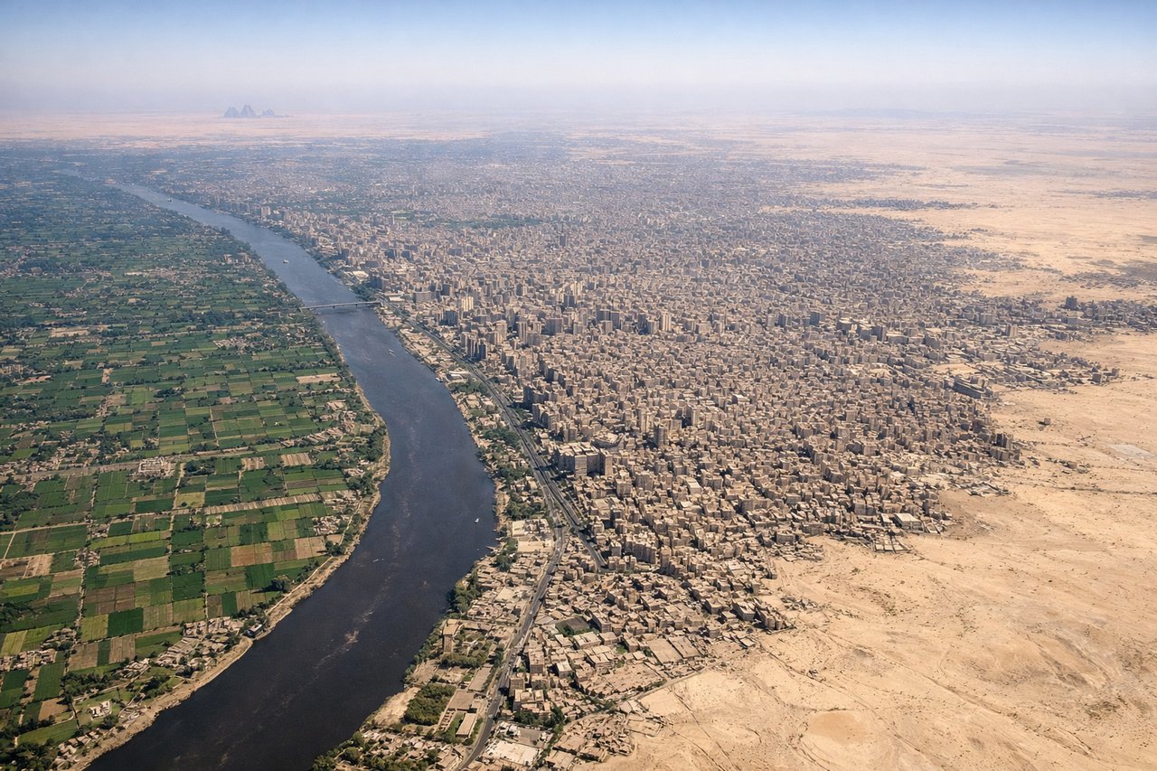
Landing at CAI
RIGHTInbound to CAI typically uses runways 05L/05R or 23L/23R. Approaching from the southeast on a right-side seat provides excellent views of the Nile River valley, Cairo's eastern suburbs, and the transition from desert to the fertile Nile floodplain. The river's distinctive green corridor against surrounding desert is striking during descent.
Landmarks on this routeAll landmarks →
Will your flight be in sunlight?
See exactly which side of the plane gets sun and shade at your departure time.
About This Route
Which side of the plane should I sit on flying from King Khaled International (RUH) to Cairo International (CAI)?
Sit on the Right side of the plane for the best views on flights from Riyadh to Cairo. While left offers good takeoff views of Riyadh, the right side provides superior landing scenery with the dramatic Nile River valley and Cairo approach. The landing experience outweighs the takeoff advantage.
What can I see during takeoff from King Khaled International in Riyadh?
During takeoff from King Khaled International (RUH), sit on the Left side for the best views. RUH typically departs runways 05R/05L or 23R/23L. Westbound departures (05R/05L) on a left side seat offer views of Riyadh's urban sprawl and the surrounding desert plateau. The city's grid pattern and modern development are clearly visible during climb-out before the aircraft turns toward Cairo. Notable sights include: Riyadh city center and eastern suburbs, Wadi Hanifah (dry riverbed system cutting through the city), flat Saudi Arabian plateau extending westward, sparse desert vegetation patterns.
What can I see when landing at Cairo International in Cairo?
When landing at Cairo International (CAI), sit on the Right side for the best views. Inbound to CAI typically uses runways 05L/05R or 23L/23R. Approaching from the southeast on a right-side seat provides excellent views of the Nile River valley, Cairo's eastern suburbs, and the transition from desert to the fertile Nile floodplain. The river's distinctive green corridor against surrounding desert is striking during descent. Notable sights include: Nile River and its green agricultural valley, Cairo's eastern urban sprawl, Eastern Desert plateau (tan, barren terrain), Helwan industrial area south of Cairo.
How long is the flight from Riyadh to Cairo?
The flight from King Khaled International (RUH) to Cairo International (CAI) takes Approximately 2 hours 15 minutes.
What does the Riyadh to Cairo flight path pass over?
The flight crosses the Sinai Peninsula's central plateau (barren, featureless desert at 3,000-4,000 feet elevation), the Gulf of Suez to the east (visible as a narrow blue water body separating Sinai from mainland Egypt), and the transition zone where the desert begins to show subtle wadi systems and limestone formations as the aircraft approaches the Nile valley. The Suez Canal itself may be visible as a thin linear feature if flying directly over it, though most routing passes slightly east. No significant mountains are visible on this route—the terrain is predominantly flat to gently rolling desert plateau.