The right side tracks the mountainous spine of the West Coast and Alaska the whole way - Sierra Nevada, Cascade volcanoes, British Columbia's Coast Mountains, and finally the Chugach Range at Anchorage - while the left side is dominated by miles of open Pacific with only occasional coastline glimpses.
Flight Path
Around the midpoint the flight tracks over the outer waters of British Columbia's coast near Vancouver Island and the Queen Charlotte Sound, with the snow-capped Coast Mountains visible inland to the right before the route continues toward the Gulf of Alaska.
Great circle distance and headings ›.jpg?width=600)


Phase by phase
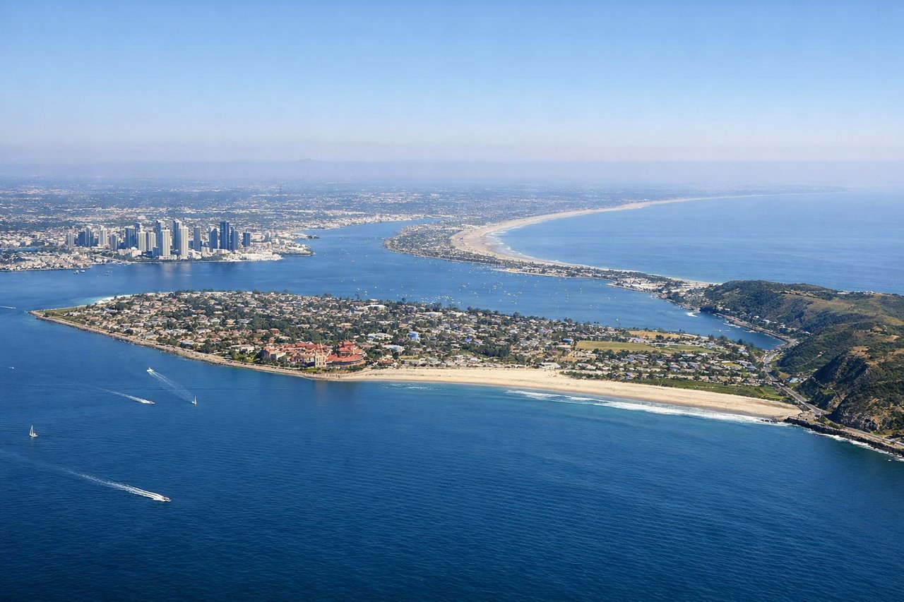
Takeoff from SAN
RIGHTDeparting Runway 27 the jet climbs west over the bay, then banks north toward Alaska, putting downtown San Diego and Balboa Park directly under the right-side windows before the coastline recedes. The left side only shows Coronado and open ocean by comparison.
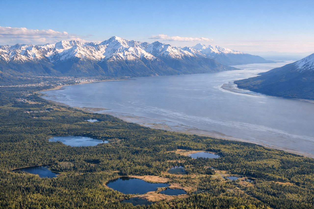
Landing at ANC
RIGHTOn the descent into Anchorage the Chugach Mountains rise abruptly just east of the runway, offering dramatic close-up peaks right at touchdown, while Anchorage's grid and Cook Inlet unfold below. The left side mainly shows the flatter Susitna lowlands and open water of Cook Inlet.
Landmarks on this routeAll landmarks →
Will your flight be in sunlight?
See exactly which side of the plane gets sun and shade at your departure time.
About This Route
Which side of the plane should I sit on flying from San Diego International Lindbergh Fld (SAN) to Ted Stevens Anchorage International (ANC)?
Sit on the Right side of the plane for the best views on flights from San Diego to Anchorage. The right side tracks the mountainous spine of the West Coast and Alaska the whole way - Sierra Nevada, Cascade volcanoes, British Columbia's Coast Mountains, and finally the Chugach Range at Anchorage - while the left side is dominated by miles of open Pacific with only occasional coastline glimpses.
What can I see during takeoff from San Diego International Lindbergh Fld in San Diego?
During takeoff from San Diego International Lindbergh Fld (SAN), sit on the Right side for the best views. Departing Runway 27 the jet climbs west over the bay, then banks north toward Alaska, putting downtown San Diego and Balboa Park directly under the right-side windows before the coastline recedes. The left side only shows Coronado and open ocean by comparison. Notable sights include: Downtown San Diego skyline, Balboa Park, San Diego Bay, La Jolla coastline.
What can I see when landing at Ted Stevens Anchorage International in Anchorage?
When landing at Ted Stevens Anchorage International (ANC), sit on the Right side for the best views. On the descent into Anchorage the Chugach Mountains rise abruptly just east of the runway, offering dramatic close-up peaks right at touchdown, while Anchorage's grid and Cook Inlet unfold below. The left side mainly shows the flatter Susitna lowlands and open water of Cook Inlet. Notable sights include: Chugach Mountains, Anchorage city grid, Knik Arm, Denali (visible in the distance on clear days).
How long is the flight from San Diego to Anchorage?
The flight from San Diego International Lindbergh Fld (SAN) to Ted Stevens Anchorage International (ANC) takes 5h 50m.
What does the San Diego to Anchorage flight path pass over?
Around the midpoint the flight tracks over the outer waters of British Columbia's coast near Vancouver Island and the Queen Charlotte Sound, with the snow-capped Coast Mountains visible inland to the right before the route continues toward the Gulf of Alaska.