The takeoff from Anchorage offers more dramatic and visually distinctive scenery with the Chugach Mountains and coastal features. While the San Diego landing provides nice urban and coastal views, the Alaska departure has greater visual impact and more varied terrain.
Flight Path
The flight path generally tracks south-southeast over British Columbia and the Pacific Northwest. Notable features include the Alaska Panhandle and Inside Passage (if visible at altitude), the Cascade Range in Washington, and the Sierra Nevada in California during the descent phase. The route primarily follows the Pacific coast or slightly inland, offering occasional views of major mountain ranges and the California coastline as the aircraft approaches San Diego.
Great circle distance and headings ›


.jpg?width=600)
Phase by phase
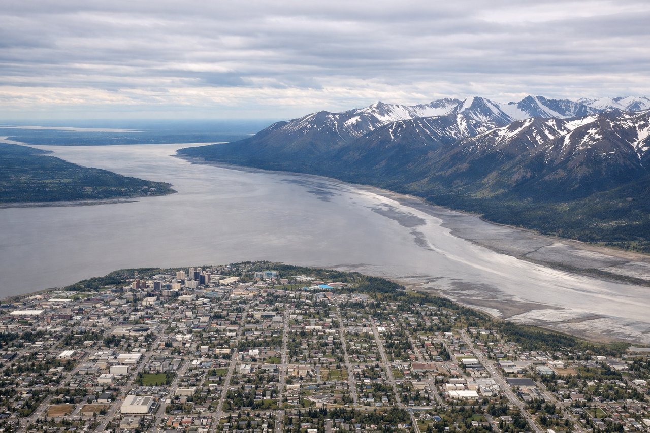
Takeoff from ANC
LEFTLeft side offers immediate views of the Chugach Mountains and Turnagain Arm as the aircraft climbs southbound from Anchorage. The dramatic coastal geography and snow-capped peaks are visible within the first 15-20 minutes of flight.
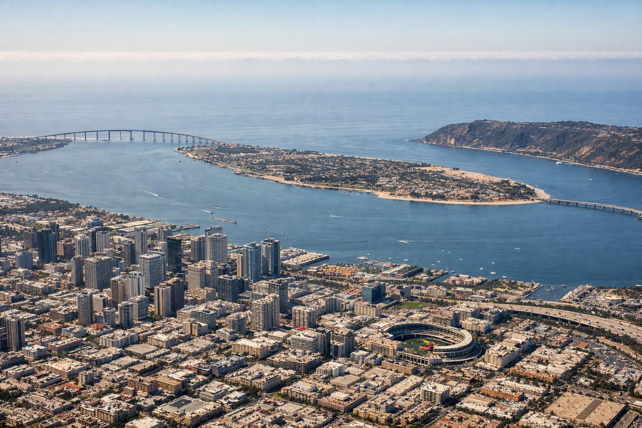
Landing at SAN
RIGHTRight side provides views of the San Diego coastline, Point Loma, and the Pacific Ocean during the descent and approach into Lindbergh Field. The city's urban layout and harbor are also visible from this angle.
Landmarks on this routeAll landmarks →
Will your flight be in sunlight?
See exactly which side of the plane gets sun and shade at your departure time.
About This Route
Which side of the plane should I sit on flying from Ted Stevens Anchorage International (ANC) to San Diego International Lindbergh Fld (SAN)?
Sit on the Left side of the plane for the best views on flights from Anchorage to San Diego. The takeoff from Anchorage offers more dramatic and visually distinctive scenery with the Chugach Mountains and coastal features. While the San Diego landing provides nice urban and coastal views, the Alaska departure has greater visual impact and more varied terrain.
What can I see during takeoff from Ted Stevens Anchorage International in Anchorage?
During takeoff from Ted Stevens Anchorage International (ANC), sit on the Left side for the best views. Left side offers immediate views of the Chugach Mountains and Turnagain Arm as the aircraft climbs southbound from Anchorage. The dramatic coastal geography and snow-capped peaks are visible within the first 15-20 minutes of flight. Notable sights include: Chugach Mountains, Turnagain Arm (Cook Inlet), Anchorage city grid, Knik Arm.
What can I see when landing at San Diego International Lindbergh Fld in San Diego?
When landing at San Diego International Lindbergh Fld (SAN), sit on the Right side for the best views. Right side provides views of the San Diego coastline, Point Loma, and the Pacific Ocean during the descent and approach into Lindbergh Field. The city's urban layout and harbor are also visible from this angle. Notable sights include: Point Loma, San Diego Bay, Pacific Ocean coastline, downtown San Diego skyline.
How long is the flight from Anchorage to San Diego?
The flight from Ted Stevens Anchorage International (ANC) to San Diego International Lindbergh Fld (SAN) takes Approximately 4 hours 45 minutes to 5 hours 15 minutes.
What does the Anchorage to San Diego flight path pass over?
The flight path generally tracks south-southeast over British Columbia and the Pacific Northwest. Notable features include the Alaska Panhandle and Inside Passage (if visible at altitude), the Cascade Range in Washington, and the Sierra Nevada in California during the descent phase. The route primarily follows the Pacific coast or slightly inland, offering occasional views of major mountain ranges and the California coastline as the aircraft approaches San Diego.