The left side wins because the northwest routing keeps the Rocky Mountain front range and Wyoming high country in view during cruise, culminating in a dramatic Mount Rainier approach into Seattle — far more terrain variety than the right side's plains and hazy horizon.
Flight Path
Colorado high plains giving way to the Rocky Mountain front range near Denver, then the Wyoming basin and Snake River plain in Idaho before descending toward the Cascades
Great circle distance and headings ›.jpg?width=600)


Phase by phase
Takeoff from SAT
RIGHTDeparting SAT on the 13R/13L southeast heading, the aircraft banks right toward the northwest bound routing, giving right-side passengers a sweeping view of downtown San Antonio's skyline and the Alamo area before the plains take over. The left side only sees flat South Texas ranchland.
Landing at SEA
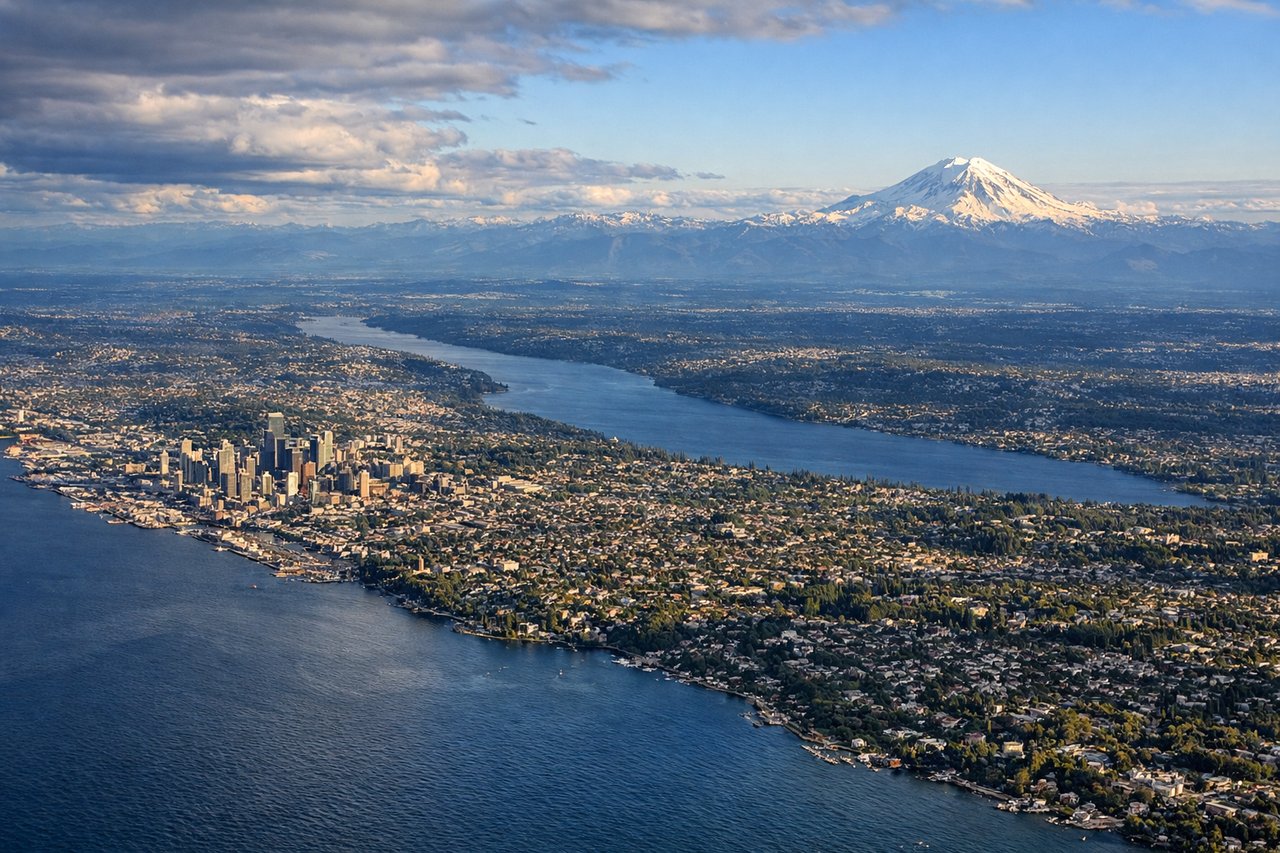
LEFTOn approach into SEA from the south, left-side passengers get a strong view of Mount Rainier's snow-capped volcanic cone rising over the Cascade foothills, along with the Green River valley below. The right side mostly shows the flatter Kent-Auburn valley and distant Olympics haze.
Landmarks on this routeAll landmarks →
Will your flight be in sunlight?
See exactly which side of the plane gets sun and shade at your departure time.
About This Route
Which side of the plane should I sit on flying from San Antonio International (SAT) to Seattle Tacoma International (SEA)?
Sit on the Left side of the plane for the best views on flights from San Antonio to Seattle. The left side wins because the northwest routing keeps the Rocky Mountain front range and Wyoming high country in view during cruise, culminating in a dramatic Mount Rainier approach into Seattle — far more terrain variety than the right side's plains and hazy horizon.
What can I see during takeoff from San Antonio International in San Antonio?
During takeoff from San Antonio International (SAT), sit on the Right side for the best views. Departing SAT on the 13R/13L southeast heading, the aircraft banks right toward the northwest bound routing, giving right-side passengers a sweeping view of downtown San Antonio's skyline and the Alamo area before the plains take over. The left side only sees flat South Texas ranchland. Notable sights include: Downtown San Antonio skyline, San Antonio River bend, Hill Country foothills to the north.
What can I see when landing at Seattle Tacoma International in Seattle?
When landing at Seattle Tacoma International (SEA), sit on the Left side for the best views. On approach into SEA from the south, left-side passengers get a strong view of Mount Rainier's snow-capped volcanic cone rising over the Cascade foothills, along with the Green River valley below. The right side mostly shows the flatter Kent-Auburn valley and distant Olympics haze. Notable sights include: Mount Rainier, Cascade foothills, Green River valley, southern Puget Sound.
How long is the flight from San Antonio to Seattle?
The flight from San Antonio International (SAT) to Seattle Tacoma International (SEA) takes 4h05m.
What does the San Antonio to Seattle flight path pass over?
Colorado high plains giving way to the Rocky Mountain front range near Denver, then the Wyoming basin and Snake River plain in Idaho before descending toward the Cascades