Right seats dominate this route. The takeoff offers unmatched Cascade and Mount Rainier views, and while landing favors the left, the 2+ hour flight path southward over the interior Pacific Northwest and northern California provides consistent right-side scenery of mountain ranges, valleys, and the Sierra Nevada during cruise.
Flight Path
The flight path crosses the Cascade Range, descends into the Willamette Valley (Oregon), passes over the Sierra Nevada's western slope (California), and crosses the Central Valley before heading southeast toward Texas. Notable visible features include Mount Shasta (14,179 ft, visible from cruise altitude in northern California), the Sierra Nevada's jagged ridgeline, and the transition from green Pacific Northwest forests to California's drier terrain. The Great Basin's high desert becomes visible as the route turns southeast toward Texas.
Great circle distance and headings ›

.jpg?width=600)
Phase by phase
Takeoff from SEA
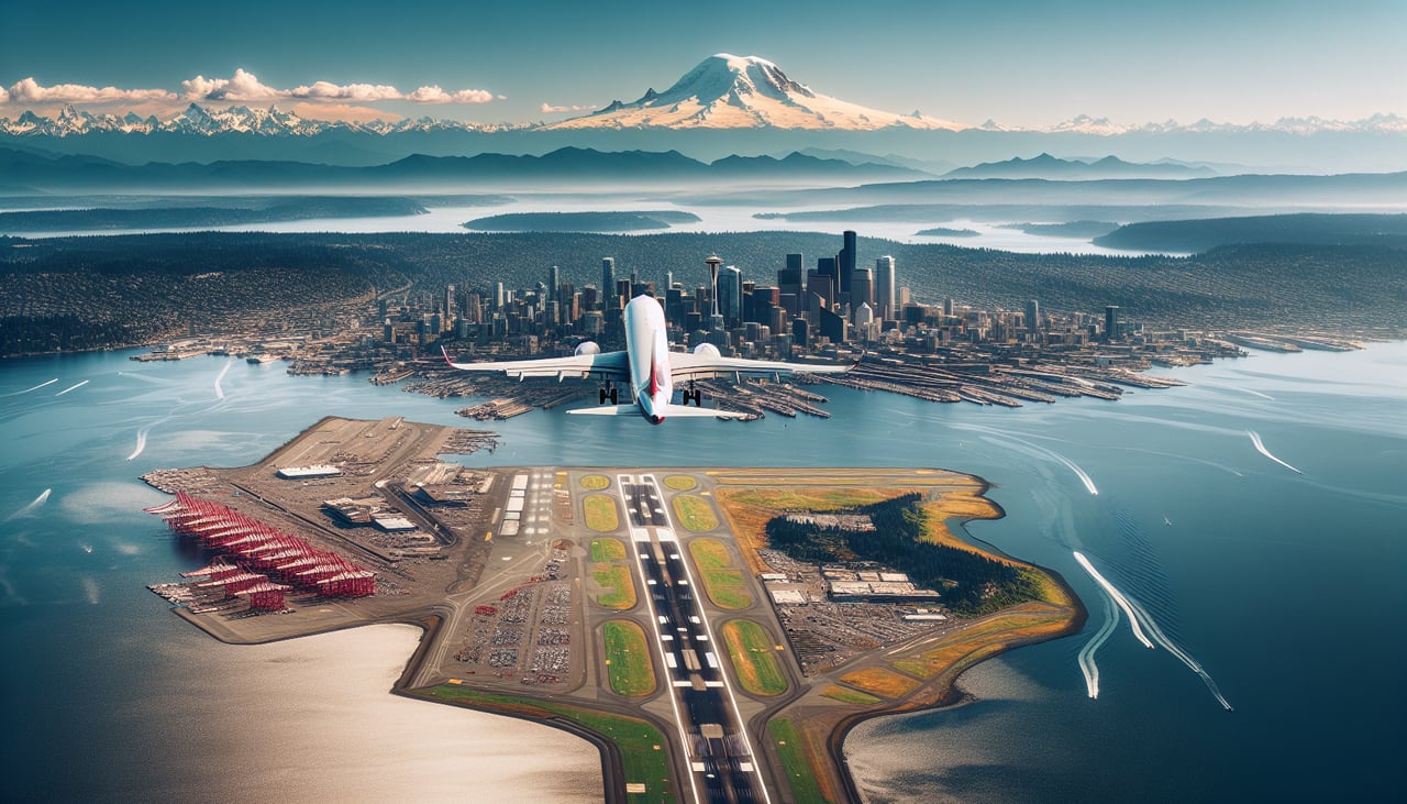
RIGHTRight-side seats capture the Cascade Range immediately after departure. SEA typically departs runways 16L/R heading south, and the Cascades dominate the eastern horizon. You'll see snow-capped peaks including Mount Rainier (14,411 ft) roughly 50-60 miles southeast, visible as a distinctive white cone during clear conditions.
Landing at SAT
LEFTLeft-side seats offer the best approach views into San Antonio. SAT typically uses runways 12L/R for landing, meaning a southbound approach. The left side faces west, revealing the Texas Hill Country's rolling terrain and the city of San Antonio sprawling across the landscape below. The Colorado River and surrounding limestone hills are visible during descent.
Landmarks on this routeAll landmarks →
Will your flight be in sunlight?
See exactly which side of the plane gets sun and shade at your departure time.
About This Route
Which side of the plane should I sit on flying from Seattle Tacoma International (SEA) to San Antonio International (SAT)?
Sit on the Right side of the plane for the best views on flights from Seattle to San Antonio. Right seats dominate this route. The takeoff offers unmatched Cascade and Mount Rainier views, and while landing favors the left, the 2+ hour flight path southward over the interior Pacific Northwest and northern California provides consistent right-side scenery of mountain ranges, valleys, and the Sierra Nevada during cruise.
What can I see during takeoff from Seattle Tacoma International in Seattle?
During takeoff from Seattle Tacoma International (SEA), sit on the Right side for the best views. Right-side seats capture the Cascade Range immediately after departure. SEA typically departs runways 16L/R heading south, and the Cascades dominate the eastern horizon. You'll see snow-capped peaks including Mount Rainier (14,411 ft) roughly 50-60 miles southeast, visible as a distinctive white cone during clear conditions. Notable sights include: Mount Rainier, Cascade Range, Puget Sound (receding westward), Olympic Mountains (western horizon).
What can I see when landing at San Antonio International in San Antonio?
When landing at San Antonio International (SAT), sit on the Left side for the best views. Left-side seats offer the best approach views into San Antonio. SAT typically uses runways 12L/R for landing, meaning a southbound approach. The left side faces west, revealing the Texas Hill Country's rolling terrain and the city of San Antonio sprawling across the landscape below. The Colorado River and surrounding limestone hills are visible during descent. Notable sights include: San Antonio city grid, Texas Hill Country terrain, Colorado River, Balcones Escarpment (distant northern horizon).
How long is the flight from Seattle to San Antonio?
The flight from Seattle Tacoma International (SEA) to San Antonio International (SAT) takes Approximately 4 hours 45 minutes to 5 hours 15 minutes.
What does the Seattle to San Antonio flight path pass over?
The flight path crosses the Cascade Range, descends into the Willamette Valley (Oregon), passes over the Sierra Nevada's western slope (California), and crosses the Central Valley before heading southeast toward Texas. Notable visible features include Mount Shasta (14,179 ft, visible from cruise altitude in northern California), the Sierra Nevada's jagged ridgeline, and the transition from green Pacific Northwest forests to California's drier terrain. The Great Basin's high desert becomes visible as the route turns southeast toward Texas.