While the takeoff offers excellent Andes views, the landing scenery over the Colorado Plateau and Cedar Breaks is more visually distinctive and unique to this specific route. Right-side seats capture the dramatic red rock formations that define the approach to Cedar City.
Flown SCL to CDC? Did we get it right?
Flight Path
Santiago to Cedar City is 5,615 miles (9,036 km), a flight of about 11 hours.
The flight path crosses the Atacama Desert (visible as extremely arid, tan terrain with minimal vegetation), passes over the Peru-Bolivia border region at high altitude, then transitions across the high Andean plateau before descending into the Colorado Plateau. The Atacama's stark, barren appearance and the transition from South American to North American geography are the most notable midpoint features, though these occur at cruise altitude where ground detail becomes minimal.
Great circle distance and headings ›


Phase by phase
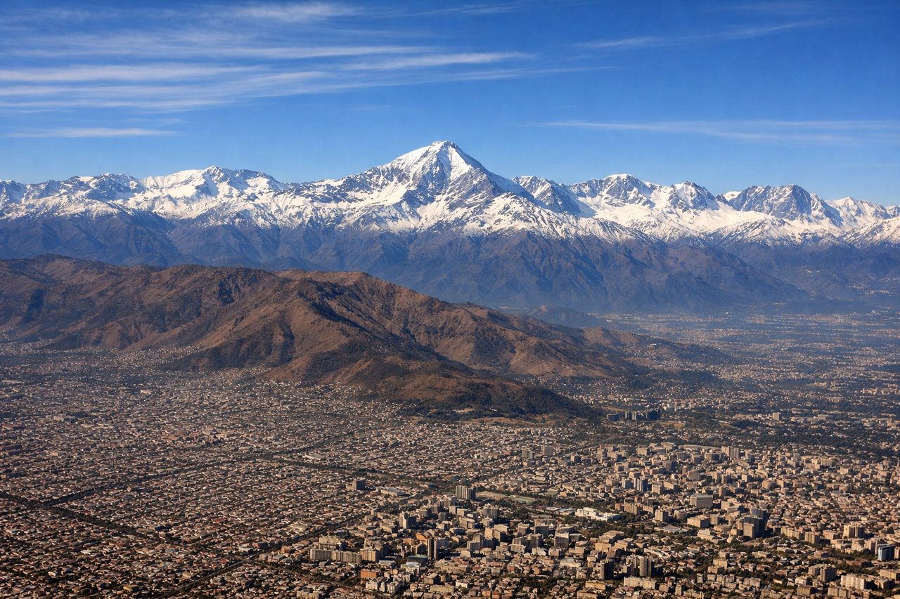
Takeoff from SCL
LEFTLeft side offers immediate views of the Andes Mountains rising dramatically to the east of Santiago. The cordillera's snow-capped peaks dominate the eastern horizon during climb-out, providing the most striking scenery in the first 15-20 minutes of flight.
Landing at CDC
RIGHTRight side provides views of the Colorado Plateau's distinctive red rock formations and Cedar Breaks National Monument as you descend into Cedar City. The terrain transitions from high desert to the characteristic rust-colored cliffs and mesas that define this region.
Will your flight be in sunlight?
Pick a date and time in the Sun Map to watch the sun move across your whole flight.
About This Route
Which side of the plane should I sit on flying from Arturo Merino Benitez International (SCL) to Cedar City Rgnl (CDC)?
Sit on the Right side of the plane for the best views on flights from Santiago to Cedar City. While the takeoff offers excellent Andes views, the landing scenery over the Colorado Plateau and Cedar Breaks is more visually distinctive and unique to this specific route. Right-side seats capture the dramatic red rock formations that define the approach to Cedar City.
What can I see during takeoff from Arturo Merino Benitez International in Santiago?
During takeoff from Arturo Merino Benitez International (SCL), sit on the Left side for the best views. Left side offers immediate views of the Andes Mountains rising dramatically to the east of Santiago. The cordillera's snow-capped peaks dominate the eastern horizon during climb-out, providing the most striking scenery in the first 15-20 minutes of flight. Notable sights include: Andes Mountains (main cordillera), Santiago urban sprawl (visible below during initial climb), Maipo River valley, pre-Andean foothills.
What can I see when landing at Cedar City Rgnl in Cedar City?
When landing at Cedar City Rgnl (CDC), sit on the Right side for the best views. Right side provides views of the Colorado Plateau's distinctive red rock formations and Cedar Breaks National Monument as you descend into Cedar City. The terrain transitions from high desert to the characteristic rust-colored cliffs and mesas that define this region. Notable sights include: Cedar Breaks National Monument (red amphitheater formations), Colorado Plateau, Markagunt Plateau, high desert scrubland.
How long is the flight from Santiago to Cedar City?
The flight from Arturo Merino Benitez International (SCL) to Cedar City Rgnl (CDC) takes about 11 hours. The shortest flight path between them is 5,615 miles (9,036 km); winds and air traffic control usually add a few percent.
What does the Santiago to Cedar City flight path pass over?
The flight path crosses the Atacama Desert (visible as extremely arid, tan terrain with minimal vegetation), passes over the Peru-Bolivia border region at high altitude, then transitions across the high Andean plateau before descending into the Colorado Plateau. The Atacama's stark, barren appearance and the transition from South American to North American geography are the most notable midpoint features, though these occur at cruise altitude where ground detail becomes minimal.