Left side wins at both ends of this flight. Departure gives you the full Andes panorama as the aircraft climbs and turns north, and arrival delivers the Manhattan skyline and New York Harbor on approach to EWR. The right side sees the Pacific coast briefly at departure and New Jersey suburbs on landing — neither competes.
Flown SCL to EWR? Did we get it right?
Flight Path
Santiago to Newark is 5,123 miles (8,245 km), a flight of about 11 hours 30 minutes.
The route tracks north over the Atacama Desert in northern Chile, crosses the Amazon Basin in Brazil (vast unbroken rainforest canopy, often obscured by cloud cover), passes over the Caribbean Sea near Venezuela or the Lesser Antilles, then crosses Cuba and the Bahamas before entering the US East Coast corridor over Florida or the Carolinas heading to the New York area.
Great circle distance and headings ›


Phase by phase
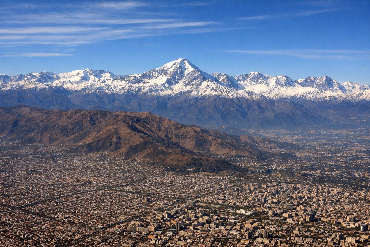
Takeoff from SCL
LEFTSCL typically departs on runway 17/35, heading north. A left (west-facing) seat gives you a direct broadside view of the Andes as the aircraft climbs and turns northeast. The Cordillera rises dramatically just 50-60 miles east, with peaks exceeding 20,000 feet clearly visible on a clear day.
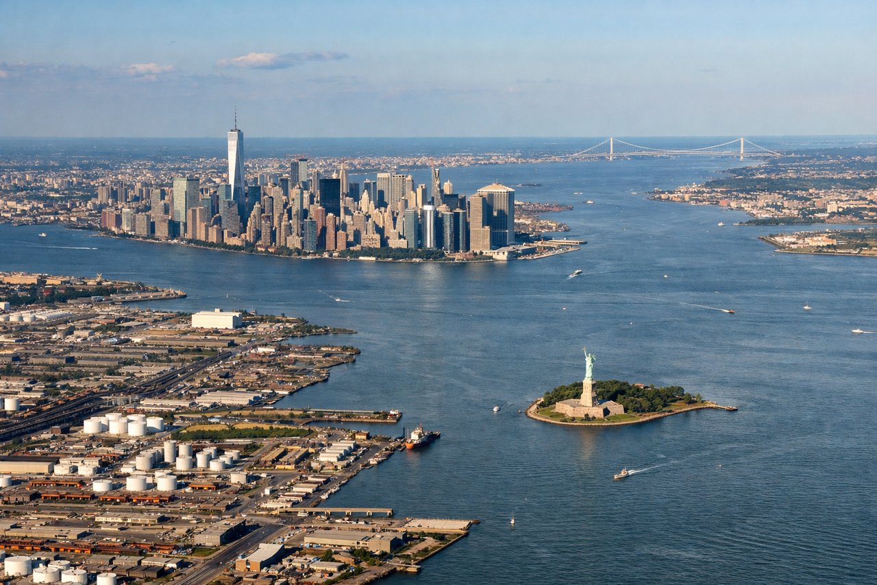
Landing at EWR
LEFTEWR approaches typically come in from the northeast or east, meaning the aircraft tracks over New Jersey and turns final heading southwest over Newark Bay. A left seat faces southeast toward Lower Manhattan, the Hudson River, and New York Harbor — the most iconic urban skyline approach in North America.
Will your flight be in sunlight?
Pick a date and time in the Sun Map to watch the sun move across your whole flight.
About This Route
Which side of the plane should I sit on flying from Arturo Merino Benitez International (SCL) to Newark Liberty International (EWR)?
Sit on the Left side of the plane for the best views on flights from Santiago to Newark. Left side wins at both ends of this flight. Departure gives you the full Andes panorama as the aircraft climbs and turns north, and arrival delivers the Manhattan skyline and New York Harbor on approach to EWR. The right side sees the Pacific coast briefly at departure and New Jersey suburbs on landing — neither competes.
What can I see during takeoff from Arturo Merino Benitez International in Santiago?
During takeoff from Arturo Merino Benitez International (SCL), sit on the Left side for the best views. SCL typically departs on runway 17/35, heading north. A left (west-facing) seat gives you a direct broadside view of the Andes as the aircraft climbs and turns northeast. The Cordillera rises dramatically just 50-60 miles east, with peaks exceeding 20,000 feet clearly visible on a clear day. Notable sights include: Aconcagua (22,838 ft, highest peak in the Americas visible to the northeast), Cerro El Plomo above Santiago, the urban grid of Santiago spread across the Central Valley, the coastal range (Cordillera de la Costa) to the west.
What can I see when landing at Newark Liberty International in Newark?
When landing at Newark Liberty International (EWR), sit on the Left side for the best views. EWR approaches typically come in from the northeast or east, meaning the aircraft tracks over New Jersey and turns final heading southwest over Newark Bay. A left seat faces southeast toward Lower Manhattan, the Hudson River, and New York Harbor — the most iconic urban skyline approach in North America. Notable sights include: Lower Manhattan skyline and One World Trade Center, Hudson River and New York Harbor, Statue of Liberty on Liberty Island, Verrazano-Narrows Bridge in the distance.
How long is the flight from Santiago to Newark?
The flight from Arturo Merino Benitez International (SCL) to Newark Liberty International (EWR) takes about 11 hours 30 minutes. The shortest flight path between them is 5,123 miles (8,245 km); winds and air traffic control usually add a few percent.
What does the Santiago to Newark flight path pass over?
The route tracks north over the Atacama Desert in northern Chile, crosses the Amazon Basin in Brazil (vast unbroken rainforest canopy, often obscured by cloud cover), passes over the Caribbean Sea near Venezuela or the Lesser Antilles, then crosses Cuba and the Bahamas before entering the US East Coast corridor over Florida or the Carolinas heading to the New York area.