Left-side seats capture the most dramatic scenery during takeoff with the Andes Mountains in full view. While landing views favor the right, the northbound climb-out from Santiago provides the flight's most visually striking moment—the cordillera's eastern face is a consistent highlight that outweighs the relatively flat approach into Santa Cruz.
Flown SCL to SRZ? Did we get it right?
Flight Path
Santiago to Santa Cruz is 1,175 miles (1,892 km), a flight of about 2 hours 15 minutes.
The flight path crosses the high Andean plateau (Altiplano) at roughly 12,000-14,000 feet altitude. Notable features include the eastern slopes of the main Andes cordillera, the transition into the Bolivian highlands with scattered salt flats and high-altitude lakes (Laguna de Poopó region visible to the east), and the gradual descent into the Chiquitano lowlands as the aircraft approaches Santa Cruz from the south. The terrain transitions from steep mountain terrain to rolling highlands to flat tropical forest over the course of the journey.
Great circle distance and headings ›


Phase by phase
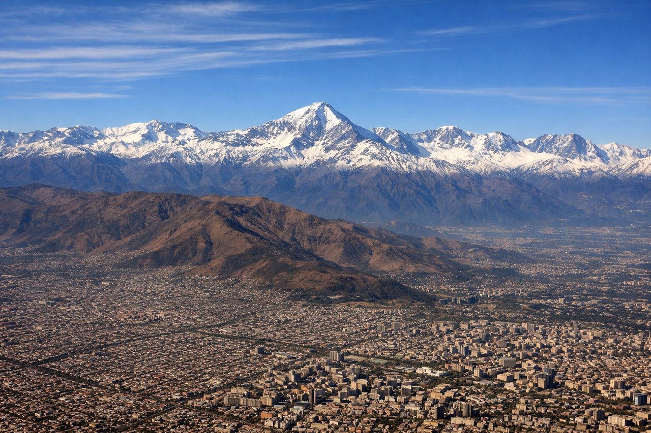
Takeoff from SCL
LEFTLeft-side seats offer the best views during the northbound climb-out from Santiago. You'll see the Andes cordillera rising dramatically to the east, while the city sprawls below. The western perspective also captures the Central Valley's agricultural grid pattern before the aircraft banks northeast toward Bolivia.
Landing at SRZ
RIGHTRight-side seats provide superior views during the descent into Santa Cruz. The approach from the south-southwest brings the city into view on the right, and you'll see the transition from the Chiquitano dry forest to the urban sprawl. The terrain is relatively flat, so the city's layout and surrounding vegetation patterns are clearly visible.
Will your flight be in sunlight?
Pick a date and time in the Sun Map to watch the sun move across your whole flight.
About This Route
Which side of the plane should I sit on flying from Arturo Merino Benitez International (SCL) to El Trompillo Airport (SRZ)?
Sit on the Left side of the plane for the best views on flights from Santiago to Santa Cruz. Left-side seats capture the most dramatic scenery during takeoff with the Andes Mountains in full view. While landing views favor the right, the northbound climb-out from Santiago provides the flight's most visually striking moment—the cordillera's eastern face is a consistent highlight that outweighs the relatively flat approach into Santa Cruz.
What can I see during takeoff from Arturo Merino Benitez International in Santiago?
During takeoff from Arturo Merino Benitez International (SCL), sit on the Left side for the best views. Left-side seats offer the best views during the northbound climb-out from Santiago. You'll see the Andes cordillera rising dramatically to the east, while the city sprawls below. The western perspective also captures the Central Valley's agricultural grid pattern before the aircraft banks northeast toward Bolivia. Notable sights include: Andes Mountains (eastern escarpment), Santiago metropolitan area, Central Valley agricultural plains, Maipo River valley.
What can I see when landing at El Trompillo Airport in Santa Cruz?
When landing at El Trompillo Airport (SRZ), sit on the Right side for the best views. Right-side seats provide superior views during the descent into Santa Cruz. The approach from the south-southwest brings the city into view on the right, and you'll see the transition from the Chiquitano dry forest to the urban sprawl. The terrain is relatively flat, so the city's layout and surrounding vegetation patterns are clearly visible. Notable sights include: Santa Cruz de la Sierra urban area, Chiquitano forest (dry tropical woodland), Rio Grande (visible as a meandering watercourse), flat Amazonian basin terrain.
How long is the flight from Santiago to Santa Cruz?
The flight from Arturo Merino Benitez International (SCL) to El Trompillo Airport (SRZ) takes about 2 hours 15 minutes. The shortest flight path between them is 1,175 miles (1,892 km); winds and air traffic control usually add a few percent.
What does the Santiago to Santa Cruz flight path pass over?
The flight path crosses the high Andean plateau (Altiplano) at roughly 12,000-14,000 feet altitude. Notable features include the eastern slopes of the main Andes cordillera, the transition into the Bolivian highlands with scattered salt flats and high-altitude lakes (Laguna de Poopó region visible to the east), and the gradual descent into the Chiquitano lowlands as the aircraft approaches Santa Cruz from the south. The terrain transitions from steep mountain terrain to rolling highlands to flat tropical forest over the course of the journey.