Santo Domingo to Orlando is 1,010 miles (1,625 km), a flight of about 3 hours 15 minutes.
The takeoff experience from SDQ on the right side—Caribbean waters and the dramatic Cordillera Central—outweighs the landing view. The Caribbean seascape is more visually striking than central Florida's flat lakes, and you'll spend more time in the climb-out phase with good visibility.
Flight Path
The flight path crosses the Bahamas platform and the Atlantic. You'll pass over or near the Turks and Caicos Islands (visible as small islands and shallow banks with distinctive turquoise water coloration), the Exuma Cays (chain of small islands in the Bahamas), and the Great Bahama Bank (shallow water visible as pale turquoise). The Straits of Florida separate the Bahamas from the Florida peninsula. No major mountain ranges are visible in the midpoint; the route is primarily over open ocean and shallow tropical water.
Great circle distance and headings ›Phase by phase
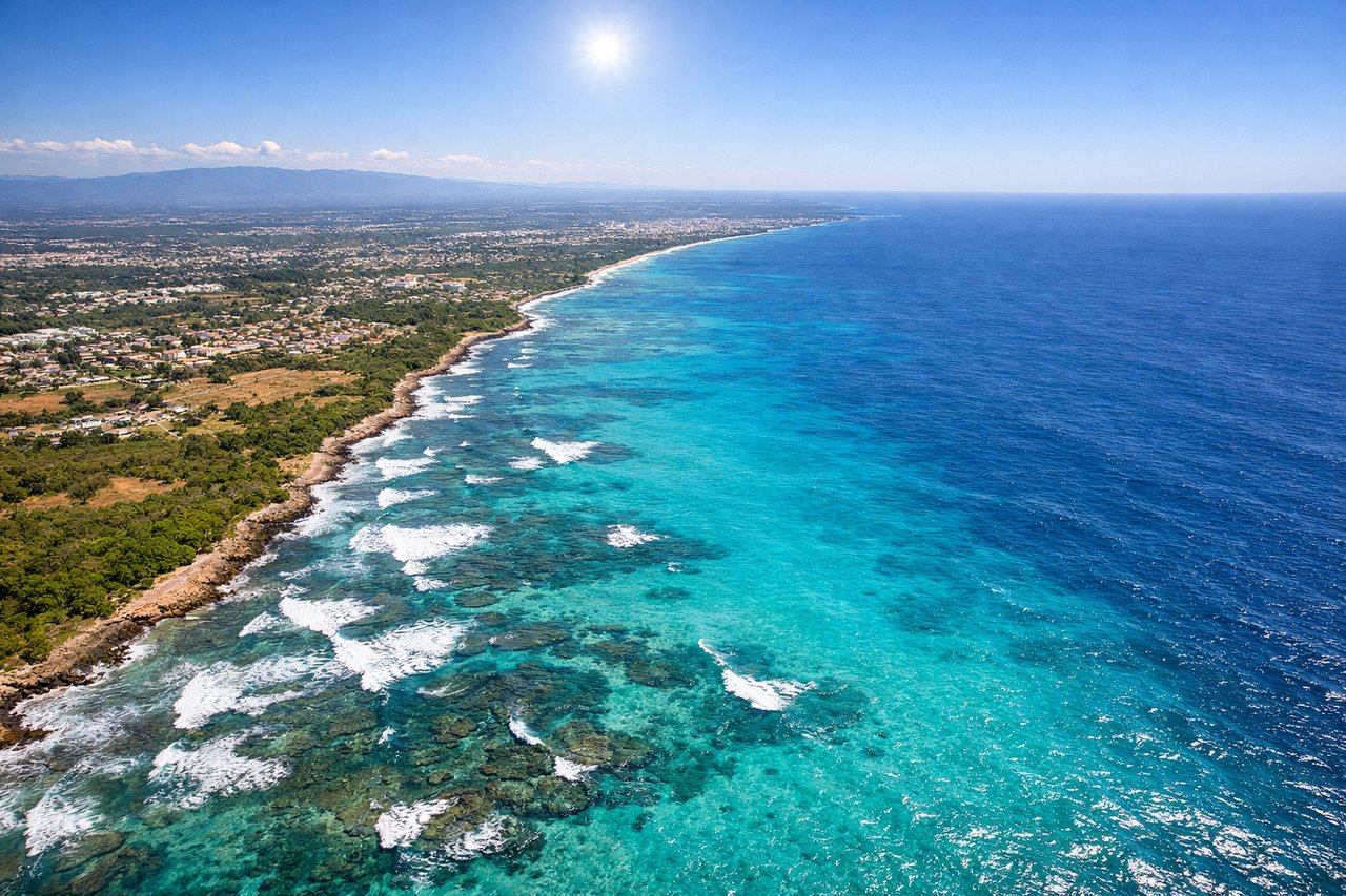
Takeoff from SDQ
RIGHTRight side captures the Caribbean Sea and the Dominican coastline as you climb out. SDQ typically departs eastbound or northeastbound, so the right window shows the turquoise waters and the Cordillera Central mountain range receding inland—much more visually interesting than the interior landscape to the left.

Landing at MCO
LEFTLeft side offers views of central Florida's lake systems and terrain during descent into MCO. Approaching from the southeast, the left window shows the chain of lakes around the Orlando area and the relatively flat central Florida landscape—more distinctive than the right side's featureless terrain.
Will your flight be in sunlight?
Pick a date and time in the Sun Map to watch the sun move across your whole flight.
About This Route
Which side of the plane should I sit on flying from Las Americas International (SDQ) to Orlando International (MCO)?
Sit on the Right side of the plane for the best views on flights from Santo Domingo to Orlando. The takeoff experience from SDQ on the right side—Caribbean waters and the dramatic Cordillera Central—outweighs the landing view. The Caribbean seascape is more visually striking than central Florida's flat lakes, and you'll spend more time in the climb-out phase with good visibility.
What can I see during takeoff from Las Americas International in Santo Domingo?
During takeoff from Las Americas International (SDQ), sit on the Right side for the best views. Right side captures the Caribbean Sea and the Dominican coastline as you climb out. SDQ typically departs eastbound or northeastbound, so the right window shows the turquoise waters and the Cordillera Central mountain range receding inland—much more visually interesting than the interior landscape to the left. Notable sights include: Caribbean Sea (immediate offshore waters), Cordillera Central (mountain range visible inland to the south), Ozama River delta (visible near airport), coastal development of Santo Domingo district.
What can I see when landing at Orlando International in Orlando?
When landing at Orlando International (MCO), sit on the Left side for the best views. Left side offers views of central Florida's lake systems and terrain during descent into MCO. Approaching from the southeast, the left window shows the chain of lakes around the Orlando area and the relatively flat central Florida landscape—more distinctive than the right side's featureless terrain. Notable sights include: Lake Apopka (largest lake in the approach corridor), Shingle Creek (source of Kissimmee River), chain of smaller lakes around greater Orlando, flat central Florida pine and palmetto scrubland.
How long is the flight from Santo Domingo to Orlando?
The flight from Las Americas International (SDQ) to Orlando International (MCO) takes about 3 hours 15 minutes. The shortest flight path between them is 1,010 miles (1,625 km); winds and air traffic control usually add a few percent.
What does the Santo Domingo to Orlando flight path pass over?
The flight path crosses the Bahamas platform and the Atlantic. You'll pass over or near the Turks and Caicos Islands (visible as small islands and shallow banks with distinctive turquoise water coloration), the Exuma Cays (chain of small islands in the Bahamas), and the Great Bahama Bank (shallow water visible as pale turquoise). The Straits of Florida separate the Bahamas from the Florida peninsula. No major mountain ranges are visible in the midpoint; the route is primarily over open ocean and shallow tropical water.