Right-side seats capture the most dramatic scenery: Mount Rainier and the Cascades during departure are visually striking, and the right side also offers views of Central America's Caribbean coastline and mountain ranges during the long southern transit.
Flight Path
The flight path crosses the continental United States heading south-southeast, passing over the Sierra Nevada and Rocky Mountain ranges (visible from altitude), then over the Gulf of Mexico and Caribbean waters. Notable geographic features include the Sierra Nevada in California, the Colorado Plateau region, the Gulf of Mexico's open waters, and the Yucatan Peninsula. As the aircraft approaches Venezuela, the Caribbean coastline becomes visible, followed by the Maracaibo Basin and the Perijá Mountains marking the Colombia-Venezuela border.
Great circle distance and headings ›
.jpg?width=600)


Phase by phase
Takeoff from SEA
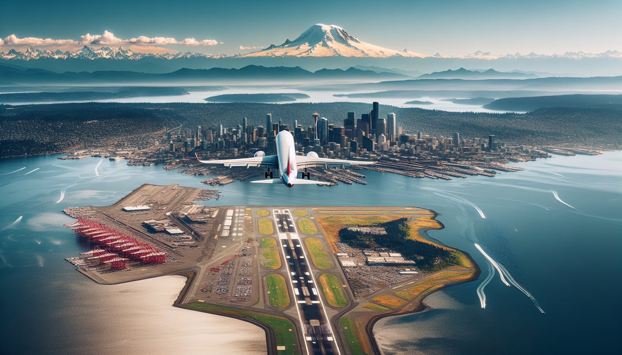
RIGHTRight-side seats offer views of the Cascade Range and Mount Rainier during the initial climb-out heading south-southeast. The mountain is prominently visible on clear days as the aircraft gains altitude over western Washington.
Landing at STB
LEFTLeft-side seats provide views of the Caribbean coastline and the Maracaibo Basin as the aircraft descends toward Santa Barbara. The coastal geography and Lake Maracaibo are distinctive visual markers during final approach.
Landmarks on this routeAll landmarks →
Will your flight be in sunlight?
See exactly which side of the plane gets sun and shade at your departure time.
About This Route
Which side of the plane should I sit on flying from Seattle Tacoma International (SEA) to Santa Barbara Del Zulia (STB)?
Sit on the Right side of the plane for the best views on flights from Seattle to Santa Barbara. Right-side seats capture the most dramatic scenery: Mount Rainier and the Cascades during departure are visually striking, and the right side also offers views of Central America's Caribbean coastline and mountain ranges during the long southern transit.
What can I see during takeoff from Seattle Tacoma International in Seattle?
During takeoff from Seattle Tacoma International (SEA), sit on the Right side for the best views. Right-side seats offer views of the Cascade Range and Mount Rainier during the initial climb-out heading south-southeast. The mountain is prominently visible on clear days as the aircraft gains altitude over western Washington. Notable sights include: Mount Rainier (14,410 ft), Cascade Range, Puget Sound, Olympic Mountains to the west.
What can I see when landing at Santa Barbara Del Zulia in Santa Barbara?
When landing at Santa Barbara Del Zulia (STB), sit on the Left side for the best views. Left-side seats provide views of the Caribbean coastline and the Maracaibo Basin as the aircraft descends toward Santa Barbara. The coastal geography and Lake Maracaibo are distinctive visual markers during final approach. Notable sights include: Lake Maracaibo, Caribbean coastline, Perijá Mountains, Maracaibo city lights.
How long is the flight from Seattle to Santa Barbara?
The flight from Seattle Tacoma International (SEA) to Santa Barbara Del Zulia (STB) takes Approximately 6.5 to 7.5 hours.
What does the Seattle to Santa Barbara flight path pass over?
The flight path crosses the continental United States heading south-southeast, passing over the Sierra Nevada and Rocky Mountain ranges (visible from altitude), then over the Gulf of Mexico and Caribbean waters. Notable geographic features include the Sierra Nevada in California, the Colorado Plateau region, the Gulf of Mexico's open waters, and the Yucatan Peninsula. As the aircraft approaches Venezuela, the Caribbean coastline becomes visible, followed by the Maracaibo Basin and the Perijá Mountains marking the Colombia-Venezuela border.