The left side wins because it captures San Francisco Bay and the city skyline during the turn after takeoff, likely views north toward the Sierra Nevada and Great Salt Lake during cruise, and the Minneapolis skyline with its lakes on final approach — the right side mostly overlooks flat Nevada desert and featureless Great Plains farmland.
Flown SFO to MSP? Did we get it right?
Flight Path
San Francisco to Minneapolis is 1,585 miles (2,551 km), a flight of about 3 hours 45 minutes.
The route crosses the Sierra Nevada near Lake Tahoe and Donner Pass, the high desert basins of Nevada, the Great Salt Lake and Wasatch Range near Salt Lake City, and the high plains of Wyoming and Nebraska, with the distant Rocky Mountain Front Range occasionally visible to the south before the terrain flattens into Minnesota farmland.
Great circle distance and headings ›


Phase by phase
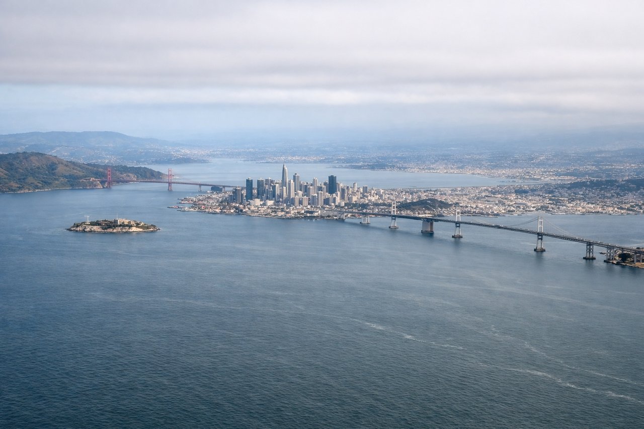
Takeoff from SFO
LEFTAfter departing to the east over San Mateo, the aircraft banks left to pick up its northeasterly course toward Minnesota, swinging passengers on the left side over San Francisco Bay. This gives a brief but clear view of the city skyline, the Golden Gate Bridge, and the East Bay hills before the climb continues north toward the Sacramento Valley.
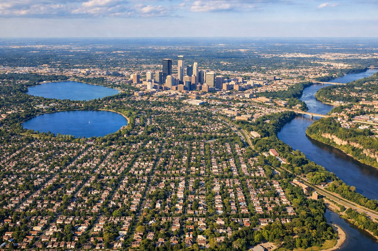
Landing at MSP
LEFTOn the descent into MSP, the flight path approaches from the northwest, putting downtown Minneapolis and its chain of lakes on the left side of the aircraft just before landing. Passengers get a clear look at the city skyline, the Mississippi River bends, and lakes like Bde Maka Ska and Lake Harriet in the final minutes.
Will your flight be in sunlight?
Pick a date and time in the Sun Map to watch the sun move across your whole flight.
About This Route
Which side of the plane should I sit on flying from San Francisco International (SFO) to Minneapolis St Paul International (MSP)?
Sit on the Left side of the plane for the best views on flights from San Francisco to Minneapolis. The left side wins because it captures San Francisco Bay and the city skyline during the turn after takeoff, likely views north toward the Sierra Nevada and Great Salt Lake during cruise, and the Minneapolis skyline with its lakes on final approach — the right side mostly overlooks flat Nevada desert and featureless Great Plains farmland.
What can I see during takeoff from San Francisco International in San Francisco?
During takeoff from San Francisco International (SFO), sit on the Left side for the best views. After departing to the east over San Mateo, the aircraft banks left to pick up its northeasterly course toward Minnesota, swinging passengers on the left side over San Francisco Bay. This gives a brief but clear view of the city skyline, the Golden Gate Bridge, and the East Bay hills before the climb continues north toward the Sacramento Valley. Notable sights include: San Francisco Bay and skyline, Golden Gate Bridge, Mount Tamalpais, Mount Diablo.
What can I see when landing at Minneapolis St Paul International in Minneapolis?
When landing at Minneapolis St Paul International (MSP), sit on the Left side for the best views. On the descent into MSP, the flight path approaches from the northwest, putting downtown Minneapolis and its chain of lakes on the left side of the aircraft just before landing. Passengers get a clear look at the city skyline, the Mississippi River bends, and lakes like Bde Maka Ska and Lake Harriet in the final minutes. Notable sights include: Minneapolis downtown skyline, Mississippi River, Chain of Lakes (Bde Maka Ska, Lake Harriet), Minnesota River valley.
How long is the flight from San Francisco to Minneapolis?
The flight from San Francisco International (SFO) to Minneapolis St Paul International (MSP) takes about 3 hours 45 minutes. The shortest flight path between them is 1,585 miles (2,551 km); winds and air traffic control usually add a few percent.
What does the San Francisco to Minneapolis flight path pass over?
The route crosses the Sierra Nevada near Lake Tahoe and Donner Pass, the high desert basins of Nevada, the Great Salt Lake and Wasatch Range near Salt Lake City, and the high plains of Wyoming and Nebraska, with the distant Rocky Mountain Front Range occasionally visible to the south before the terrain flattens into Minnesota farmland.