San Francisco to Tokyo is 5,112 miles (8,227 km), a flight of about 11 hours 5 minutes.
The left side wins across the whole flight: a scenic San Francisco Bay departure, a stretch of Pacific Northwest and Alaskan coastline visible during the early cruise as the route curves north past Oregon, Washington, and the Alaska Peninsula/Aleutians, and a Japan coastal approach into Narita. The right side faces open ocean for nearly the entire flight with no landmass in view.
Flight Path
The great-circle route curves north of the direct line, passing south of the Alaska Peninsula and Aleutian Islands in the Gulf of Alaska region before crossing the International Date Line and continuing over open North Pacific water toward Japan.
Great circle distance and headings ›


Phase by phase
Takeoff from SFO
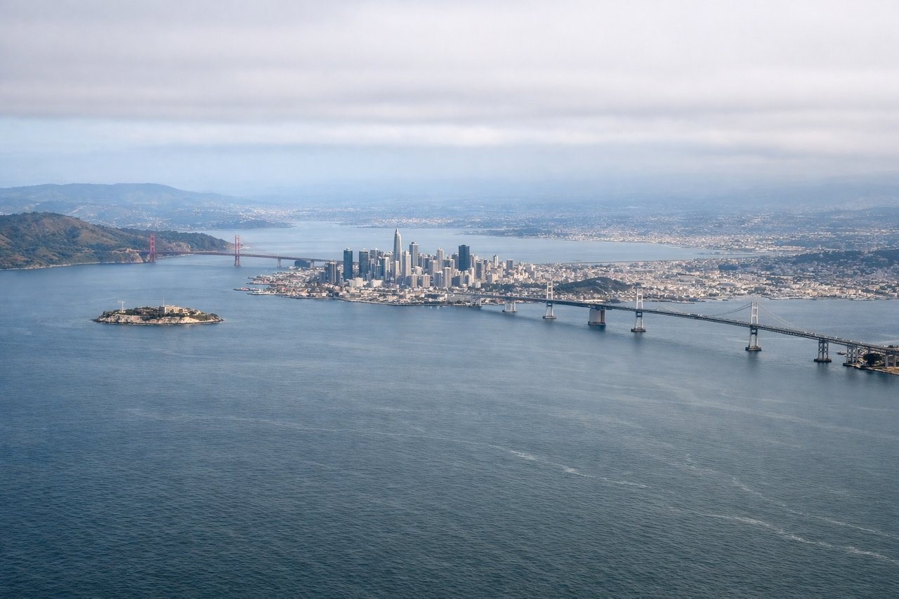
LEFTSFO departures to the northwest turn left almost immediately after takeoff to intercept the oceanic route toward Japan, banking the left side of the aircraft down toward San Francisco. Passengers get a strong view of the city skyline, the Golden Gate Bridge, and the Marin Headlands before the aircraft settles onto its coastal heading. The right side mostly shows the flatter South Bay and Silicon Valley suburbs.
Landing at NRT
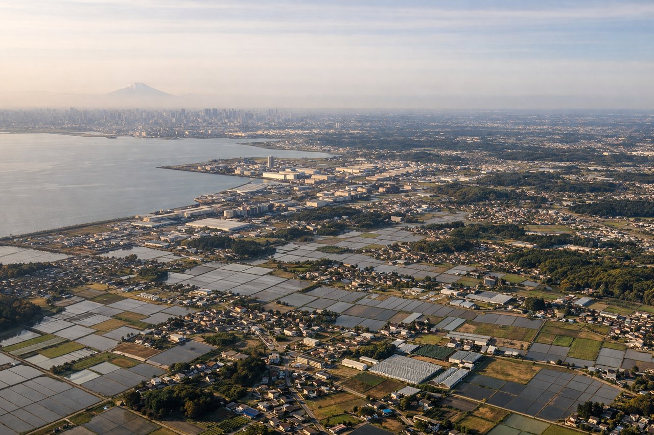
LEFTBecause the flight has been curving gently leftward across the entire North Pacific great-circle route, the aircraft approaches Narita from the northeast, keeping Japan's Pacific coastline and Tokyo Bay on the left side during descent. Passengers see the Boso Peninsula's patchwork farmland and rivers pass beneath before landing, while the right side faces open ocean until very late in the approach.
Landmarks on this routeAll landmarks →
Will your flight be in sunlight?
Pick a date and time in the Sun Map to watch the sun move across your whole flight.
About This Route
Which side of the plane should I sit on flying from San Francisco International (SFO) to New Tokyo International (NRT)?
Sit on the Left side of the plane for the best views on flights from San Francisco to Tokyo. The left side wins across the whole flight: a scenic San Francisco Bay departure, a stretch of Pacific Northwest and Alaskan coastline visible during the early cruise as the route curves north past Oregon, Washington, and the Alaska Peninsula/Aleutians, and a Japan coastal approach into Narita. The right side faces open ocean for nearly the entire flight with no landmass in view.
What can I see during takeoff from San Francisco International in San Francisco?
During takeoff from San Francisco International (SFO), sit on the Left side for the best views. SFO departures to the northwest turn left almost immediately after takeoff to intercept the oceanic route toward Japan, banking the left side of the aircraft down toward San Francisco. Passengers get a strong view of the city skyline, the Golden Gate Bridge, and the Marin Headlands before the aircraft settles onto its coastal heading. The right side mostly shows the flatter South Bay and Silicon Valley suburbs. Notable sights include: San Francisco skyline, Golden Gate Bridge, Marin Headlands, San Francisco Bay.
What can I see when landing at New Tokyo International in Tokyo?
When landing at New Tokyo International (NRT), sit on the Left side for the best views. Because the flight has been curving gently leftward across the entire North Pacific great-circle route, the aircraft approaches Narita from the northeast, keeping Japan's Pacific coastline and Tokyo Bay on the left side during descent. Passengers see the Boso Peninsula's patchwork farmland and rivers pass beneath before landing, while the right side faces open ocean until very late in the approach. Notable sights include: Boso Peninsula coastline, Tokyo Bay (distant), Tone River delta, Chiba farmland.
How long is the flight from San Francisco to Tokyo?
The flight from San Francisco International (SFO) to New Tokyo International (NRT) takes about 11 hours 5 minutes. The shortest flight path between them is 5,112 miles (8,227 km); winds and air traffic control usually add a few percent.
What does the San Francisco to Tokyo flight path pass over?
The great-circle route curves north of the direct line, passing south of the Alaska Peninsula and Aleutian Islands in the Gulf of Alaska region before crossing the International Date Line and continuing over open North Pacific water toward Japan.