The right side gets the best of both airports: Ho Chi Minh City and the Saigon River on takeoff, and the Danang coastline, Marble Mountains and Son Tra Peninsula on landing. The left side's Central Highlands view is pleasant but has less variety and fewer recognizable landmarks.
Flown SGN to DAD? Did we get it right?
Flight Path
Ho Chi Minh City to Danang is 376 miles (605 km), a flight of about 1 hour 30 minutes.
The route runs north-northeast over the Dong Nai lowlands, then over the forested Central Highlands plateau and the Truong Son (Annamite) foothills, passing inland of the Kon Tum and Pleiku area before turning east toward the coast near Danang. The left side has the best view of the highlands, while the right side may catch the distant coast.
Great circle distance and headings ›Phase by phase
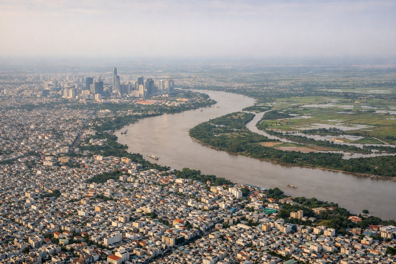
Takeoff from SGN
RIGHTWhichever runway is used, the climb-out turns north-northeast, so the right side looks over the Saigon River bend and the central districts of Ho Chi Minh City. The left side looks over the flat suburbs of Go Vap and Hoc Mon toward Binh Duong.
Landing at DAD
RIGHTArrivals normally approach Danang from the south and turn onto final over the coastal plain, so the right side faces east to the beaches, the Han River mouth and the city. Son Tra Peninsula rises out of the sea and the Marble Mountains stand out on the flat coastal plain. The left side only shows the green foothills and Ba Na range inland.
Will your flight be in sunlight?
Pick a date and time in the Sun Map to watch the sun move across your whole flight.
About This Route
Which side of the plane should I sit on flying from Tansonnhat International (SGN) to Danang International (DAD)?
Sit on the Right side of the plane for the best views on flights from Ho Chi Minh City to Danang. The right side gets the best of both airports: Ho Chi Minh City and the Saigon River on takeoff, and the Danang coastline, Marble Mountains and Son Tra Peninsula on landing. The left side's Central Highlands view is pleasant but has less variety and fewer recognizable landmarks.
What can I see during takeoff from Tansonnhat International in Ho Chi Minh City?
During takeoff from Tansonnhat International (SGN), sit on the Right side for the best views. Whichever runway is used, the climb-out turns north-northeast, so the right side looks over the Saigon River bend and the central districts of Ho Chi Minh City. The left side looks over the flat suburbs of Go Vap and Hoc Mon toward Binh Duong. Notable sights include: Landmark 81 tower, Saigon River bends, Thu Thiem and District 1 skyline, Thu Duc and Dong Nai river lowlands.
What can I see when landing at Danang International in Danang?
When landing at Danang International (DAD), sit on the Right side for the best views. Arrivals normally approach Danang from the south and turn onto final over the coastal plain, so the right side faces east to the beaches, the Han River mouth and the city. Son Tra Peninsula rises out of the sea and the Marble Mountains stand out on the flat coastal plain. The left side only shows the green foothills and Ba Na range inland. Notable sights include: Marble Mountains (Ngu Hanh Son), My Khe beach and the Han River mouth with Dragon Bridge, Son Tra Peninsula, Cham Islands on the offshore horizon.
How long is the flight from Ho Chi Minh City to Danang?
The flight from Tansonnhat International (SGN) to Danang International (DAD) takes about 1 hour 30 minutes. The shortest flight path between them is 376 miles (605 km); winds and air traffic control usually add a few percent.
What does the Ho Chi Minh City to Danang flight path pass over?
The route runs north-northeast over the Dong Nai lowlands, then over the forested Central Highlands plateau and the Truong Son (Annamite) foothills, passing inland of the Kon Tum and Pleiku area before turning east toward the coast near Danang. The left side has the best view of the highlands, while the right side may catch the distant coast.