While takeoff offers good delta views, landing provides the more distinctive visual experience with Mount Agung and Bali's volcanic landscape. The left side captures the island's defining geographic feature during approach.
Flown SGN to DPS? Did we get it right?
Flight Path
Ho Chi Minh City to Denpasar is 1,473 miles (2,371 km), a flight of about 3 hours 30 minutes.
The flight path crosses the Gulf of Thailand and the Siam Gulf, passing over open water for most of the journey. Around the midpoint, the aircraft will be over the Siam Gulf approximately 200 km southwest of Cambodia. The Cambodian coast and Tonlé Sap region remain too distant (100+ km) to be clearly visible. The approach to Bali involves crossing the Java Sea, with the northern coast of Java potentially visible as a distant landmass to the south during descent, though typically obscured by haze. The Lombok Strait becomes visible during the final descent phase.
Great circle distance and headings ›Phase by phase
Takeoff from SGN
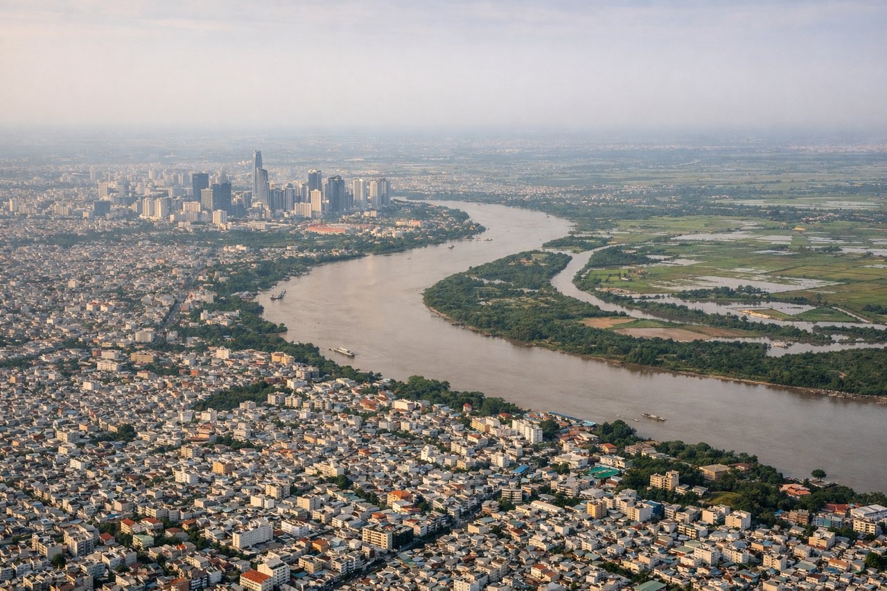
RIGHTSGN typically departs runway 25L/R (westbound). Right-side seats face south toward the Saigon River delta and the Mekong floodplain, offering views of the extensive rice paddies and waterways that dominate the landscape immediately south of the airport.
Landing at DPS
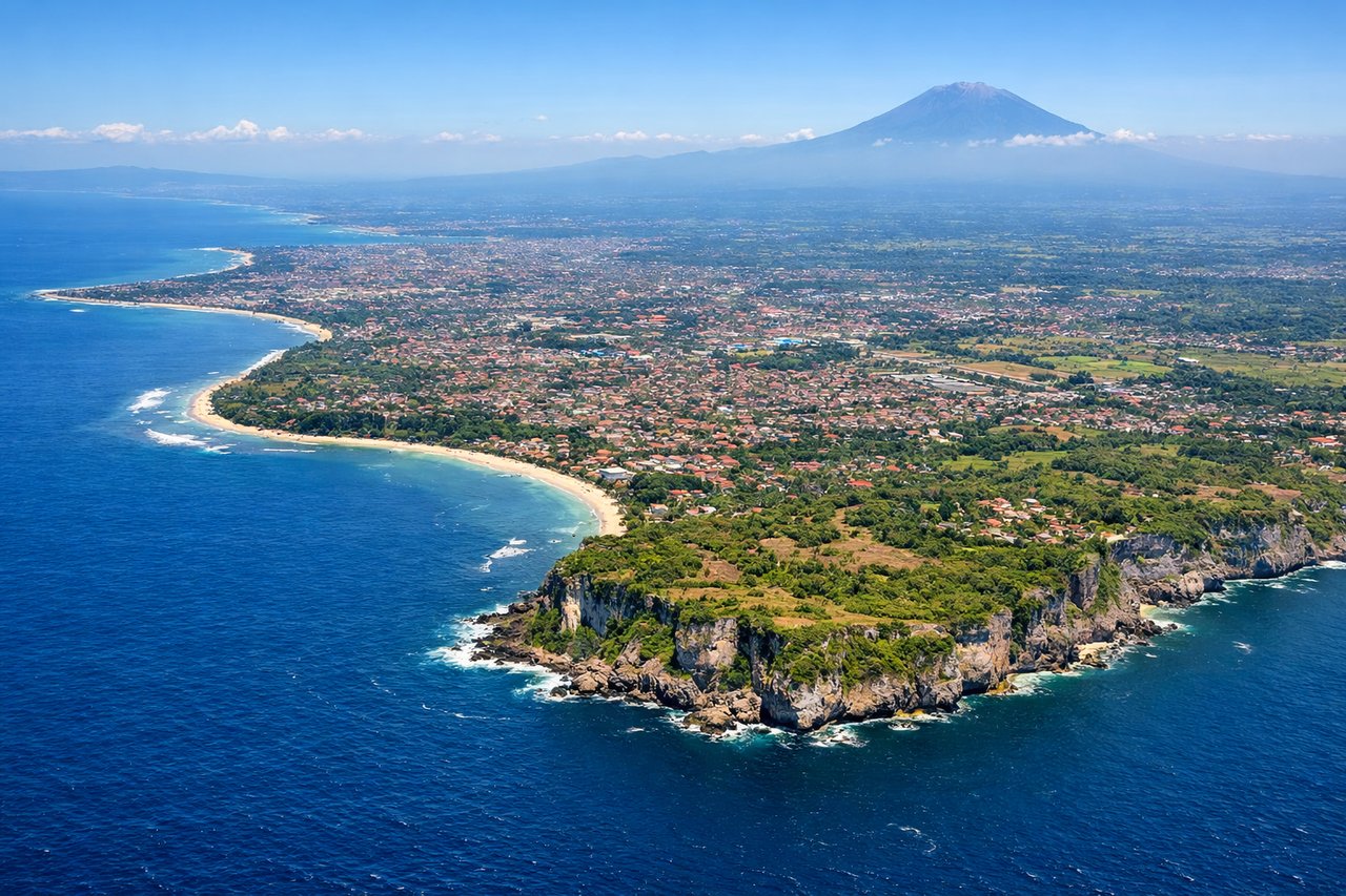
LEFTDPS approaches from the south or southwest (runway 09L/R typical). Left-side seats on descent face east toward Mount Agung and the volcanic ridgeline that dominates Bali's interior. This provides the most dramatic view of the island's central highlands and the approach over the Badung Strait.
Will your flight be in sunlight?
Pick a date and time in the Sun Map to watch the sun move across your whole flight.
About This Route
Which side of the plane should I sit on flying from Tansonnhat International (SGN) to Denpasar I Gusti Ngurah Rai International Airport (DPS)?
Sit on the Left side of the plane for the best views on flights from Ho Chi Minh City to Denpasar. While takeoff offers good delta views, landing provides the more distinctive visual experience with Mount Agung and Bali's volcanic landscape. The left side captures the island's defining geographic feature during approach.
What can I see during takeoff from Tansonnhat International in Ho Chi Minh City?
During takeoff from Tansonnhat International (SGN), sit on the Right side for the best views. SGN typically departs runway 25L/R (westbound). Right-side seats face south toward the Saigon River delta and the Mekong floodplain, offering views of the extensive rice paddies and waterways that dominate the landscape immediately south of the airport. Notable sights include: Saigon River (visible as a brown ribbon threading through the city), Mekong Delta wetlands (expansive patchwork of flooded fields), Can Tho city (visible ~100 km southwest as a developed area), Vung Tau peninsula (distant landmass to the southeast).
What can I see when landing at Denpasar I Gusti Ngurah Rai International Airport in Denpasar?
When landing at Denpasar I Gusti Ngurah Rai International Airport (DPS), sit on the Left side for the best views. DPS approaches from the south or southwest (runway 09L/R typical). Left-side seats on descent face east toward Mount Agung and the volcanic ridgeline that dominates Bali's interior. This provides the most dramatic view of the island's central highlands and the approach over the Badung Strait. Notable sights include: Mount Agung (3,031 m active volcano, visible as a prominent peak on the horizon during descent), Badung Strait (the water body between Bali and Lombok), Lombok island (visible across the strait to the east), Denpasar city sprawl (visible below during final approach).
How long is the flight from Ho Chi Minh City to Denpasar?
The flight from Tansonnhat International (SGN) to Denpasar I Gusti Ngurah Rai International Airport (DPS) takes about 3 hours 30 minutes. The shortest flight path between them is 1,473 miles (2,371 km); winds and air traffic control usually add a few percent.
What does the Ho Chi Minh City to Denpasar flight path pass over?
The flight path crosses the Gulf of Thailand and the Siam Gulf, passing over open water for most of the journey. Around the midpoint, the aircraft will be over the Siam Gulf approximately 200 km southwest of Cambodia. The Cambodian coast and Tonlé Sap region remain too distant (100+ km) to be clearly visible. The approach to Bali involves crossing the Java Sea, with the northern coast of Java potentially visible as a distant landmass to the south during descent, though typically obscured by haze. The Lombok Strait becomes visible during the final descent phase.