The right side captures the most dramatic scenery during takeoff (Mekong Delta and river systems), while the left side during landing shows Ankara's urban geography and the Anatolian landscape. However, the takeoff phase offers more visually distinctive natural features, making right-side seats the better overall choice for this route.
Flight Path
The flight path crosses the Indian subcontinent (Himalayas visible from altitude if routing north of India), the Arabian Sea or Persian Gulf depending on routing, the Zagros Mountains in Iran (dramatic north-south ridges), and the Anatolian Plateau. Major waypoints include airspace over Pakistan, Iran, and Iraq before reaching Turkey. The Tigris and Euphrates river valleys may be visible during the approach to Turkish airspace.
Great circle distance and headings ›


.jpg?width=600)
Phase by phase
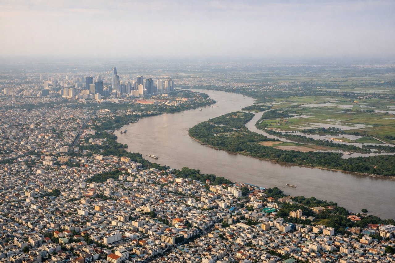
Takeoff from SGN
RIGHTRight-side seats capture the Saigon River delta and Mekong River system as the aircraft climbs northwestward from Tan Son Nhat. The river networks, agricultural patchwork, and coastal features of southern Vietnam are best viewed from the right side during the initial climb-out phase.
Landing at ESB
LEFTLeft-side seats provide views of the Ankara approach corridor, including the Anatolian Plateau terrain, the Ankara cityscape, and the Kızılırmak River valley. The descent into Esenboga brings the surrounding steppe and city infrastructure into clear view from the left side.
Landmarks on this routeAll landmarks →
Will your flight be in sunlight?
See exactly which side of the plane gets sun and shade at your departure time.
About This Route
Which side of the plane should I sit on flying from Tansonnhat International (SGN) to Esenboga (ESB)?
Sit on the Right side of the plane for the best views on flights from Ho Chi Minh City to Ankara. The right side captures the most dramatic scenery during takeoff (Mekong Delta and river systems), while the left side during landing shows Ankara's urban geography and the Anatolian landscape. However, the takeoff phase offers more visually distinctive natural features, making right-side seats the better overall choice for this route.
What can I see during takeoff from Tansonnhat International in Ho Chi Minh City?
During takeoff from Tansonnhat International (SGN), sit on the Right side for the best views. Right-side seats capture the Saigon River delta and Mekong River system as the aircraft climbs northwestward from Tan Son Nhat. The river networks, agricultural patchwork, and coastal features of southern Vietnam are best viewed from the right side during the initial climb-out phase. Notable sights include: Saigon River (winding through Ho Chi Minh City), Mekong River Delta (extensive agricultural grid visible below 8,000 ft), Can Tho city and waterways, Coastal mangrove zones along the southern Vietnam coast.
What can I see when landing at Esenboga in Ankara?
When landing at Esenboga (ESB), sit on the Left side for the best views. Left-side seats provide views of the Ankara approach corridor, including the Anatolian Plateau terrain, the Ankara cityscape, and the Kızılırmak River valley. The descent into Esenboga brings the surrounding steppe and city infrastructure into clear view from the left side. Notable sights include: Ankara city and its urban districts, Kızılırmak River valley (major river running south of Ankara), Anatolian Plateau terrain (rolling steppe landscape), Esenboga Airport approach zone with surrounding semi-arid grassland.
How long is the flight from Ho Chi Minh City to Ankara?
The flight from Tansonnhat International (SGN) to Esenboga (ESB) takes Approximately 11-12 hours (including one stop or direct routing via Middle East airspace).
What does the Ho Chi Minh City to Ankara flight path pass over?
The flight path crosses the Indian subcontinent (Himalayas visible from altitude if routing north of India), the Arabian Sea or Persian Gulf depending on routing, the Zagros Mountains in Iran (dramatic north-south ridges), and the Anatolian Plateau. Major waypoints include airspace over Pakistan, Iran, and Iraq before reaching Turkey. The Tigris and Euphrates river valleys may be visible during the approach to Turkish airspace.