Right seats capture the more dramatic geography: the Mekong Delta's intricate waterway patterns on departure and the Titiwangsa Range's presence on approach. The flight path itself crosses the Gulf of Thailand, which offers less visual interest than the delta and valley views.
Flown SGN to KUL? Did we get it right?
Flight Path
Ho Chi Minh City to Kuala Lumpur is 653 miles (1,050 km), a flight of about 1 hour 25 minutes.
Gulf of Thailand (open water, largely featureless at cruise altitude), Cambodian coast near Sihanoukville (distant, rarely visible due to cruise altitude and haze), transition from Vietnamese delta to Malaysian peninsula occurs over open water with no significant landmarks visible at 30,000+ feet
Great circle distance and headings ›Phase by phase
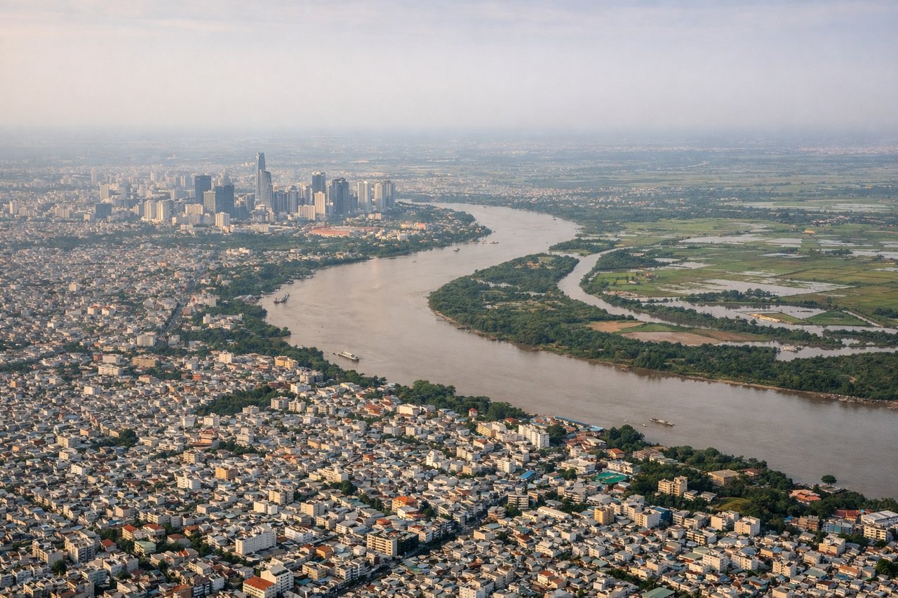
Takeoff from SGN
RIGHTTan Son Nhat typically departs eastward (Runway 25L/25R). Right-side seats face the Saigon River delta and the broader Mekong Delta plain stretching southeast, with the river's distributaries visible as silver threads through the landscape.
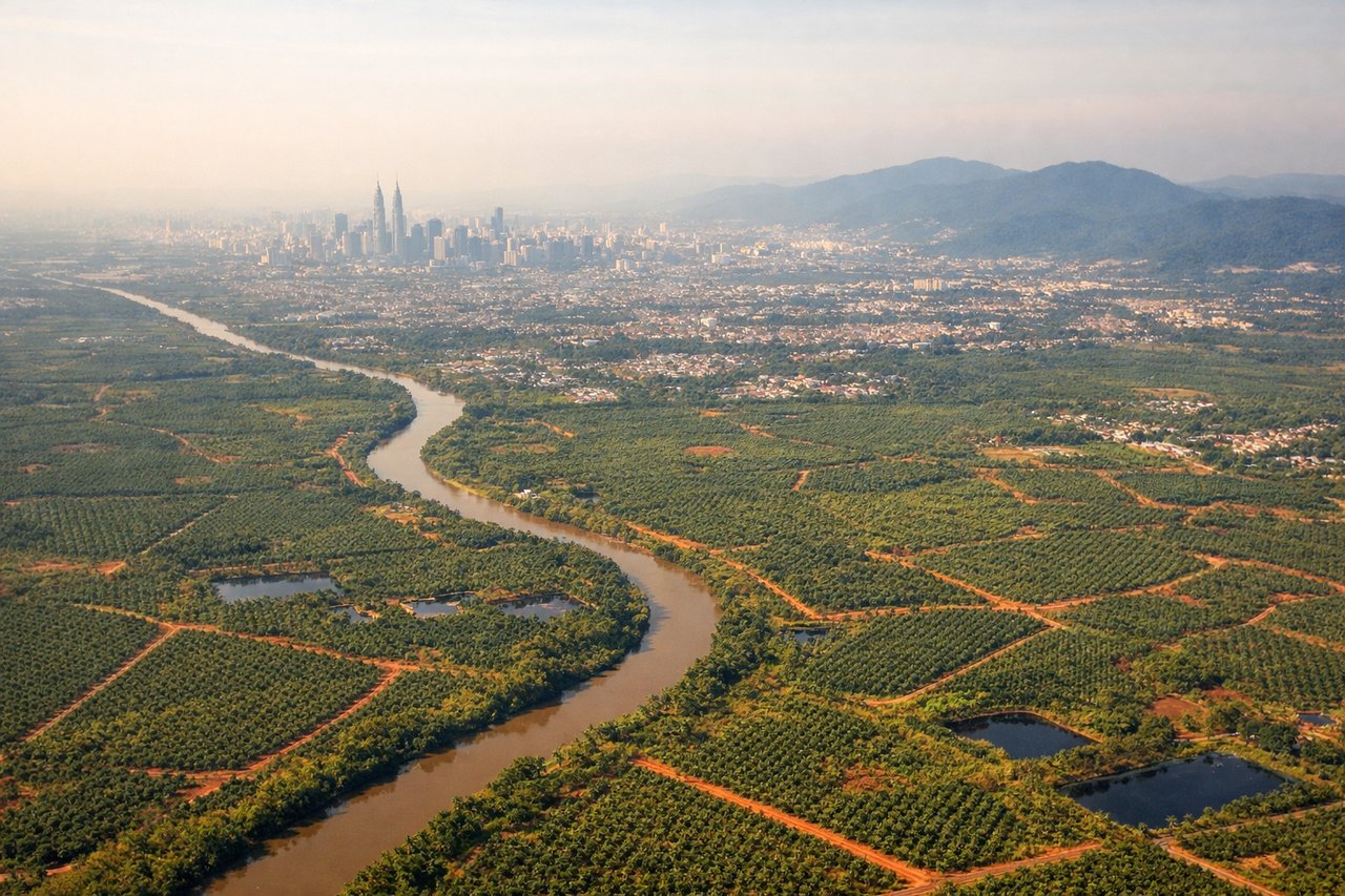
Landing at KUL
LEFTKuala Lumpur International (KLIA) typically lands westward on Runway 32L/32R. Left-side seats during descent face the Klang Valley and Selangor state, with the Titiwangsa Range visible as a distant ridge to the east, and the developed lowlands of the Klang River basin below.
Will your flight be in sunlight?
Pick a date and time in the Sun Map to watch the sun move across your whole flight.
About This Route
Which side of the plane should I sit on flying from Tansonnhat International (SGN) to Kuala Lumpur International (KUL)?
Sit on the Right side of the plane for the best views on flights from Ho Chi Minh City to Kuala Lumpur. Right seats capture the more dramatic geography: the Mekong Delta's intricate waterway patterns on departure and the Titiwangsa Range's presence on approach. The flight path itself crosses the Gulf of Thailand, which offers less visual interest than the delta and valley views.
What can I see during takeoff from Tansonnhat International in Ho Chi Minh City?
During takeoff from Tansonnhat International (SGN), sit on the Right side for the best views. Tan Son Nhat typically departs eastward (Runway 25L/25R). Right-side seats face the Saigon River delta and the broader Mekong Delta plain stretching southeast, with the river's distributaries visible as silver threads through the landscape. Notable sights include: Saigon River (immediate, winding through Ho Chi Minh City), Mekong Delta (vast flat alluvial plain with rice paddies and waterways), Can Tho region (distant, ~100 km south), South China Sea horizon (far southeast).
What can I see when landing at Kuala Lumpur International in Kuala Lumpur?
When landing at Kuala Lumpur International (KUL), sit on the Left side for the best views. Kuala Lumpur International (KLIA) typically lands westward on Runway 32L/32R. Left-side seats during descent face the Klang Valley and Selangor state, with the Titiwangsa Range visible as a distant ridge to the east, and the developed lowlands of the Klang River basin below. Notable sights include: Titiwangsa Mountain Range (eastern horizon, ~50 km away, appears as a low blue ridge), Klang River valley (winding through developed areas below), Petronas Twin Towers area/Kuala Lumpur city center (visible as urban sprawl, ~50 km north), Selangor coastal plain (flat developed landscape with roads and industrial areas).
How long is the flight from Ho Chi Minh City to Kuala Lumpur?
The flight from Tansonnhat International (SGN) to Kuala Lumpur International (KUL) takes about 1 hour 25 minutes. The shortest flight path between them is 653 miles (1,050 km); winds and air traffic control usually add a few percent.
What does the Ho Chi Minh City to Kuala Lumpur flight path pass over?
Gulf of Thailand (open water, largely featureless at cruise altitude), Cambodian coast near Sihanoukville (distant, rarely visible due to cruise altitude and haze), transition from Vietnamese delta to Malaysian peninsula occurs over open water with no significant landmarks visible at 30,000+ feet