The right side scores higher due to the dramatic volcanic island approach to Naha and the visual variety of the Kerama Islands and coral reef patterns during landing. While the left side offers the Mekong Delta during takeoff, the right side's combination of island topography, reef colors, and the scenic Okinawa approach outweighs the flat delta scenery. The flight's most visually distinctive segment occurs on the right during descent.
Flown SGN to OKA? Did we get it right?
Flight Path
Ho Chi Minh City to Naha is 1,733 miles (2,788 km), a flight of about 3 hours 55 minutes.
Gulf of Tonkin coastline (Vietnam-China border region), Hainan Island's southern coast, open South China Sea with occasional fishing vessel clusters, transition from Vietnamese coastal waters to Okinawan island waters
Great circle distance and headings ›Phase by phase
Takeoff from SGN
LEFTHo Chi Minh City's Saigon River delta and urban sprawl are visible during climb-out on the left side. The Mekong Delta's intricate waterways and rice paddies create texture and contrast against the city's development.
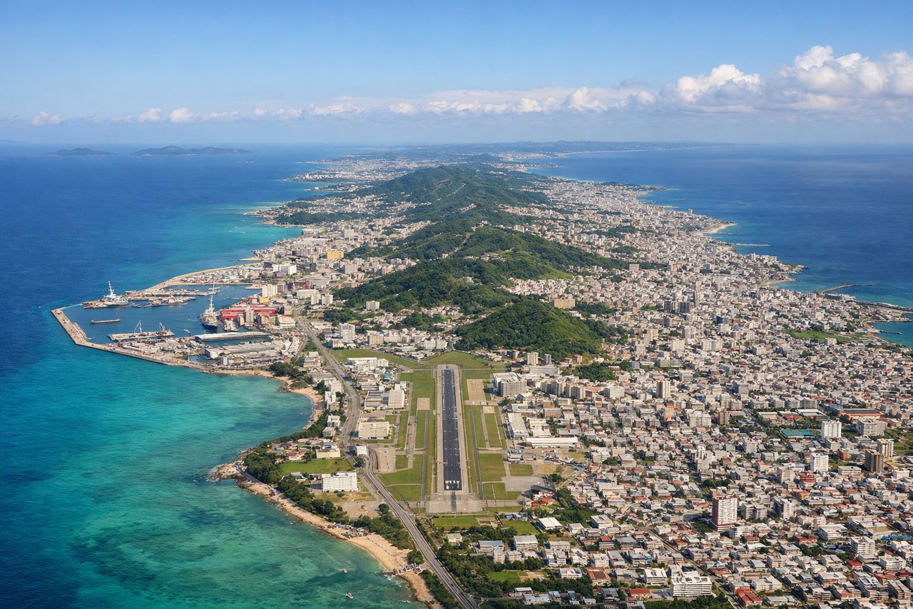
Landing at OKA
RIGHTThe approach to Naha crosses the Okinawa island chain with dramatic volcanic topography, coral reefs visible in shallow waters, and the East China Sea. The islands' rugged terrain and the distinctive Kerama Islands create visual interest absent on the left side's open ocean.
Will your flight be in sunlight?
Pick a date and time in the Sun Map to watch the sun move across your whole flight.
About This Route
Which side of the plane should I sit on flying from Tansonnhat International (SGN) to Naha (OKA)?
Sit on the Right side of the plane for the best views on flights from Ho Chi Minh City to Naha. The right side scores higher due to the dramatic volcanic island approach to Naha and the visual variety of the Kerama Islands and coral reef patterns during landing. While the left side offers the Mekong Delta during takeoff, the right side's combination of island topography, reef colors, and the scenic Okinawa approach outweighs the flat delta scenery. The flight's most visually distinctive segment occurs on the right during descent.
What can I see during takeoff from Tansonnhat International in Ho Chi Minh City?
During takeoff from Tansonnhat International (SGN), sit on the Left side for the best views. Ho Chi Minh City's Saigon River delta and urban sprawl are visible during climb-out on the left side. The Mekong Delta's intricate waterways and rice paddies create texture and contrast against the city's development. Notable sights include: Saigon River winding through Ho Chi Minh City, Mekong Delta agricultural grid, Can Tho city to the southwest.
What can I see when landing at Naha in Naha?
When landing at Naha (OKA), sit on the Right side for the best views. The approach to Naha crosses the Okinawa island chain with dramatic volcanic topography, coral reefs visible in shallow waters, and the East China Sea. The islands' rugged terrain and the distinctive Kerama Islands create visual interest absent on the left side's open ocean. Notable sights include: Kerama Islands (volcanic ridges and bays), Okinawa's central ridge and forested interior, coral reef patterns in turquoise shallows around Naha.
How long is the flight from Ho Chi Minh City to Naha?
The flight from Tansonnhat International (SGN) to Naha (OKA) takes about 3 hours 55 minutes. The shortest flight path between them is 1,733 miles (2,788 km); winds and air traffic control usually add a few percent.
What does the Ho Chi Minh City to Naha flight path pass over?
Gulf of Tonkin coastline (Vietnam-China border region), Hainan Island's southern coast, open South China Sea with occasional fishing vessel clusters, transition from Vietnamese coastal waters to Okinawan island waters