While takeoff offers delta scenery on the right, the landing approach on the left provides more dramatic and visually distinctive features: Lake Michigan's massive presence, the Indiana dune system, and the St. Joseph River valley create a more memorable final descent experience than the Mekong Delta's distributed waterways.
Flown SGN to SBN? Did we get it right?
Flight Path
Ho Chi Minh City to South Bend is 8,715 miles (14,026 km), a flight of about 18 hours.
The flight path crosses the Pacific Ocean with potential views of the Aleutian Islands (if routed through Alaska), then crosses the North American continent. Notable inland features during descent include the Great Lakes region, with Lake Michigan being the most prominent freshwater landmark visible during the final approach phase. The flight traverses diverse terrain from tropical Southeast Asia through temperate North American zones.
Great circle distance and headings ›


Phase by phase
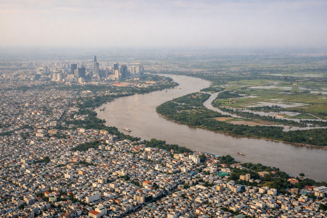
Takeoff from SGN
RIGHTRight-side seats offer views of the Saigon River delta and the Mekong Delta's intricate waterway network as the aircraft climbs northwestward out of Ho Chi Minh City. The left side faces inland terrain with less distinctive visual features during initial climb.
Landing at SBN
LEFTLeft-side seats provide excellent views during the descent approach into South Bend, with views of Lake Michigan's eastern shoreline, the St. Joseph River valley, and the distinctive landscape of northern Indiana. The right side faces inland terrain with fewer visually distinctive features.
Will your flight be in sunlight?
Pick a date and time in the Sun Map to watch the sun move across your whole flight.
About This Route
Which side of the plane should I sit on flying from Tansonnhat International (SGN) to South Bend International Airport (SBN)?
Sit on the Left side of the plane for the best views on flights from Ho Chi Minh City to South Bend. While takeoff offers delta scenery on the right, the landing approach on the left provides more dramatic and visually distinctive features: Lake Michigan's massive presence, the Indiana dune system, and the St. Joseph River valley create a more memorable final descent experience than the Mekong Delta's distributed waterways.
What can I see during takeoff from Tansonnhat International in Ho Chi Minh City?
During takeoff from Tansonnhat International (SGN), sit on the Right side for the best views. Right-side seats offer views of the Saigon River delta and the Mekong Delta's intricate waterway network as the aircraft climbs northwestward out of Ho Chi Minh City. The left side faces inland terrain with less distinctive visual features during initial climb. Notable sights include: Saigon River (winding through the city), Mekong Delta distributaries (branching waterways), Can Tho city area (visible as urban sprawl to the southwest), Tonle Sap Lake region (distant, on clearer days).
What can I see when landing at South Bend International Airport in South Bend?
When landing at South Bend International Airport (SBN), sit on the Left side for the best views. Left-side seats provide excellent views during the descent approach into South Bend, with views of Lake Michigan's eastern shoreline, the St. Joseph River valley, and the distinctive landscape of northern Indiana. The right side faces inland terrain with fewer visually distinctive features. Notable sights include: Lake Michigan (massive freshwater body on the western horizon), St. Joseph River (visible as a linear feature cutting through the landscape), Indiana dune formations (sandy ridges along the lake shore), South Bend urban area (visible as developed grid pattern in the middle distance).
How long is the flight from Ho Chi Minh City to South Bend?
The flight from Tansonnhat International (SGN) to South Bend International Airport (SBN) takes about 18 hours. The shortest flight path between them is 8,715 miles (14,026 km); winds and air traffic control usually add a few percent.
What does the Ho Chi Minh City to South Bend flight path pass over?
The flight path crosses the Pacific Ocean with potential views of the Aleutian Islands (if routed through Alaska), then crosses the North American continent. Notable inland features during descent include the Great Lakes region, with Lake Michigan being the most prominent freshwater landmark visible during the final approach phase. The flight traverses diverse terrain from tropical Southeast Asia through temperate North American zones.